Luxembourg City

Luxembourg City is the capital of Luxembourg and one of Europe’s most rewarding small cities to visit. It’s known for amazing views right in the centre: steep cliffs, deep river valleys, and viewpoints that look over the Old Town and toward modern areas like Kirchberg. The city sits on different levels, so many walks come with “two-level” views—bridges above, green valleys below.


Most attractions are clustered in and around Luxembourg City’s Old Town, part of a UNESCO World Heritage area. The historic heart is Ville Haute (Upper Town) on higher ground, while Grund (Lower Town) sits down in the valley by the Alzette River. They’re close to each other, but the climb can be steep—so using lifts and viewpoints is part of the experience.

This guide shares the city’s best sights with clear, practical details—so you can explore at your own pace.

Map of Luxembourg City

Use the interactive map below to plan your route before you go. It includes pins for every place mentioned in this guide, plus a few spots to try local food and several helpful parking options. Main elevators are pinned on the map too (including the lifts that connect the Upper Town viewpoints with areas like Grund and Pfaffenthal), so you can move between levels without unnecessary uphill walking.

Next, you’ll find the 14 best things to do in Luxembourg City. Each stop includes what to expect, how long to spend, whether it’s free or paid, and one practical tip.

1. Grund

Grund is the city’s most atmospheric riverside quarter, sitting at the bottom of the valley along the Alzette. For the best views, stop at Pont du Grund (Grund Bridge), then walk along the river paths for classic photo spots looking up to the cliffs. While you’re here, visit neimënster (Neumünster Abbey), a former abbey complex that now hosts exhibitions and cultural events.

The area is free to visit, and you can spend 1–2 hours here depending on whether you stop for coffee or dinner.

Tip: Use Ascenseur Elevator Plateau St. Esprit Grund (pinned on the map) for an easy connection back up—no steep uphill walk needed.

2. Chemin de la Corniche

Chemin de la Corniche is the city’s most famous viewpoint walk, running along old ramparts above the valley. It’s often called “the most beautiful balcony of Europe,” and it’s easy to see why: from the path, you get postcard views of the lower town rooftops, green river paths, and dramatic cliff edges.

The area is free to visit, and you can spend 30–60 minutes here depending on how many photo stops you make.

Tip: Go late afternoon for softer light over the valley. It often looks much better than midday sun.

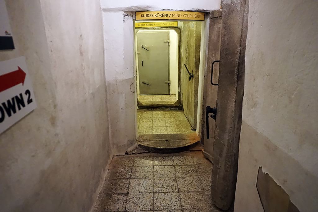
3. Bock Casemates (Casemates du Bock)

The Bock Casemates are underground tunnels carved into rock as part of Luxembourg’s fortress defenses. The first tunnels were built in 1644 under Spanish rule, and later generations expanded the galleries into a much larger system. Before you enter the tunnels, you can also see the archaeological area linked to the city’s earliest history on the Bock rock. Inside you’ll explore stone corridors, stairways, and openings that look out over the valley—one of the most unique experiences in the Old Town.

This is a paid attraction, and you can spend about 45–60 minutes inside (often with timed entry).

Tip: If you like fortress tunnels, also look for Pétrusse Casemates near the Monument of Remembrance area for another underground option.

ticket iconBook Official Tickets


4. Adolphe Bridge (Pont Adolphe)

Adolphe Bridge is one of Luxembourg City’s main landmarks. It crosses the Pétrusse valley and connects the historic centre with areas closer to the train station. The purpose is practical, but the views are the real reason to stop: you get a wide panorama of the green valley below and the city above.

The area is free to visit, and you can spend 15–30 minutes here depending on whether you take photos from both sides.

Tip: Look for the lower path under the main deck. It gives a fresh angle and is often quieter than the top.

5. Notre-Dame Cathedral, Luxembourg

Notre-Dame Cathedral is the city’s main cathedral and one of the most peaceful stops in the centre. It began as a Jesuit church: the foundation stone was laid in 1613, and the original church was completed in 1621. However, the cathedral you see today is larger than that early church, because it was extended on the south side in the 1930s, adding new sections (including a transept and a larger choir). Inside you can see tall arches, stained glass, and side chapels that feel calm even on busy days.

Entry is free, and you can spend 20–40 minutes here depending on how much you explore inside.

Tip: Visit outside service times for a quieter experience, and avoid flash photography to keep the atmosphere respectful.

6. Grand Ducal Palace (Palais Grand-Ducal)

The Grand Ducal Palace is the official city residence of Luxembourg’s Grand Duke. Most visitors come for the beautiful façade in the old town centre, but the palace is also important for state ceremonies. Inside visits are special because you can see formal rooms used for official events, but access is limited and not year-round.

You can see the palace from outside for free in 10–20 minutes. If you visit during the summer tour season, a guided tour is paid and takes about 1h15.

Tip: If you want to go inside, book early—places are limited and tours can sell out.

globe iconOfficial Palace Tours

7. Pfaffenthal Panoramic Elevator (Ascenseur Panoramique du Pfaffenthal)

This glass elevator is one of the easiest “wow” moments in Luxembourg City. It connects the upper town area near Pescatore Park to the Pfaffenthal valley below, with sweeping views over rooftops and greenery. It’s also practical: the lower level puts you close to the transport hub that links toward Kirchberg (the modern district with EU institutions, museums, and concert halls) via the Pfaffenthal–Kirchberg funicular and tram.

The elevator is free to use, and you can spend 20–40 minutes here including photos and a short walk at the bottom.

Tip: After the ride, walk a few minutes along the valley paths for a different view before going back up.

8. Monument of Remembrance (Gëlle Fra)

The Monument of Remembrance is one of the city’s most important memorial sites and a strong viewpoint at the same time. Many people know it by its nickname, “Gëlle Fra” (“Golden Lady”). It honors Luxembourgers who served and died in major conflicts, and it sits right above the valley with wide views. Nearby, you can also visit the Pétrusse Casemates, another set of underground tunnels built into the fortifications—easy to combine in the same area.

The area is free to visit, and you can spend 10–20 minutes here.

Tip: This is a great sunset stop. Stay a little longer and look across the valley for one of the best wide views in the city.

9. Mudam Luxembourg – Musée d’Art Moderne Grand-Duc Jean

Mudam is Luxembourg City’s main museum for modern and contemporary art. Even if you don’t usually visit art museums, the building is a highlight and the exhibitions change often, so each visit can feel different. The museum sits next to Fort Thüngen, which adds a nice “old meets new” feeling in the same area.

This is a paid attraction, and you can spend 1–2 hours here depending on your interest in the exhibitions.

Tip: Combine Mudam with Fort Thüngen next door for a strong half-day in the Kirchberg area.

globe iconOfficial Mudam Website


10. Viaduct (Passerelle)

The Passerelle (also called the Luxembourg Viaduct) is the “old bridge” with long stone arches over the Pétrusse valley. It was built to connect key parts of the city as Luxembourg developed, and today it’s still an important route. For visitors, it’s a simple stop with great valley views and strong architecture photos.

The area is free to visit, and you can spend 15–30 minutes here.

Tip: For the best photo of the arches, look for paths in the valley below and shoot from underneath.

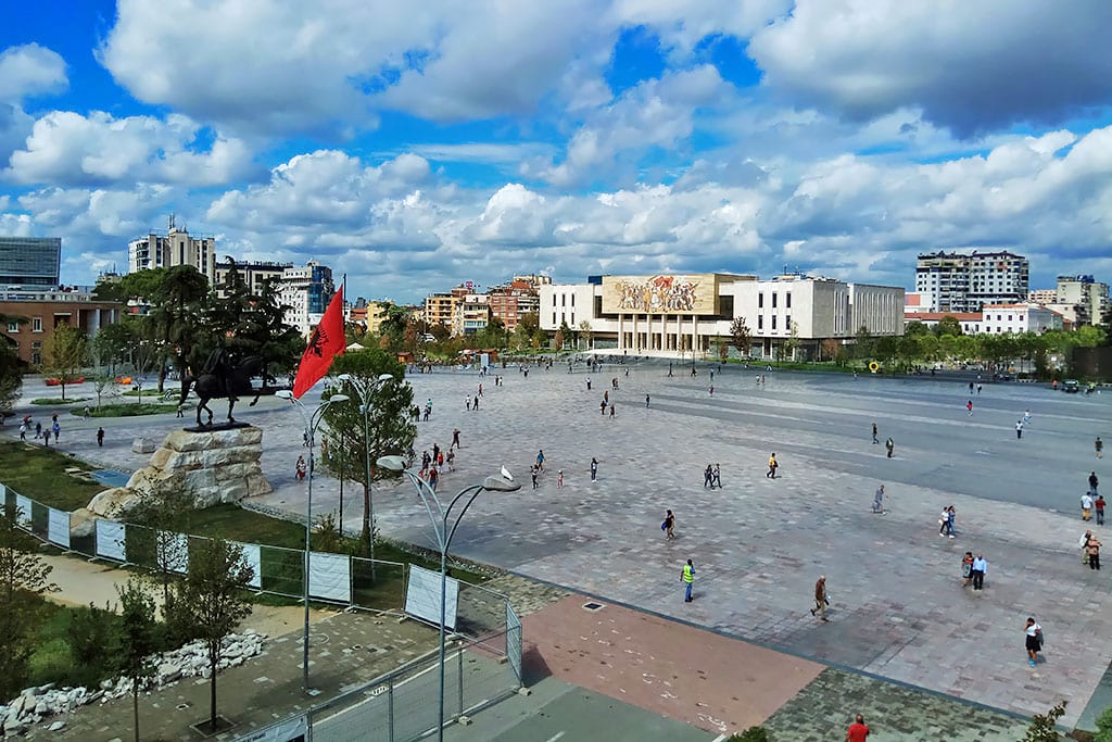
11. Place Guillaume II (Knuedler)

Place Guillaume II is one of the main squares in the historic centre. It’s known for the Town Hall, markets, and events that often fill the space with life. The square also helps you “connect the dots,” because many key streets, cafés, and shops start from this area. A short walk away is Place d’Armes, another popular square with terraces.

The area is free to visit, and you can spend 30–60 minutes here depending on what is happening that day.

Tip: For an easy evening close to the centre, sit outside around Place d’Armes or Rue du Marché-aux-Herbes. For a bigger nightlife scene with bars and clubs, Clausen (Rives de Clausen Street) is a classic choice—and Limpertsberg also has popular bars and dance bars.

12. National Museum of History and Art

This museum is one of the best places to understand Luxembourg beyond viewpoints. It focuses on Luxembourg’s archaeology, history, and art, with collections that help explain daily life through the centuries as well as the city’s wider cultural story. Parts of the museum are built into rock, which makes the visit feel special.

Entry is paid (standard adult ticket), but the last hour before closing is free. You can spend 1–2 hours here depending on how deep you go into the collections.

Tip: If you have limited time, choose one focus (history/archaeology or art) instead of trying to see everything.

globe iconOfficial Museum Website

13. Philharmonie Luxembourg

Philharmonie Luxembourg is one of the city’s most impressive modern buildings. It is famous for its elegant design and high-quality acoustics, so it’s a top stop for music lovers. Even if you don’t attend a concert, the building is worth seeing from outside, and guided tours can be a great way to understand the architecture.

You can visit outside for free in 10–15 minutes. If you attend a concert or join a guided tour, it is paid and takes around 1 hour (or longer for a performance).

Tip: If you want to see the inside without a concert ticket, look for an English guided tour on your travel dates.

Official Philharmonie Website

14. Luxembourg American Cemetery and Memorial

This cemetery is one of the most moving places to visit near Luxembourg City. It is beautifully maintained, peaceful, and deeply respectful. The memorial explains key WWII history connected to the Battle of the Bulge, and many visitors come to reflect and understand the human side of history beyond museums.

The area is free to visit, and you can spend 1–2 hours here plus travel time.

Tip: Go earlier in the day for the quietest atmosphere, and plan a calm pace—this is not a place to rush.


Day Trips from Luxembourg City

If you have more time, Luxembourg City is a great base for castles and nature. These three day trips are the most popular add-ons.

Vianden Castle

Vianden Castle is one of the most famous castles in Luxembourg, sitting high above the riverside town of Vianden. The main purpose of this day trip is simple: explore a real hilltop castle with panoramic views, then enjoy the town below with cafés and scenic streets. Inside, you can walk through historic halls and rooms, see fortress-style architecture, and enjoy viewpoints over the valley.

The castle is paid to enter, and you can spend 4–6 hours here (castle + town), or make it a full day if you prefer a slow pace.

If you want to plan your visit in more detail, read the full Vianden Castle guide.

Travel time from Luxembourg City: about 1–1.5 hours each way (depending on connections)
Typical guided tour length: around 6–8 hours
Why visit: castle interiors, big valley views, charming riverside town
Time needed: full day is ideal

ticket iconBook Vianden Tour

Valley of the Seven Castles

The Valley of the Seven Castles is a scenic route through the Eisch Valley where you can see a high concentration of medieval castles within a short drive. The main purpose of this day trip is to enjoy countryside views, castle silhouettes, and village stops—rather than spending the whole day inside one single site. Along the way you’ll pass several well-known castle spots (including Mersch, Schoenfels, Hollenfels, the Ansembourg castles, Septfontaines, and Koerich), with a mix of viewpoints, short walks, and photo-friendly stops.

Most stops are free to see from outside, and you can shape the day your way. Plan a half day if you mainly want a relaxed drive with a few quick stops, or a full day if you add gardens, longer walks, and more villages.

If you want to plan the route in more detail, read the full Valley of the Seven Castles guide.

Travel time from Luxembourg City: about 25–40 minutes each way (to reach the valley area)
Typical guided tour length: around 4–7 hours (depending on the tour route and stops)
Why visit: castle scenery, easy countryside escape, flexible stops and viewpoints
Time needed: half day to full day

ticket iconBook Valley Tour

Mullerthal Region (Mullerthal Trail)

The Mullerthal Region is Luxembourg’s best nature day trip and home to the famous Mullerthal Trail. The purpose of this trip is to swap city streets for forests, sandstone rock formations, narrow gorges, and short “adventure” hikes that feel surprisingly wild for such a small country. Many visitors focus on one highlight area (like the Schiessentümpel Waterfall photo spot) plus a trail section nearby, then finish in a town like Echternach for a relaxed meal.

Most hikes are free, and you can make this trip as easy or as active as you want. Plan a shorter loop if you only want a taste of the landscape, or spend the whole day if you want a longer hike with multiple viewpoints.

If you want to plan hikes and viewpoints in more detail, read the full Mullerthal Trail guide.

Travel time from Luxembourg City: about 45–60 minutes each way (depending on which trail area you choose)
Typical guided tour length: around 6–8 hours (full-day tours often include a longer hike + multiple stops)
Why visit: best hiking near the city, rock landscapes, forest trails, iconic photo stops
Time needed: full day is ideal

ticket iconBook Mullerthal Tour

Practical Information for Visiting Luxembourg City

Getting around the centre

The city is walkable, but the cliffs and valleys mean some routes feel steep. A good plan is to explore the Upper Town first, then go down to the lower areas, and use elevators to return up.

Public transport

Public transport across Luxembourg is free in standard class (buses, trams, and second-class trains). This is helpful for reaching Kirchberg, the cemetery, or your hotel without extra costs.

Where to stay

For a first visit, staying in the historic centre saves time. The Gare area is practical for trains and early departures. Kirchberg is quieter and modern, with museums and business-style hotels.

Parking

Parking in the very centre can be stressful, especially on weekends. Many visitors prefer larger car parks on the edge of the centre and then walk or use public transport.


Frequently Asked Questions About Luxembourg City

Is Luxembourg City worth visiting?

Yes. It’s compact but full of viewpoints, fortress history, and a mix of old and modern districts. It also works well for day trips, so a short stay still feels complete.

What to do in Luxembourg City in one day?

Prioritize the Upper Town viewpoints and squares, add one paid highlight (casemates or a museum), then finish in Grund for a riverside walk and dinner.

What is there to do in Luxembourg City for free?

Many top sights are free, including viewpoints, bridges, squares, the cathedral, and scenic districts like Grund.

How many days do you need in Luxembourg City?

Most travelers need 1–2 days for the main highlights. Add a third day if you want a full day trip without rushing.

Where is the best shopping in Luxembourg City?

Shopping in Luxembourg City is best in the pedestrian-friendly city centre. Start with Grand-Rue for a classic stroll with many well-known brands. Nearby, Rue Philippe II is known for more upscale boutiques, and Rue des Capucins is popular for shops and a lively atmosphere. For indoor shopping, try Royal-Hamilius in the centre or Shopping Center Cloche d’Or for a bigger mall experience.

Where is the best nightlife in Luxembourg City?

For terraces and a relaxed evening, start around Place d’Armes and nearby streets like Rue du Marché-aux-Herbes and Rue de la Boucherie. If you want bars and clubs, head to Clausen—especially around Rives de Clausen (the former brewery area). Limpertsberg is another solid option for bars and late-night spots. To end the night in a calmer setting, finish in Grund for riverside cafés and seasonal outdoor terraces along the Alzette.

Tirana

Tirana is the capital of Albania and one of the most colorful and interesting cities in the Balkans. It is small, walkable, and easy to explore in just a few days. The city mixes Ottoman heritage, Italian-style boulevards, communist-era bunkers, and modern cafés and restaurants all in one place.


Most attractions are close to Skanderbeg Square, the main square of Tirana. From here you can walk to museums, mosques, markets, and lively neighborhoods like Blloku in just a few minutes. Public transport and taxis are available, but you will rarely need them.

Tirana is a safe and relaxed city with friendly locals and a growing café culture. It is less crowded than many European capitals, which makes it a pleasant place to explore at a slow pace. Spring and autumn are the best times to visit, with warm weather and fewer tourists.

Map of Tirana

Below, you will find a complete list of the best things to do in Tirana. For each place, you will see what to expect, how much time to spend, and practical tips for a smooth visit.

1. Skanderbeg Square

Skanderbeg Square is the main square in the center of Tirana and the heart of the city. It is named after Gjergj Kastrioti Skanderbeg, Albania’s national hero who fought against the Ottoman Empire in the 15th century. In the middle of the square stands a large equestrian statue of Skanderbeg, one of the most famous symbols of Albania.

The square is surrounded by some of Tirana’s most important buildings, including the National History Museum, the Et’hem Bey Mosque, the Clock Tower, and the National Opera House. The area is wide, open, and covered with beautiful stone from all parts of Albania. It’s a popular place for walks, public events, and celebrations.

At night, the lights and fountains make the square especially beautiful. Many cafés and restaurants nearby offer a nice place to relax and watch city life.

Tip: Visit in the evening for a lively atmosphere, or in the morning before crowds arrive. From here, you can easily walk to Bunk’Art 2 and the New Bazaar.

2. Bunk’Art 1

Bunk’Art 1 is a large underground bunker museum on the edge of Tirana. It was built in the early 1980s during the communist time of Enver Hoxha as a safe place for government and army leaders in case of war. The bunker has five floors, about 3,000 m² of space, and 106 rooms made of thick concrete.

Today, it is a museum of history and art that shows Albania’s past from World War II through the communist years to modern times. Visitors walk through a long tunnel into rooms with photos, films, and objects that tell how people lived during that period.

A visit usually takes 1–2 hours, and the air inside is cool, so bring a light jacket. The museum is open daily from morning until evening, and tickets cost about €6.

Tip: Because it is outside the city center, plan extra time for transport. You can also take the cable car to Mount Dajti nearby for great views and a relaxing trip after your visit.

3. Dajti Ekspres Cable Car

The Dajti Ekspres cable car takes you from the edge of Tirana up to Mount Dajti in about 15 minutes. The ride gives you beautiful views over the city, hills, and countryside. At the top, there are walking paths, restaurants, and a small adventure park.

It’s one of the best ways to escape the city for a few hours and enjoy fresh air. The cable car station is close to Bunk’Art 1, so many visitors do both on the same day. The ticket price is reasonable and includes the return ride.

Tip: Try to go on a clear day for the best views. It can be cooler at the top, so bring a light jacket.

globe iconOfficial Dajti Ekspres Website


4. Bunk’Art 2

Hidden beneath the city center, Bunk’Art 2 is one of the most fascinating things to do in Tirana. Built in the early 1980s during the Cold War, this secret nuclear bunker was created to protect Albania’s Interior Ministry leaders in case of foreign attack. Known as Objekti Shtylla (“Object Pillar”), it includes 24 rooms, thick reinforced-concrete walls, and an air-filtration system designed for survival.

Today, the bunker serves as a museum that reveals the dark history of communist Albania. Visitors can see offices, interrogation rooms, and exhibits about the Sigurimi secret police, who spied on citizens for decades. Its cracked dome near Skanderbeg Square stands as a lasting reminder of the country’s fear and isolation during that time.

A visit usually takes around an hour, and the museum is open daily from morning until early evening (tickets cost about €6).

Tip: Visit early for a quieter experience and bring a light jacket—the bunker stays cool all year.

5. Tirana Free Tour

Tirana Free Tour, Albania

The Tirana Free Tour is a walking tour with local guides who explain the city’s history, culture, and daily life. It usually starts at the National History Museum and lasts about 2–2.5 hours. You will see the main landmarks and hear many interesting stories.

The tour is free, but tipping the guide at the end is expected. It’s a good idea to do this on your first day in Tirana so you understand the city better.

Tip: Wear comfortable shoes, bring water, and check their website for the current meeting time.

ticket iconBook Free Tour

6. Resurrection of Christ Orthodox Cathedral

The Resurrection of Christ Orthodox Cathedral is one of the most beautiful churches in Tirana and one of the largest Orthodox cathedrals in the Balkans. It is located near the city center, only a few minutes’ walk from Skanderbeg Square.

The cathedral was opened in 2012 and became the main church for Albania’s Orthodox community. Its large white dome and tall bell tower can be seen from many parts of the city. Inside, the church is bright and peaceful, with colorful frescoes, icons, and a golden iconostasis. The main dome shows Christ surrounded by angels, painted in the traditional Byzantine style.

Visitors are welcome to enter respectfully, and it is often quiet except during services. Photography may be limited inside, depending on the time of visit.

Tip: The cathedral looks especially beautiful at sunset, when the light shines on its white walls. It’s also close to the Blloku district, where you can enjoy cafés and a relaxing walk.

7. Et’hem Bey Mosque

Et’hem Bey Mosque is one of the oldest buildings in Tirana. It survived the communist period when most religious buildings were closed. The mosque has beautiful wall paintings and wooden details.

It is located on Skanderbeg Square and is free to enter. Non-Muslims are welcome outside prayer times.

Tip: Remove your shoes before entering and wear clothing that covers your shoulders and knees.

8. Blloku

Blloku is a lively district full of cafés, bars, restaurants, and shops. During communist times, it was closed to the public and only for government officials. Now it is the most popular place for nightlife and dining.

You can come during the day for coffee or in the evening for dinner and drinks. Prices are reasonable compared to other European capitals.

Tip: Most places accept card, but carrying some cash is useful for small cafés.

9. Pyramid of Tirana

The Pyramid of Tirana was built as a museum for the communist leader Enver Hoxha. Later it became abandoned, but now it is renovated into a modern cultural center with stairs to climb to the top.

It is free to enter and fun to walk around. The rooftop gives a nice city view. It is located near Blloku and Skanderbeg Square.

Tip: Come during daylight for the best view and safe climbing.


10. National History Museum

This is the biggest museum in Albania, located on Skanderbeg Square. It shows the history of the country from ancient times to the present. There are many interesting objects, old maps, and stories about Albania’s past.

There is a small entry fee, and you should plan 1–2 hours here.

Tip: The signs are mostly in Albanian, but you can rent an audio guide in English at the entrance.

11. Grand Park of Tirana

This is the largest green space in the city, located just south of the center. It has a big artificial lake, walking paths, cafés, and a playground. Locals come here to walk, run, or relax on the grass.

Entry is free, and it’s a peaceful place to take a break from the busy streets.

Tip: Visit in the morning or late afternoon to avoid the heat in summer.

12. House of Leaves

The House of Leaves is a museum about surveillance and secret police during communist times. It shows how people were watched, recorded, and controlled.

It is small but very interesting if you like history. There is a small entrance fee. You need about 1 hour to see it all.

Tip: Read the descriptions carefully — it gives a good understanding of life under the regime.

13. Sky Tower Tirana

Sky Tower is a tall building in the Blloku area. On the top floor, there is a café and bar with 360-degree views of the city and mountains.

You can go up for free if you buy a drink. It is especially beautiful at sunset when the city lights turn on.

Tip: It can be windy on the terrace — bring a light jacket.

14. Pazari i Ri (New Bazaar)

Pazari i Ri is a lively market area near the center. It has colorful buildings, fresh fruit and vegetables, cheese, spices, and local products. Around the market are many small restaurants and cafés.

It is a good place to buy souvenirs or try local food. Prices are low and bargaining is common.

Tip: Come in the morning for the best selection and fewer crowds.

15. Namazgah Mosque

Namazgah Mosque is the largest mosque in Albania and one of the biggest in the Balkans. Opened in 2024, it was built with support from the Turkish government and can hold thousands of worshippers. The mosque has four tall minarets, a large central dome, and a spacious interior decorated with Islamic calligraphy and geometric patterns.

It is located near the Parliament of Albania, just a short walk from Skanderbeg Square. Entry is free, and visitors are welcome outside prayer times. The mosque also has a library, conference hall, and educational spaces, making it not only a place of worship but also a cultural center.

Tip: Dress modestly and remove your shoes before entering. Women may be asked to cover their hair with a scarf. The mosque is especially beautiful to photograph in the evening when it is illuminated.


Day Trips from Tirana

If you have more than one day in Tirana, the city is a great base for exploring other parts of central Albania. Several beautiful towns and historic sites are close enough for an easy day trip. Here are the three most popular day trips from Tirana.

Berat (UNESCO World Heritage Site)

Berat is one of the most picturesque towns in Albania and is known as the “City of a Thousand Windows.” Its white Ottoman houses climb the hillside below a large castle, and the views over the valley and the Osum River are fantastic. Inside the castle walls, people still live in old stone houses, and there are churches, mosques, and small museums to explore.

If you want to explore Berat more deeply, read full Things to Do in Berat guide.

Travel time from Tirana: about 1.5–2 hours each way
Typical guided tour length: around 10 hours (full-day tour)
Why visit: UNESCO old town, castle, traditional houses, great views
Time needed: full day is ideal

ticket iconBook Berat Tour

Kruja

Kruja (Krujë) is a historic mountain town strongly linked with Albania’s national hero, Skanderbeg. The castle stands high above the plain with wide views, and the old bazaar below is one of the best places in the country to buy souvenirs such as carpets, copperware, and traditional crafts. It’s close to Tirana, so it works well as a half-day trip.

If you want to explore Kruja more deeply, read full Things to do in Kruja guide.

Travel time from Tirana: about 40–50 minutes each way
Typical guided tour length: around 8 hours (often combined with nearby sights)
Why visit: Skanderbeg’s castle, museum, traditional bazaar, mountain views
Time needed: half-day to relaxed full day

ticket iconBook Kruja Tour

Durrës

Durrës is a coastal city on the Adriatic Sea and one of Albania’s oldest ports. It has long sandy beaches, many cafés and restaurants along the seafront, and an impressive Roman amphitheater near the center. In summer, it is a popular place to escape the heat of Tirana and enjoy a day by the sea.

If you want to explore Durrës more deeply, read full Things to do in Durrës guide.

Travel time from Tirana: about 35–45 minutes each way
Typical guided tour length: around 9 hours (full-day tour)
Why visit: beach, sea views, fresh seafood, Roman history
Time needed: half-day or full-day

ticket iconBook Durrës Tour

Practical Information for Visiting Tirana

Getting to Tirana

Tirana International Airport (TIA) is located about 17 km from the city centre. The airport shuttle bus runs every hour and is the most affordable option. Taxis take 20–30 minutes; agree on the fare or ensure the meter is running. Private transfers are also available. There is currently no train connection between the airport and the city.

Getting Around Tirana

The city centre is compact and very walkable, with most attractions 10–20 minutes from Skanderbeg Square. City buses connect major districts and tickets are sold on board. Taxis are relatively affordable — popular apps include Speed Taxi, MerrTaxi, and Taxi.al.

Best Time to Visit Tirana

The best seasons are spring (April–June) and autumn (September–October), when temperatures are pleasant. Summers can reach 30–35°C, while winters are mild but rainy, especially November to February.

Money & Currency

The official currency is the Albanian lek (ALL). Hotels, larger restaurants, and supermarkets accept credit cards, but cash is preferred in smaller shops and cafés. ATMs are widely available. Tipping (5–10%) is appreciated but not mandatory.

Safety in Tirana

Tirana is generally safe for tourists, including solo travellers. As in any capital city, watch for pickpockets in crowded places and avoid poorly lit areas late at night. The emergency number is 112.

Language in Tirana

Albanian is the official language. English is widely spoken in hotels, restaurants, and by younger locals. Italian and Greek may also be understood, especially among older generations.

Internet & SIM Cards

Wi-Fi is available in most hotels, cafés, and restaurants. Local SIM cards (Vodafone, One, Albtelecom) offer inexpensive data plans and can be purchased at mobile shops. You’ll need your passport to register a SIM card.

Dress Code & Etiquette

Casual clothing is acceptable throughout Tirana. When visiting religious sites such as mosques and churches, dress modestly by covering shoulders and knees. Women may be asked to cover their hair in some mosques (scarves are sometimes provided).


Frequently Asked Questions About Tirana

Is Tirana worth visiting?

Yes. Tirana offers a mix of history, culture, and modern attractions. Highlights include Skanderbeg Square, the Bunk’Art museums, the Grand Park, and its vibrant café culture.

What are the best areas to stay in Tirana?

  • Blloku – trendy and full of cafés, restaurants, and nightlife
  • Skanderbeg Square area – central and close to major attractions
  • Lakeside/Grand Park – quieter and ideal for families or a relaxed stay

How Many Days Do You Need in Tirana?

Most visitors find that 2–3 days is the ideal amount of time to explore Tirana comfortably.

  • 1 day is enough to see the main highlights around Skanderbeg Square and Blloku.
  • 2 days lets you visit Bunk’Art, the Grand Park, local markets, and enjoy the café culture.
  • 3 days gives you time for museums, neighborhoods, and a short half-day trip (e.g., Mount Dajti cable car).

If you’re planning day trips to Berat, Kruja, or Shkodra, consider staying 4–5 days.

Is Tirana safe for solo female travellers?

Generally yes. Use common-sense precautions, avoid empty streets late at night, and keep your belongings secure.

How can I travel from Tirana Airport to the city centre?

You can take the airport shuttle bus, a taxi, or a pre-booked transfer. Taxis take about 20–30 minutes.

Is Uber available in Tirana?

No. Instead, use local ride apps such as Speed Taxi, MerrTaxi, or Taxi.al.

Can I pay with euros in Tirana?

Some tourist-oriented places accept euros, but the Albanian lek (ALL) is the official and preferred currency. For everyday purchases, it’s better to use lek.

Can I use my EU roaming data in Albania?

No. Albania is outside the EU roaming agreement. Most visitors choose a local SIM card for cheaper data.

Can I drink the tap water in Tirana?

Tap water is safe for brushing teeth and washing, but many visitors prefer bottled water for drinking.

Are there common scams in Tirana?

Scams are uncommon, but be cautious with currency exchange booths and taxi drivers who refuse to use the meter. Always confirm the fare or check the meter.

Vianden Castle

Vianden Castle is a large medieval fortress above the town of Vianden in Luxembourg. It stands on a rocky hill over the River Our, which made it ideal for defence, control of the valley, and political prestige. The castle was built mainly between the 11th and 14th centuries, on older foundations that include a Roman castellum and a Carolingian refuge. For centuries, it served as a feudal residence and power centre, acting as the seat of the Counts of Vianden, who ruled and administered the surrounding region.


After major political changes in Europe, the castle slowly declined. In 1820, it was sold “piece by piece”, and large parts were dismantled and reused elsewhere, leaving the structure in ruins. A decisive turning point came in 1977, when the Grand Ducal family handed over ownership to the Luxembourg state. This allowed a long and careful restoration to begin, with the goal of respecting the castle’s historical form. Today, Vianden Castle is fully restored and open to visitors, combining medieval architecture, museum-style interiors, and some of the best viewpoints in Luxembourg.


Map of Vianden Castle and key spots

The map helps you plan your visit at a glance. It shows Vianden Castle, the chairlift top and bottom stations, the forest path from the top station to the castle, the top viewpoints (including a Route de Diekirch photo spot), Grand-Rue, and the main parking areas.


What to see inside Vianden Castle

The visit is set up as an easy self-guided route. You move through different levels and sections, with rooms that show daily life, power, and religion in medieval times.

Look out for these highlights:

  • Grand halls and state rooms: Big spaces where nobles met, ate, and hosted guests
  • Chapel and religious spaces: A calmer part of the castle, with a different atmosphere
  • Armour and weapons displays: Great for anyone who likes knights, battles, and medieval craft
  • Courtyards and outer walls: Some of the best “castle feelings” come from simply walking outside
  • Window views and terraces: Many rooms have openings that frame the Our Valley like a picture

Take your time in the rooms that interest you most. Some visitors enjoy the views and architecture more than reading every sign, and that is completely fine.


Best viewpoints and photo spots

These are the best viewpoints for photos of Vianden Castle, and they are pinned on the map in this article.

  • Top station viewpoint (Vianden Chairlift): The strongest panoramic view of the castle, town, and valley
  • Route de Diekirch viewpoints: Open angles along Route de Diekirch offer classic “postcard” photos as you approach Vianden
  • Town and river views: From the river area, you can photograph the castle rising above rooftops and bridges

For the best light, late afternoon usually works best, especially in summer.


Vianden Chairlift

The Vianden Chairlift is one of the most popular attractions in the area and the easiest way to reach the best viewpoint. It takes you up to a panoramic spot above Vianden, where you can look down on the castle and the Our Valley.

  • Price (approx.): Adults around €9 return (about €6.50 one-way); children around €5 return
  • Winter operation: The chairlift is seasonal and is usually closed in winter, operating mainly from spring to autumn
  • Walking tip: In dry weather, you can walk from the top station to the castle via a forest path. This avoids walking uphill, but the path is rough and slippery when wet, so use it only in good conditions and with proper shoes.
globe iconOfficial Hours & Rates

Vianden town

Vianden is more than just “the place under the castle”. It is part of the experience and worth time on its own.

Grand-Rue is the main street and the heart of the town. You’ll find cafés, restaurants, terraces, and small local spots for lunch, coffee, or ice cream. The town follows the river valley, so an easy walk along the River Our and across the bridges gives you constant castle views from below.

You can also visit the Victor Hugo House, a small museum in the home where the French writer Victor Hugo stayed in Vianden. Other short, worthwhile stops include the Trinitarian Church and Cloister, parts of the old town walls and gates, and quieter viewpoints from the upper streets above the river.


Parking in Vianden

Parking is straightforward if you know the main options:

  • Near the castle: Most convenient, but often full during busy periods
  • Street parking in town: Usually paid, depending on area and season
  • Near the river or chairlift bottom station: Easier to find space, but requires walking uphill unless you use the chairlift

A popular strategy is to park near the bottom station, take the chairlift up, walk downhill to the castle, and then continue downhill into the town.


Nearby attractions

If you want to explore more of northern Luxembourg, these nearby places are the strongest additions:

  • Mullerthal Region (Luxembourg’s Little Switzerland)
    Famous for sandstone rock formations, forest trails, and scenic gorges
  • Bourscheid Castle
    One of the largest castle ruins in Luxembourg, with wide open valley views
  • Esch-sur-Sûre
    A picturesque river village with a medieval centre and castle ruins above it
  • National Museum of Military History (MNHM)
    A major museum focused on World War II and the Battle of the Bulge


Practical information

Location

  • Address: Château de Vianden, Montée du Château, L-9408 Vianden

Opening times (approx.):

Last entry is 30 minutes before closing time.

  • Summer: around 10:00–18:00
  • Spring and autumn: around 10:00–17:00
  • Winter: around 10:00–16:00
globe iconOfficial Hours

Tickets (approx.):

  • Adult ticket around €13; reduced rates available for some groups
globe iconOfficial Rates

Guided tours

  • Guided tours need to be requested by email in advance (the castle team can confirm options and language). Contact details for guided tours can be found in the “Official rates” button above.

Getting there (easy day trip)

  • Public transport: Luxembourg’s buses, trains, and trams are free in 2nd class inside the country, which makes this a very budget-friendly trip. From Luxembourg City, a common route is: train to Ettelbruck, then bus to Vianden.
  • By car: Drive to Vianden and follow signs for Parking Château (near the castle). If it’s full, park in town / near the river / by the chairlift bottom station, then walk up. In good, dry weather, you can also take the chairlift up and walk downhill to the castle via the forest path.

Accessibility notes

  • The walk up to the castle is steep on a cobbled path. Inside, the visitor route goes over several levels and includes many steps.
  • There is disabled parking around 300 m away (still with a steep approach).
  • Some parts are step-free (for example, key halls), but many rooms are not.

Facilities and rules

  • On site: Visitor centre, café, shop, toilets, lockers/safe-deposit options
  • Dogs: Not allowed inside the castle rooms

FAQ

Is Vianden Castle worth visiting?

Yes—if you want one “must-see” castle in Luxembourg, this is the easiest top pick. The combination of size, views, and restored rooms makes it feel like a true medieval fortress experience.

How long do you need for a visit?

Most visitors spend 2 to 3 hours on the castle itself, plus extra time if you also explore the town or take the chairlift.

Can you do Vianden Castle as a day trip from Luxembourg City?

Yes. It’s one of the most popular day trips in the country. You can travel independently by public transport or car, or join a guided tour from Luxembourg City for an easier, organised visit.

ticket iconBook Tour

Is Vianden Castle a good visit in winter?

Yes. The castle is open in winter, but the days are shorter and closing times are earlier. Plan an earlier start and always double-check the seasonal hours before you go.

Andorra la Vella Old Town

The Andorra la Vella Old Town, also called Barri Antic or Centro Histórico, is the oldest and most historic area of the capital. This small part of the city has narrow stone streets, quiet squares, and a mix of old medieval houses and traditional Andorran mountain-style buildings. While the rest of the city is known for modern shopping streets, the Old Town is calm and peaceful. It shows what Andorra la Vella looked like many years ago.


The area is small and easy to walk around. Visitors can see Sant Esteve Church, visit Casa de la Vall, and enjoy cosy cafés, small shops, and nice viewpoints between the historic buildings. It is one of the best places to discover Andorra’s culture and a great stop for anyone who enjoys local history, charming streets, and photography.


Map – Andorra la Vella Old Town

Below you can see a simple map of the Old Town with the main places marked, including historic buildings, key streets, restaurants, and convenient parking spots.

Now let’s look more closely at the main attractions and streets shown on the map, starting with the most important places to see in Andorra la Vella’s historic centre.


Things to See in the Old Town

1. Sant Esteve Church

Sant Esteve Church is an important place in the Old Town. It was built in the 12th century in a Romanesque style and later repaired in some areas. The church is known for its tall bell tower, stone walls, and simple but beautiful arches.

Inside, the church is quiet and peaceful. You can see restored artwork and religious details from different periods. Even if you do not go inside, the outside of the church is beautiful and very popular for photos. Visitors usually spend 10–20 minutes inside, depending on how closely they observe the artworks and architectural details.

Tip: Visit in the morning for softer light and fewer people inside the church.


2. Casa de la Vall

Casa de la Vall is one of the most important historic buildings in Andorra. Built in the 16th century, it served as the home of the General Council, the country’s parliament, for more than 300 years. The parliament moved to a new building in 2011, and in 2012 Casa de la Vall officially reopened as a museum.

The house has thick stone walls, small windows, and a traditional design that fits perfectly into the mountain landscape. Inside, you can see original meeting rooms, wooden furniture, and documents explaining how Andorra was governed in the past. Outside, there is a small terrace area with a short but beautiful view of the surrounding mountains. Most visitors spend 20–30 minutes here, or slightly longer if joining a guided tour.

For more background, photos, and tips, see our dedicated Casa de la Vall guide.

Tip: Take a guided tour to hear stories about Andorra’s political history and to visit rooms that are not always open to the public.


3. Streets of the Barri Antic

The streets of the historic centre are narrow, quiet, and full of charm. You will see a mix of old stone façades and newer buildings that preserve the traditional Andorran look, with wooden balconies and old-style lamps. The atmosphere is slow and peaceful, making it easy to enjoy the surroundings. Some streets gently slope up or down, and in a few places the view opens up, giving you a clear look at the mountains in the distance.

The main streets to look for are Carrer Major, Carrer de la Vall, and Carrer del Pui. These are some of the oldest and most picturesque streets in the Barri Antic and perfectly represent the character of Andorra la Vella Old Town.

Tip: Visit in the late afternoon for soft light and better photos of the stone houses and mountain views.


4. Plaça Príncep Benlloch

Plaça Príncep Benlloch is a small and welcoming square located in the centre of the Old Town. It has cafés, benches, and a relaxed atmosphere, making it a nice spot to rest during your walk. Traditional stone buildings surround the square, adding to its historical charm. Several short streets begin here, making it a natural point to continue exploring the Barri Antic.

Tip: Stop here for a coffee in the afternoon when the square is quieter and the light is best for photos.


5. Local Restaurants and Shops

The Old Town has several small restaurants serving traditional Andorran and mountain cuisine. Many are located inside renovated stone buildings, creating a warm and cozy atmosphere. You will also find a few shops offering souvenirs, local food products, and handmade items. This area is quieter than the modern shopping streets, making it a pleasant place for a relaxed meal.

Two popular local restaurants shown on the map are Restaurant el Crostó and Restaurant Can Manel, both known for traditional dishes and a friendly atmosphere.

Tip: Try classic Andorran dishes such as trinxat (cabbage and potato), escudella (mountain stew), or grilled meats. These simple dishes are traditional in Andorra and the Pyrenees.


Attractions Near Andorra la Vella Old Town

  • Avinguda Meritxell
    Andorra la Vella’s main shopping avenue and part of the “Shopping Mile.” It’s a short walk from the Old Town, lined with fashion stores, cosmetics/perfume shops, electronics, and cafés—ideal if you want to combine sightseeing with shopping.
  • Puente de París
    Puente de París is a modern bridge with a special design. It offers nice views of the river and is easy to visit before or after exploring the Old Town.
  • The Nobility of Time (Dalí Sculpture)
    This famous Salvador Dalí bronze sculpture stands beside the river. It is one of the most popular artworks in the city and a great place for photos.
  • Sola Irrigation Canal Trail
    This peaceful walking trail runs above the city and offers wide views of Andorra la Vella. It is perfect if you want a short nature walk close to the town centre.
  • Caldea
    is Andorra’s most famous spa and wellness centre, known for its futuristic architecture and large thermal pools. It’s only a short distance from the Old Town and offers relaxing hot springs, saunas, and outdoor lagoons with mountain views. It’s a great way to unwind after a day of sightseeing.

If you want a deeper experience of the Old Town with a local guide, you can book a private tour here:

ticket iconBook Private Tour


Practical Information for Visiting Andorra la Vella Old Town

How Much Time Do You Need?

  • 30 minutes – Quick walk
  • 1 hour – Normal visit
  • 2–3 hours – Full visit with church, Casa de la Vall, and café time

Most people spend 1–2 hours here.


Best Time to Visit

  • Spring (April–June) & Autumn (September–October): Mild temperatures, comfortable for walking, and fewer crowds.
  • Summer (July–August): Warm to hot and busier, but with long days and clear skies.
  • Winter (Dec–Feb): Colder and sometimes icy, but cosy atmosphere and Christmas lights.

Sunset is one of the best times for photos.


How to Get There

  • On Foot
    The Old Town is very close to the main shopping streets (Avinguda Meritxell and Carlemany). Look for signs to Barri Antic or Casa de la Vall.
  • By Public Transport
    Local buses stop near the area. From the main bus station, the walk takes about 10–15 minutes uphill.
  • Parking
    Several paid parking garages are close to the Old Town. After parking, you can walk into the pedestrian zone.
  • Footwear
    Wear comfortable shoes, as some streets are steep and paved with stone.

Tips for Visitors

  • Bring a camera — the stone streets and old buildings are very photogenic.
  • Be ready for small hills and cobblestones.
  • Combine your visit with Parc Central, Puente de París, the Dalí sculpture, or Caldea Spa.
  • The early evening is beautiful when the lights turn on.
  • The area is safe, calm, and perfect for slow walking.


FAQ – Andorra la Vella Old Town

What makes Andorra la Vella Old Town worth visiting?

It is the historic heart of the capital, known for narrow stone streets, mountain architecture, and landmarks such as Casa de la Vall and Sant Esteve Church. It’s the best place to experience Andorra’s traditional atmosphere.

Is the Old Town family-friendly and easy to walk?

Yes. It is generally quiet and safe. Some streets are steep or cobbled, but most visitors — including families — find it easy to explore with comfortable shoes.

Do you need a ticket to visit any part of the Old Town?

Walking through the Old Town is free. Only specific attractions, such as Casa de la Vall, require a ticket for guided visits.

Is the Old Town open in the evening?

Yes. The area is open and well-lit at night, making it pleasant for an evening walk.

Is parking available near the Old Town?

Yes. Several paid parking garages are located a short walk away. They can fill during busy periods, so arriving early helps.

How do I get to the Old Town from the main shopping area or bus station?

It’s about a 10–15 minute walk from Avinguda Meritxell and the central bus stops. Just follow signs for Barri Antic or Casa de la Vall.

Berat

Berat, often called the “City of a Thousand Windows,” is one of Albania’s most beautiful and historic towns. Known for its white Ottoman houses, hilltop castle, and riverside setting, Berat offers a unique mix of history, culture, and scenery. Visiting here feels like stepping back in time, while still enjoying a relaxed modern atmosphere.


The town is a UNESCO World Heritage Site, famous for its well-preserved Ottoman architecture and Byzantine churches. Set along the Osum River and surrounded by mountains, Berat is as picturesque as it is historic. Most attractions are within walking distance, making it easy to explore the cobbled streets, old neighborhoods, and museums on foot.

Berat is less crowded than coastal towns, which makes it a perfect destination for those who want a slower pace. Whether you’re exploring its ancient fortress, tasting local wine, or simply admiring the traditional houses, there are plenty of things to do in Berat that suit both history lovers and casual travelers.

This 2026 guide to Berat includes a detailed map, practical travel tips, and the best places to visit for first-time visitors.

Map of Berat

Below, you will find a complete list of the best things to do in Berat. For each place, you will see what to expect, how much time to spend, and practical tips for a smooth visit.

1. Berat Castle (Kalaja e Beratit)

The castle is the city’s main landmark and one of the few in Albania still inhabited today. Inside its walls, you’ll find stone houses, churches, and cobbled lanes with sweeping views of the river and valley. Some families still live here, and there are small cafés and guesthouses inside the fortress walls, which gives it a special “living castle” atmosphere.

You can reach the castle by walking uphill from the old town (about 20–30 minutes), by taxi (5–10 minutes), or with your own car. There is a small parking area just outside the entrance, though spaces fill up quickly in high season. Many visitors choose to walk up for the experience and then take a taxi down.

Tip: Go in the late afternoon for cooler air and beautiful sunset light over the Osum River. Wear sturdy shoes, as the paths are uneven.

2. Mangalem and Gorica Quarters

These historic neighborhoods sit on opposite sides of the Osum River. Mangalem, climbing the hillside below Berat Castle, is famous for its stacked white Ottoman houses — the “thousand windows” view that gave Berat its nickname. Gorica, across the river, is quieter, with traditional stone houses and narrow lanes. Both neighborhoods are great for wandering, but the perspectives you get of each are different.

Tip: For the best view of Mangalem Quarter, go to the Ura e Varur (pedestrian suspension bridge) — this is the classic photo angle with the castle above. To see the Gorica Quarter, cross the Gorica Bridge, which offers a perfect vantage point of Gorica’s houses along the hillside.

3. Gorica Bridge

The Gorica Bridge is one of Berat’s most recognizable landmarks. Originally built in the 18th century, it was later rebuilt in the 1920s to give it the stone form we see today. With its seven arches stretching across the Osum River, it connects the Mangalem and Gorica quarters and is still used by pedestrians and light vehicles.

Crossing the bridge offers a great perspective of the Gorica Quarter rising above the river. It’s also one of the best places to enjoy a calm riverside view away from the busier parts of town.

Tip: Visit at sunrise or sunset when the arches cast reflections in the river — it’s a favorite photo spot for locals and travelers alike.

4. Onufri Museum

Located inside the Church of the Dormition within Berat Castle, this museum is dedicated to the 16th-century icon painter Onufri. It houses a collection of religious icons, manuscripts, and liturgical objects. Onufri is famous for his unique shade of red, known as “Onufri Red,” which gives his icons a distinctive brilliance. The painted wooden ceilings inside the church are also worth admiring.

Tip: A combined ticket with other museums is available. Ask about photography rules — in some areas, photos are restricted.

globe iconOfficial Museum Website


5. Ethnographic Museum

This museum is housed in an 18th-century Ottoman residence, complete with carved wooden ceilings, stone foundations, and a traditional courtyard. It shows how wealthy families once lived in Berat, with displays of costumes, tools, furniture, and household objects.

Tip: Visit early in the morning before tour groups arrive so you can enjoy the rooms and courtyard in peace.

globe iconOfficial Etnographic Museum Website

6. Holy Trinity Church

One of Berat’s most photographed landmarks, this small Byzantine church sits on a hillside inside the castle. From here, you’ll get panoramic views over the town, river, and valley. The mix of Christianity and Islam in Berat’s skyline is especially visible from this spot.

Tip: Best visited at golden hour when the stone glows in warm light.

7. Lead Mosque and King Mosque

Berat is home to several Ottoman-era mosques, the most notable being the Lead Mosque (16th century) and the King Mosque (15th century). The Lead Mosque was once part of a larger religious complex with schools and baths, while the King Mosque is one of the oldest still active in Albania. Both remain open to respectful visitors.

Tip: Cover shoulders and knees before entering and visit outside prayer times.

8. Bulevardi Republika

This lively pedestrian boulevard is the social heart of modern Berat. It’s lined with cafés, restaurants, and shops, and in the evening, locals gather here for the traditional xhiro (evening walk). Try Albanian coffee, a scoop of ice cream, or a fresh byrek while people-watching.

Tip: Come after sunset, when the street fills with families and street vendors.

9. Wine Tasting in Berat Region

The Berat area has a long history of winemaking, with vineyards stretching across its fertile hills. Local wineries such as Çobo Winery welcome visitors for tastings and tours, where you can try indigenous grape varieties and learn about Albanian wine traditions.

Tip: Ask your hotel to recommend a winery tour — many can arrange transport if you don’t have a car.

ticket iconBook Winery Tour


Day Trips from Berat

If you’re staying more than one night in Berat, the town makes an excellent base for exploring the surrounding nature. Two of the most popular day trips are Osum Canyon and Bogovë Waterfall.

Osum Canyon (Day Trip)

Osum Canyon is one of Albania’s most dramatic natural sights, with steep cliffs, turquoise water, and lush greenery. It’s especially beautiful in spring and early summer when the river is fuller.

Most visitors join a guided tour from Berat, which includes several viewpoints and short walks along the canyon rim. In season, some tours also offer swimming or rafting, depending on water levels.

If you want to explore Osum Canyon more deeply, read full Osum Canyon guide.

Travel time from Berat: about 1.5 hours each way
Typical guided tour length: full-day (8–10 hours)
Why visit: canyon views, photo stops, fresh air, dramatic landscapes
Time needed: full day

ticket iconBook Guided Tour

Bogovë Waterfall (Day Trip)

Bogovë Waterfall is a refreshing natural pool hidden in the forested hills near Berat. The trail to the waterfall is easy to moderate, taking about 30–45 minutes.

The water is cold year-round, making it a perfect stop on hot days. Many tours combine Osum Canyon and Bogovë Waterfall, but you can also visit it as a shorter standalone trip.

If you want to explore Bogovë Waterfall more deeply, read full Bogovë Waterfall guide.

Travel time from Berat: 45–60 minutes
Hiking time: 30–45 minutes each way
Why visit: swimming, nature, beautiful forest walk
Time needed: half-day or combined full-day tour

ticket iconBook Bogovë Tour

Practical Information for Visiting Berat

Getting there

Berat is about 120 km from Tirana (around two hours by car or bus). Direct buses also run from Durrës and Fier.
If you’re driving, it’s best to park near the old town and explore the historic quarters on foot.

Hours and fees

Museums typically open from 09:00 to 17:00 and may close on Mondays. Entry fees are inexpensive. Carry cash, as not all places accept cards.

Best time to visit

Spring (April–June) and autumn (September–October) offer the most comfortable temperatures. Summer can be very hot, especially on the castle hill.

How long to stay

One full day is enough to see Berat’s main highlights.
Two or three days allow time for a winery visit, a slow evening on Bulevardi Republika, and a day trip to Osum Canyon or Bogovë Waterfall.

Footwear and terrain

The old town has steep, uneven cobblestone streets. Wear sturdy shoes and bring water, especially in summer.

Local flavor

Try local gliko (fruit preserves), especially fig and cherry — a specialty of Berat.


Frequently Asked Questions About Berat

Is Berat worth visiting?

Yes. Berat is one of Albania’s most atmospheric towns, with hillside Ottoman houses, a lived-in castle, and great river views. It’s compact, walkable, and easy to combine with other destinations.

What is Berat known for?

Berat is famous as the “City of a Thousand Windows.” It’s known for its preserved Ottoman houses, inhabited hilltop castle, Byzantine churches, Ottoman-era mosques, and nearby nature such as Osum Canyon and Bogovë Waterfall.

Is Berat safe?

Berat is generally very safe, even for solo travellers. The old town is relaxed and welcoming. Use normal precautions, especially at night or in remote areas.

Do I need a car in Berat?

No. The main attractions are walkable. A car or organized tour is useful only for day trips like Osum Canyon, wineries, or Bogovë Waterfall.

Is Berat good for families?

Yes. The atmosphere is calm, and there is little traffic in the historic areas. Keep an eye on children on steep cobbled streets and near castle edges.

Can I pay with euros in Berat?

Some places accept euros, but the official currency is the Albanian lek (ALL). Small shops and cafés prefer lek. ATMs are available.

Can I drink the tap water?

Most travellers prefer bottled or filtered water for drinking. Tap water is generally fine for brushing teeth.

Mullerthal Trail

The Mullerthal Trail is the hike that shows you why the Mullerthal Region is called “Luxembourg’s Little Switzerland.” You don’t come here for one big mountain or one famous viewpoint. You come for a whole day of small “wow” moments: mossy rocks that look like a fairytale set, narrow gorges with stone steps, quiet forests with streams, and little towns where you can end your walk with a coffee or a local meal.


What makes the trail special is how much variety you get in a short distance. One moment you are walking on a soft forest path, and a few minutes later you are between tall sandstone walls. Even if you are not a serious hiker, you can still enjoy the best parts. Many highlights are easy to reach by car + a short walk, so you can still visit the most famous spots even if you don’t want a long hike.

If it’s your first visit, this guide helps you choose the right route, find the top highlights, and pick the best “short hike” if you only have about an hour.

What is the Mullerthal Trail?

The Mullerthal Trail is the best-known long-distance hiking trail in Luxembourg. It is about 112 km in total and is divided into three main loop routes (Route 1, Route 2, and Route 3). Each route has its own feel, so you can choose the one that matches your time and interests.

There are also additional official routes in the region (shorter options included). For the full list, use the official Mullerthal Trail website.

Why people love it

It feels adventurous, but still accessible

You can walk through rocky corridors, climb short staircases, and explore gorges, without needing special skills.

The scenery changes all the time

Forests, sandstone rocks, streams, small bridges, and open viewpoints all appear on the same day.

You can mix nature with culture

Towns like Echternach add history, food, and a relaxed travel vibe, not just hiking.


Mullerthal Trail Map: Routes, Highlights & Parking

Use the map below to explore Routes 1–3, with pinned highlights and the nearest parking spots. The route lines follow the official trail, but in forest sections the path can twist a lot—so use the map as a guide and simply follow the trail markings on the ground. For precise GPX/KML coordinates, use the official route links in each section below.

Now that you’ve seen the map, let’s go through each route in more detail—what it feels like, the main highlights, and what’s realistic for a first-time visitor.


The three main routes (and what each one feels like)

Route 1: Culture + gentle scenery around Echternach

Official route facts: Full loop distance 36.7 km • Official time estimate 10h25 (plan roughly 10–12 hours, depending on pace and photo stops) • Highest elevation 390 m.
Official start/finish: Echternach (Basilica area) (it’s a loop, so you finish where you start).
Difficulty: long but steady—more about endurance than technical terrain.

Route 1 is a great “first route” if you want a balanced day: forest paths, open countryside, and a strong travel vibe at the start and end. The route is closely connected to Echternach, so it’s easy to combine hiking with a historic old town, cafés, and a relaxed lakeside break.

Along the way you’ll pass quiet stretches of countryside and forest, with wide valley views and small villages that feel very “local Luxembourg.” One of the cultural highlights on this route is Rosport’s Tudor Castle. Another memorable stop is the Girsterklaus chapel, known for its viewpoint feeling. The best parts you can’t get by car are the long, peaceful transitions between villages—the sections where the landscape slowly changes from river valley to forest to open fields.

By car vs. only on foot: You can drive to Echternach (and nearby stops like Rosport) and do short walks, but the real value of Route 1 is the continuous countryside experience you only get by hiking.

Services tip: Echternach has the most reliable services (shops, cafés, restrooms). Outside the towns and villages, don’t expect toilets or shops in forest stretches—carry water and a snack.

globe iconOfficial Route 1 Website

Route 2: The “classic” rock route with gorges and narrow passages

Official route facts: Full loop distance 39.7 km • Official time estimate 12h50 (plan roughly 12–14 hours, depending on pace and photo stops) Highest elevation 387 m.
Official start/finish: Echternach (Basilica area) (loop route).
Difficulty: the most demanding route for many first-timers—rocky terrain, stairs, and slow “photo pace.”

Route 2 is the one people picture when they hear “Mullerthal Trail.” It takes you into the heart of the sandstone landscape: narrow rock corridors, gorges, ladders, dramatic viewpoints, and famous photo spots. If your main goal is to see the most iconic scenery, Route 2 is usually the favorite.

Starting in Echternach, you climb up to the Trooskneppchen viewpoint quite early—many hikers find this the hardest section, because it comes right at the beginning. From there, Route 2 delivers highlight after highlight: Wollefsschlucht (the legendary gorge), Perekop (with ladders), Huel Lee (historic rock traces), and the very famous Schéissendëmpel waterfall and bridge. It also includes the Kuelscheier rock passage, which can feel narrow and dark (a phone light helps).

If you want to avoid the toughest early climb, it’s a good idea to leave your car at Trooskneppchen Parking and start from there—because Route 2 is a loop, you’ll still return to the same place at the end.

By car vs. only on foot: You can reach several highlights by car + short walk (Trooskneppchen viewpoint area, Berdorf, Müllerthal village, and the Schéissendëmpel parking area). But the most unforgettable parts—the gorges and rock passages—only make sense on foot.

Services tip: Echternach is the strongest base for food and supplies. On the route, villages like Berdorf, Müllerthal, and Consdorf are your best “service checkpoints.” Between them, plan as if there are no services.

globe iconOfficial Route 2 Website

Route 3: Stream valleys + castles + romantic countryside

Official route facts: Full loop distance 37.7 km • Official time estimate 11h05 (plan roughly 11–13 hours, depending on pace and photo stops) Highest elevation 420 m.
Official start/finish: Müllerthal village (loop route).
Difficulty: long-distance day with varied terrain—valleys, some climbs, and viewpoints.

Route 3 feels more “storybook” than the others. It blends stream valleys, forest paths, and castle scenery, so it’s perfect if you want nature with a strong cultural layer. You get a calmer rhythm: water sounds, shaded forest, and then a castle town atmosphere that makes the day feel like travel, not just hiking.

Highlights include the romantic valley feeling near Halerbaach, the castle atmosphere at Beaufort Castle, and the dramatic skyline of Larochette Castle ruins above the town. One of the most special nature moments is the long wooden footbridge leading to the Kallektuff spring, a mossy, photo-friendly spot that feels hidden. Depending on how you walk it, Route 3 can also bring you near the Schéissendëmpel area again, which is a nice bonus if it’s your first time in the region.

By car vs. only on foot: You can visit Beaufort and Larochette by car easily, but Route 3’s magic is in the stream valleys and connecting trails—the parts you can’t experience from viewpoints or parking spots.

Services tip: Villages like Beaufort and Larochette are your easiest places for food, restrooms, and breaks. Between villages, it’s mostly nature—pack what you need.

globe iconOfficial Route 3 Website

The best 1-hour hike: see the most in the shortest time

If you only have about one hour, the best choice for “maximum impact” is a short walk around Schéissendëmpel. It is one of the most famous photo spots on the Mullerthal Trail, with a small waterfall and a stone bridge in a classic forest setting. The area also gives you a quick taste of the region’s streams, rocks, and shaded paths.

You can reach it by car and park nearby. For a simple first-timer plan, do an out-and-back: walk from the parking area to the waterfall and bridge (your main photo stop), then continue along the stream for about 10–15 minutes to enjoy more quiet forest scenery and rocky edges. Turn around and return the same way. It’s not a steep hike—more gentle ups and downs—so it’s ideal if you want a beautiful short walk without a big climb.

Why this is the best short hike:

  • iconic view in a short time
  • beautiful even on a cloudy day
  • easy to combine with a longer day in the region

Where to base yourself for a first visit

Echternach: the easiest base with the best travel feel

Echternach is one of the best places to stay if it’s your first time. It has a real “small town holiday” vibe, with a historic center, cafés, and easy access to trail sections. Even if you don’t hike all day, Echternach still feels like a trip.
Best base for: Route 1 and Route 2 (official start area + strongest services)

Berdorf: for quick access to rock formations

If your main goal is rocky landscapes and short scenic hikes, Berdorf is a smart base. You are close to many of the classic “rock and gorge” moments.
Best base for: Route 2 (rock highlights + useful mid-route stop)

Beaufort / Müllerthal village: for nature + quiet evenings

These areas feel more rural and calm, with a strong “sleep in nature, hike in the morning” atmosphere.
Best base for: Route 3 (castles, valleys, and the Müllerthal hub)


Practical information

Getting here

The easiest hub is Luxembourg City, then continue by car or bus into the Mullerthal Region.

Costs

The trail is free to hike.

Trail marking

Wayfinding is clear on the official routes, but it’s still smart to carry an offline map for peace of mind.

Footwear

Wear hiking shoes with good grip. Many paths can be slippery after rain because of stone, roots, and wet leaves.

Time planning

Even short distances can take longer than expected in rocky sections, because you naturally slow down to enjoy the scenery (and take photos).

Food and water

Bring water and a snack, especially outside peak season or if you hike between villages.

Best time to visit

Spring to autumn is ideal for green forests and comfortable temperatures.

Safety note

Some rocky passages can be narrow and dark. Take your time, and avoid rushing if the ground is wet.


FAQ

How many days do you need to hike the whole Mullerthal Trail?

Many hikers split it over several days. A common approach is to do one route per day, or break each route into shorter stages.

Do you need a car to enjoy the Mullerthal Trail?

No, but a car makes it easier to mix trail sections and nearby attractions in one day. Without a car, staying in Echternach is often the simplest plan.

Is the Mullerthal Trail good for families?

Yes, if you choose shorter sections and avoid the tightest rock corridors with very small kids. Many highlights are reachable with easy walks.

Can you hike the Mullerthal Trail in winter?

You can, but conditions can be slippery and daylight is short. Choose simpler paths and check local conditions before you go.

Where can I find the most up-to-date route details and GPX tracks?

Use the official Mullerthal Trail website for the newest information, including any temporary changes.

Gjirokaster

Gjirokastër is one of Albania’s most beautiful and historic towns, famous for its Ottoman-era stone houses, cobbled streets, and dramatic hillside setting. Often called the “City of Stone”, it is a UNESCO World Heritage Site that feels like stepping back in time. The stone rooftops, fortress walls, and old bazaar create an atmosphere you won’t find anywhere else in the Balkans.


Most attractions are close to the Old Town, which makes Gjirokastër easy to explore on foot. Be prepared, though — the streets are steep and uneven, so good shoes are a must. Compared to the coast, the city is quieter and more relaxed, making it a perfect stop for history lovers, photographers, and travelers looking for something authentic.

Spring and autumn are the best seasons to visit, when the weather is pleasant and the town feels less crowded. In summer, Gjirokastër can be very hot during the day, but evenings are cooler and lively, with cafés and tavernas buzzing.


Map of Gjirokastër

Use the interactive map below to explore Gjirokastër and all the key locations mentioned in this guide. It highlights the main attractions, top-rated traditional restaurants, free and paid parking spots, and helpful walking routes — including the path from the Bazaar to Gjirokastër Castle and the route from the parking area to Ali Pasha Bridge. This map is designed to help you plan your visit efficiently and navigate the city with ease.


The map gives you a quick overview of the city. Below is a full list of the best things to do in Gjirokastër, so you can explore each place in more detail.


1. Gjirokastër Castle

Gjirokastër Castle dominates the skyline and is one of the largest fortresses in the Balkans. It offers sweeping views over the Drino Valley and the surrounding mountains. Inside, you’ll find artillery, an underground prison, a small military museum, and even a U.S. Air Force plane that crash-landed during the Cold War.

The castle also hosts Albania’s National Folk Festival, a major cultural event held every five years, as well as concerts and shows in summer. Walking up is steep but rewarding, with picturesque alleys along the way. Allow 1–2 hours to explore.

Tip: Visit around 11:45 — the castle clock tower rings at noon and echoes across the valley, an experience most visitors miss.

2. Gjirokastër Old Bazaar

The Old Bazaar is the heart of the city and one of the top Gjirokastër attractions. Its fan-shaped cobbled streets are lined with souvenir shops, artisan stalls, and cafés. The current look dates back to the 19th century, after several fires destroyed earlier markets.

Here you can shop for handwoven rugs, silver jewelry, antiques, and traditional crafts. In the evening, the bazaar lights up, and the atmosphere is magical.

Tip: Come around 10:00 when shops first open. Merchants are setting up, prices are friendlier, and the streets are less crowded.

3. Zekate House

Built in the early 1800s, Zekate House is one of the finest examples of an Ottoman tower house (kulla) in Albania. The three-story house belonged to a wealthy family and showcases painted wooden ceilings, frescoed walls, and original furniture.

The upper balconies offer some of the best views over Gjirokastër. The uphill walk from the bazaar takes about 10–15 minutes, and the small entrance fee is worth it.

Tip: Don’t rush through — the painted reception rooms are some of the most beautiful interiors in the Balkans.


4. Skenduli House

Skenduli House is another traditional residence, smaller and more intimate than Zekate. It has been owned by the same family for generations, and often a member of the family gives personal tours. This makes the visit feel authentic and warm.

You’ll see hidden storage rooms, a unique underground safe room, and a traditional guest room with decorated ceilings. It takes about 30–45 minutes to explore.

Tip: Ask to see the “security room” in the basement — it was used to hide valuables and shows how wealthy families protected themselves in Ottoman times.

5. Gjirokastër Ethnographic Museum

The Ethnographic Museum sits on the site where dictator Enver Hoxha’s birthplace once stood. The original house burned down in the 1960s, and the museum was rebuilt to reflect how life looked in Ottoman-era Gjirokastër.

Inside are household tools, clothing, and daily items that give a sense of traditional life. It’s small, so 30 minutes is enough.

Tip: Ask for the free English leaflet at the entrance — it explains each room and saves you from guessing.

6. Cold War Tunnel

Beneath the castle lies a vast Cold War bunker built in the 1970s for Albania’s communist elite. The tunnel has over 50 rooms, including offices, dormitories, and escape passages.

It stays cool even in summer and can only be visited with a guide, which makes the stories of nuclear fears and paranoia come alive. Tours last about 30 minutes.

Tip: Bring a light jacket — the underground air is surprisingly chilly, even on hot days.

7. Ali Pasha Bridge

Ali Pasha Bridge

© malenki @ Mapillary.com

/ Wikimedia | CC BY-SA 4.0 (modified)

The Ali Pasha Bridge is part of the aqueduct system that once supplied the castle with water. Today only part of it survives, but its stone arches stretching across a small valley look like something out of a fairy tale.

You can walk there in about 30–40 minutes from the bazaar or drive in 10 minutes. It’s rarely crowded, so it feels peaceful and hidden.

Tip: Start early in the morning to avoid the heat, and you may see tortoises and lizards along the path.

8. Traditional Gjirokastër Food

Food is one of the best things to do in Gjirokastër. The city is famous for qifqi (herb rice balls), pasha kofte (meatballs in yogurt sauce), and byrek (savory pies). You’ll also find gliko, a fruit preserve made from figs, cherries, or walnuts, often served with coffee.

Most tavernas are family-run and serve homemade dishes in old stone houses, making meals here cozy and authentic. Prices are affordable compared to the coast.

Tip: Skip tourist menus — ask for the daily specialties (usually seasonal and cheaper).

9. Walk the Cobbled Streets at Sunset

One of the most magical things to see in Gjirokastër is the old town in the golden light of sunset. The stone houses glow warmly, streets empty out, and the atmosphere becomes calm.

Start at the bazaar and wander slowly uphill toward the castle for the best experience. Photographers especially love this time of day.

Tip: Bring a camera or phone with good low-light settings — the old town at sunset is unforgettable.


Best Day Trips from Gjirokastër

Many travellers only visit Gjirokastër for a few hours, but staying one night gives you the chance to see more of southern Albania. The city is well placed for simple day trips to nearby nature and small towns. The options below can be done with your own car or by booking a guided tour, and each one has a full guide you can read.

Blue Eye (Syri i Kaltër)

The Blue Eye is one of southern Albania’s most famous natural springs. The deep turquoise water bubbles up from an underwater source, surrounded by forest and shaded walking paths. It’s a relaxing nature stop and an easy trip if you decide to stay overnight in Gjirokastër.

If you want to explore the Blue Eye more deeply, read the full “Blue Eye Guide

Travel time from Gjirokastër: about 30–40 minutes each way
Typical guided tour length: around 6 hours (sometimes combined with other stops)
Why visit: crystal-blue spring, forest walk, cool natural air, great photo spots
Time needed: half-day trip or 2–3 hours at the spring

ticket iconBook Blue Eye Tour

Benja Thermal Baths (PËRMET)

The Benja Thermal Baths are warm natural pools in a quiet valley near Përmet, with a historic stone bridge and mountain views all around. The water stays warm all year, and the area feels calm and natural, making it a great choice if you want a more relaxing day trip from Gjirokastër.

If you want to explore the Benja Thermal Baths more deeply, read the full Benja Thermal Baths Guide

Travel time from Gjirokastër: about 1 hour 20 minutes each way
Typical guided tour length: half-day to full-day (often combined with Përmet)
Why visit: warm natural pools, mountain scenery, stone bridge, peaceful atmosphere
Time needed: 2–4 hours or a relaxed full day

ticket iconBook Benja Baths Tour


Suggested 2–3 Hour Walking Route in Gjirokastër (For Visitors With a Car)

If you arrive in Gjirokastër by car, you can follow this short 2–3 hour walking route to see the main highlights of the Old Town. Before you start, park your car in one of the parking spots shown on the map above. This itinerary begins in the Old Town and does not include the long uphill walk from the bus station.

1. Start at the Old Bazaar

After parking, begin your visit in the Old Bazaar. Walk through the stone streets, browse the small shops, and enjoy the historic atmosphere.

2. Walk to Zekate House

From the bazaar, follow the uphill road to Zekate House. It is one of the best-preserved Ottoman homes, and the balcony has great views over Gjirokastër.

3. Visit the Cold War Tunnel

Walk back toward the bazaar area and enter the Cold War Tunnel. The guided visit takes about 20–30 minutes and shows the secret bunker built under the city.

globe iconOfficial Cold War Tunnel

4. Continue up to Gjirokastër Castle

From the tunnel, follow the steep stone path up to the castle. Explore the viewpoints along the walls, and if you have time, visit the Gjirokastër Museum inside the castle to learn more about the city’s history.

5. End with traditional local food

After visiting the castle, follow the downhill paths and walk to one of the traditional local food restaurants shown on the map above. Some restaurants are close to the Old Bazaar, while others are a bit farther away but still easy to reach when walking downhill from the castle. All of them are good options and a nice way to finish your visit.


Gjirokastër Travel FAQ (Most Asked Questions)

Is Gjirokastër worth visiting?

Yes. Gjirokastër is one of Albania’s most beautiful UNESCO towns, known for its stone houses, steep cobbled streets, and a large hilltop castle with amazing views. It is smaller than Berat but feels more dramatic and unique.


How many days do you need in Gjirokastër?

Most visitors need half a day or one full day to see the main attractions. Stay one night if you also want to visit the Blue Eye or Benja Thermal Springs.


Where to Stay in Gjirokastër?

The best place to stay in Gjirokastër is near the Old Bazaar, because you can walk to the main attractions, restaurants, and viewpoints. This area has the most traditional stone houses and the classic old-town atmosphere.

If you travel by car, choose a guesthouse that offers private parking or is close to one of the parking areas marked on the map. The old streets are narrow, steep, and not easy for driving or parking.

For the best balcony views, stay in the upper part of the Old Town. This area is quieter and higher, but the walk is uphill. If you prefer easier access, pick a place just below the bazaar, where the streets are flatter but still beautiful.

Most travellers stay one night, which is enough to see the Old Town and the castle. If you plan to visit the Blue Eye or Benja Thermal Springs as day trips, staying two nights is more comfortable.


Is Gjirokastër easy to walk around?

Yes, but the old town has very steep streets made from smooth stone. Wear good shoes, especially for the walk up to the castle.


How do I get to Gjirokastër?

You can reach Gjirokastër from Saranda, Tirana, Berat, or Himara by bus or by car. The bus station is in the lower part of the city, and taxis can take you up to the old town.


How do buses to Gjirokastër work, and how far is the bus station from the Old Town?

Public transport to Gjirokastër is good, and buses arrive from Tirana, Saranda, Berat, and other cities. All buses stop at the new bus station, which is located in the lower part of the city. From the bus station to the Old Bazaar (Old Town) is about 30 minutes of walking, and the walk is mostly uphill. The climb is steep, because the Old Town sits about 120–150 meters higher than the bus station. If you have luggage or arrive during the heat, it is easier to take a taxi, which normally takes 5–7 minutes and is inexpensive.


Do I need a car in Gjirokastër?

No. If you stay in or near the old town, you can visit everything on foot. A car is helpful only for day trips like the Blue Eye or Benja Thermal Springs.


Is parking easy in Gjirokastër?

Parking near the Old Bazaar can be more difficult in July and August, especially from late morning to early afternoon. The streets are narrow, and many people visit the Old Town during the high season. Paid parking areas usually have more space than the free ones, but they can also become busy during peak hours.

The easiest time to find a parking spot is before 10:00 in the morning or later in the evening. If you arrive in the middle of the day, you may need to try several parking areas or choose a spot that is a short walk from the bazaar. Even in high season, you can still find parking — it just might take a bit longer.


What is Gjirokastër famous for?

Gjirokastër is known for its Ottoman-era stone houses, the castle, the Cold War Tunnel, and traditional local dishes such as qifqi and oshaf.


What is the best time to visit Gjirokastër?

Spring and autumn offer the best weather. July and August are very hot, especially when climbing to the castle.


Is Gjirokastër good for kids or strollers?

The steep cobblestone streets are not stroller-friendly. For small children, a baby carrier is much easier.


Where is the best area to stay in Gjirokastër?

The best place to stay is close to the Old Bazaar, where you can walk to restaurants, museums, and the castle.


Are there guided tours in Gjirokastër?

Yes. Walking tours of the old town and castle are available, and some also include a visit to the Blue Eye.


What should I wear in Gjirokastër?

Wear comfortable shoes with good grip, especially for the steep stone paths. In summer, bring water and sun protection.

Butrint National Park

Butrint National Park is one of the most beautiful and important places to visit in Albania. It is close to Ksamil and Saranda, and very easy to reach by road. This complete guide to Butrint National Park will help you understand what to see, how to visit, and why this amazing place is so special.


The park is a mix of wild nature and ancient ruins. When you walk through Butrint, you explore Greek, Roman, Byzantine, Venetian, and Ottoman history in one place. The ruins are surrounded by forests, water, birds, turtles, and quiet paths. Many visitors say Butrint feels like walking through an old city that nature is slowly taking back.

Butrint National Park is also a protected natural area with wetlands, a large lagoon, and many animals. You can reach Butrint easily from Ksamil by road—you do not need a ferry to get to the main entrance. However, on the south side of the Vivari Channel, there is a small traditional ferry that takes cars and people across the canal.


Map of Butrint National Park

Below you can see Butrint National Park on the map. This area includes the entrance, the Venetian Castle, the Roman Theatre, the Lion Gate, the Baptistery, lagoon viewpoints, and the small ferry crossing.


Things to Do in Butrint National Park (Main Highlights)

1. The Roman Theatre

The Roman Theatre is one of the top things to see in Butrint. It was built in the 2nd century BC and could hold many people. Today, it is a quiet place surrounded by trees and old stones.


2. The Great Basilica

This large 6th-century church shows the strong Christian history of the Butrint archaeological site. The tall columns and big open space make it a special stop during your walk.


3. The Baptistery and Mosaics

The Baptistery is a round building with beautiful mosaics on the floor. Most of the time they are covered to protect them, but when open, they show detailed patterns and colors.


4. The Venetian Castle and Museum

At the top of the hill is the Venetian Castle. From here, you can enjoy beautiful views over the lagoon. The castle also has a museum with many objects from different historical periods.


5. The Lion Gate

The Lion Gate is a famous entrance with a stone carving of a lion attacking a bull. It is an important symbol of ancient Butrint and very popular for photos.


6. The Roman Forum and Roman Baths

The Roman Forum was the main public square of ancient Butrint. It was a busy place where people met, traded goods, and discussed daily life. Today, you can still see the stone foundations and imagine how important this area once was during Roman times.

Next to it, the Roman Baths show how people used water for relaxation and hygiene. You can walk around the small rooms and channels where hot and cold water once flowed. These ruins help you understand what everyday life looked like in the Roman city.


History of Butrint National Park

Greek Beginnings

Butrint started as a Greek settlement around the 8th–6th century BC and grew into an important port.

Roman Development

The Romans made the city larger and added many structures:

  • theatre
  • forum
  • baths
  • basilicas
  • aqueduct

Byzantine and Medieval Period

During this time, Butrint became a Christian center with new churches and strong defensive walls.

Venetian Rule

The Venetians built castles, gates, and fortifications, including the triangular fortress near the channel.

Abandonment and Excavation

Because of marshlands and sickness, people slowly left the area. Modern excavations began in the 20th century.

UNESCO World Heritage

In 1992, Butrint became a UNESCO site for its natural and historical importance.


Where Is Butrint Located?

Butrint is in southern Albania, near the Greek border.

  • 5 km from Ksamil (road access only, no ferry needed)
  • 18 km from Saranda
  • Next to the Vivari Channel, where a small ferry crosses the canal

The road from Ksamil and Saranda leads directly to the entrance of the Butrint archaeological site.


How to Get to Butrint National Park

By Car

The road from Saranda and Ksamil is simple and well-paved. Parking is available at the main entrance. The drive from:

  • Ksamil → Butrint takes about 10 minutes
  • Saranda → Butrint takes about 25–30 minutes

By Bus (Saranda → Ksamil → Butrint)

Local buses run often, usually every 30–60 minutes.
The ride is cheap (usually around 100–150 lek) and very easy. Many visitors use this option in summer.

By Taxi

A taxi is fast, comfortable, and perfect for families.
Approximate prices:

  • Ksamil → Butrint: 1,000–1,500 lek
  • Saranda → Butrint: usually 1,500–2,000 lek

By Ferry (Inside the Park Area Only)

There is a small ferry that crosses the Vivari Channel.
Important:
The ferry is not needed to reach the main entrance of Butrint from Ksamil or Saranda.
It is only used inside the park area to cross the canal or to travel further south.

From Corfu (via Saranda)

Many visitors come from Corfu. Ferries from Corfu arrive in Saranda, and from there you can take a bus, taxi, or tour to Butrint.


Guided Tours to Butrint National Park

Many travelers choose a guided tour of Butrint because it helps them understand the history better. Guides explain the meaning of each monument, important events, and small details that you might miss when walking alone.

Guided tours are available from:

  • Saranda
  • Ksamil
  • Corfu (via ferry)

Tours often include:

  • transport
  • entry ticket
  • guide
  • sometimes a visit to additional places nearby
Powered by GetYourGuide

Opening Hours

  • 1 April – 31 October: open roughly 08:30–20:00 (last entry ~18:00)
  • 1 November – 31 March: open roughly 09:00–17:30 (last entry ~15:00)

(Check the official website before your visit, as hours can change).

globe iconOfficial Butrint Website

Ticket Prices (2026)

  • Adults: 1,000 ALL (~10 EUR)
  • Youth 12–18 / students / seniors: 500 ALL
  • Children under 12: free

Best Time to Visit Butrint

Best Months: April–June & September–October

Comfortable weather and fewer crowds.

High Season: July–August

Hot and busy, but still enjoyable.

Low Season: November–March

Quiet but shorter opening hours.


Is Butrint National Park Worth Visiting?

Yes, definitely. Butrint is one of the top things to do in southern Albania, and one of the most beautiful archaeological sites in the Balkans. It is easy to reach, peaceful, and full of history and nature.


Tips for Visiting

  • Wear comfortable shoes
  • Bring water
  • Start early in summer
  • Plan 2–3 hours for the full loop
  • Visit the museum
  • Good to combine with Ksamil after your visit

FAQ – Butrint National Park

How long do you need in Butrint?

Most visitors spend 2–3 hours inside the park.

Is Butrint easy to walk?

Yes. The main path is flat and simple, but some areas have stones, steps, or tree roots.

Are there toilets in the park?

Yes, toilets are available near the entrance.

Are there places to buy food or drinks?

There is a small café/kiosk near the entrance, but food options inside are limited.

Is Butrint good for kids?

Yes. The paths are safe for children, and there is shade in the forest areas.

Is Butrint wheelchair or stroller friendly?

Some parts are accessible, but not all. The ground is uneven in many places, so it is best to check the map and plan only the easier paths if you need accessibility.

Do you need a guide to enjoy Butrint?

You can walk alone with signs and maps, but a guide can help you learn more history.

Can you swim in the lagoon?

No, swimming is not allowed in the lagoon.

Ksamil Islands

The Ksamil Islands are a small group of green islets in the south of Albania, close to the town of Ksamil and the city of Sarandë. Many people call this area the “Maldives of Europe” because the water is very clear and blue, and the sand is light and soft. The islands sit in the Ionian Sea, just across from the Greek island of Corfu, so you can visit them on the same trip.


Ksamil is popular, but it is still smaller and cheaper than many famous Mediterranean resorts. You can relax on the beach, swim to the little islands, or rent a kayak or boat and explore many bays. Families like Ksamil because the water near the shore is quite shallow and calm. Couples enjoy the sunset views and beach bars in the evening.

In this guide, you will learn how to get to the Ksamil Islands, when to visit, what to do, and where to stay. At the end, you can also read a short FAQ with the most common questions people ask online.


Map of Ksamil & the Ksamil Islands

On this map, you’ll find the main beaches, parking areas, and restaurants around Ksamil, along with all four Ksamil Islands. It’s a practical map for planning your day—showing exactly where to swim, where to rent kayaks or pedal boats, and where to grab food without walking too far.


How to Get to Ksamil Islands

From Sarandë

The easiest way is to reach Sarandë, then travel to Ksamil:

  • By car or taxi: 15–25 minutes
  • By local bus: Buses run often in summer and take around 30 minutes

From Corfu (Greece)

Many tourists arrive from Corfu Island:

  • Fly to Corfu Airport (CFU)
  • Take a ferry from Corfu Town to Sarandë (30–70 minutes)
  • Continue to Ksamil by bus or taxi

Reaching the islands from Ksamil

Once in Ksamil:

  • Rent a kayak,
  • Take a boat taxi,
  • Or swim (only if you are a strong swimmer).

Best Time to Visit Ksamil Islands

The best months are May, June, September, and early October.
You get warm weather, good swimming conditions, and fewer crowds.

July and August are the busiest months, with higher prices and crowded beaches.


Top Things to Do on the Ksamil Islands

1. Enjoy the Beaches (Sunbeds, Umbrellas & Public Areas)

Ksamil’s beaches are known for soft white sand and shallow turquoise water. Almost the whole coastline is operated by private beach bars that rent sunbeds and umbrellas.

Recent Prices:

  • Standard set (2 sunbeds + umbrella): €20–€40 per day
  • Premium beachfront spots or popular clubs: €35–€60+ per day
  • July–August prices are usually at the highest end
  • Morning/late-afternoon discounts are sometimes available

Public beach areas still exist, but during the summer season it’s almost impossible to find a free place for a towel, especially near the central beaches. Nearly all space is taken by private sunbeds.

For more free space and fewer crowds, explore outer beaches or coves slightly outside the main town area. These spots give you a better chance of finding a public area, especially early in the morning.


2. Visit the Ksamil Islands by Kayak or Boat

Kayaking or renting a pedal boat is the easiest way to reach the Ksamil Islands. Rentals are mainly located on the beaches directly facing the islands, especially Ksamil Beach 7 and Ksamil Beach 9, where multiple rental huts operate throughout the day.

Recent Rental Prices:

  • Kayak (2-person): €10–€20 per hour
  • Pedal boat (4-person): €15–€25 per hour
  • Life jackets included
  • Extra hours are usually discounted

Most travelers rent the kayak or pedal boat for 1–2 hours, which is enough time to reach the islands, swim, and explore. If you want to relax on the island beaches longer, consider 3+ hours.


3. Visit Butrint National Park (UNESCO Site)

Butrint National Park is one of Albania’s most impressive archaeological sites and a UNESCO World Heritage location. Only a short drive from Ksamil, it’s the perfect half-day trip for travelers interested in history and beautiful landscapes. Inside the park, you’ll find ancient city walls, a Roman theatre, temples, Venetian towers, and peaceful nature paths.

Plan 1.5 to 3 hours for your visit.

Read full Butrint guide: Butrint National Park Guide


4. Take a Trip to the Blue Eye Spring

The Blue Eye (Syri i Kaltër) is a stunning natural spring famous for its deep blue color and crystal-clear water bubbling from an underwater cave. It’s located 35–45 minutes from Ksamil and is one of the most photographed places in southern Albania. The area has viewing platforms, walking paths, and great spots for photos, especially around the main spring.

Many organized tours to the Blue Eye also include a visit to Gjirokastër, another UNESCO town, so you can combine nature and culture in one day.

ticket iconBook Blue Eye Tour

Read full guide to the Blue Eye:
Blue Eye Albania Guide


5. Eat Fresh Seafood and Albanian Food

Ksamil has many small restaurants and beach bars where you can try:

  • Fresh fish and seafood
  • Byrek (savoury pastry) and grilled meat
  • Local wine and raki

Prices are often lower than in many other Mediterranean countries, especially outside the high season.


Where to Stay in Ksamil

Staying close to the beach is the most convenient option in Ksamil. Hotels and guesthouses near the shore offer easy access to swimming areas, water activities, and restaurants.

Advantages of staying near the beach:

  • Short walking distance to the most popular beaches
  • Easy access to bars, rentals, shops, and restaurants
  • Some accommodations may offer discounts on beach clubs or provide reserved sunbeds
  • Less need for a car during your stay

Disadvantages:

  • Higher room prices, especially in peak season
  • More noise and busier surroundings late into the evening
  • Limited parking and higher parking fees in the most central areas

If you prefer quieter evenings and easier parking, choose accommodations slightly away from the main beachfront.


Practical Tips for Ksamil

  • Currency: Albanian lek (ALL). Cash is helpful.
  • Language: Many locals speak English or Italian.
  • Water shoes: Useful because some areas have stones.
  • Shops: Supermarkets and ATMs are available in Ksamil.
  • Respect nature: The islands are natural areas—take your trash back with you.

Frequently Asked Questions about Ksamil Islands

Is parking available in Ksamil?

Yes, but parking near the central beaches is usually paid during the summer season. Prices vary, and free parking spots are rare in July and August. It’s recommended to park a little farther from the beach or choose accommodation with private parking included.


Is Ksamil safe for tourists?

Yes, Ksamil is considered safe. Most visitors feel comfortable walking around, even in the evening. Use normal travel sense and keep valuables secure on the beach.


Can you swim to the Ksamil Islands?

Yes, but only if you are a strong swimmer and the sea is calm. Always watch for boats.


Are there public beaches in Ksamil?

Yes, but they are small and limited. Most beach space is managed by beach bars with sunbeds.


What is the best month to visit Ksamil?

May, June, September, and early October offer warm weather, clear water, and fewer crowds.


How far are the Ksamil Islands from the beach?

Only a few hundred meters. With a kayak, you can reach the islands in about 10–20 minutes.


Can I visit Butrint from Ksamil?

Yes. Butrint National Park is only 5 km away and easy to reach by bus, taxi, or car.

Abbey of Echternach

The Abbey of Echternach is one of the most important heritage sites in Luxembourg, set in Echternach, a small historic town near the German border. This is also the gateway to the Müllerthal Region, known for forest trails, sandstone rocks, and gorge-like paths. Even if you only know Echternach by name, the abbey helps explain why the place is special: Saint Willibrord founded it in 698, and the town grew into an early medieval centre of religion and culture.


Today, the heart of the abbey visit is the St Willibrord Basilica. It feels grand but calm, and it is easy to appreciate even if you are not interested in religion. The most meaningful highlight is below ground in the crypt, where Saint Willibrord’s tomb connects the place to its origins. For the wider story, the Abbey Museum adds the “why” behind the site, especially the abbey’s reputation for learning and manuscript culture.

Because everything is close together, the abbey also works well as part of a half-day or full-day trip with the old town, the lake, and nearby nature. If you’re continuing your trip, nearby highlights include Luxembourg City, Vianden Castle, Bourscheid Castle, and Esch-sur-Sûre.


Map of Abbey of Echternach and key spots

The map makes it easy to see how close everything is. It highlights the Abbey of Echternach (St Willibrord Basilica and the museum), the town centre around Place du Marché, and a few extra stops like the Rokoko Pavillon. It also marks the Trooskneppchen viewpoint and Echternach Lake for a simple nature add-on, plus nearby parking and the main streets that connect the sights.


Why the Abbey of Echternach is worth visiting

Echternach Abbey is not just a quick church photo stop. It has real historical depth, linked to Saint Willibrord and the early Christian history of the region.

In the Middle Ages, the abbey became known for learning and book-making. Its scriptorium helped shape Echternach’s identity far beyond Luxembourg, and that cultural legacy is still an important part of the story today.

The abbey is also connected to the town’s most famous tradition: the Hopping Procession (Sprangprëssioun), held every year on Whit Tuesday. Even if you do not visit on that day, many people associate Echternach with this event, and the basilica is at the centre of it.


Top things to see at the Abbey of Echternach

Most of the former abbey buildings around the basilica are used as a secondary school today, so they are not normally open for sightseeing. In practice, visitors focus on the parts that are accessible: the basilica, the crypt, and the Abbey Museum.

St Willibrord Basilica (the main landmark)

This is the building most visitors mean when they say “Abbey of Echternach.” The interior is spacious and peaceful, and the architecture feels immediately significant. It is an easy visit at your own pace, without needing a guided tour to enjoy it.

The crypt and Saint Willibrord’s tomb (the key highlight)

The crypt is the “must-see” part of the visit. It is quieter, more atmospheric, and closely tied to the abbey’s founding story. For many visitors, this is the moment the site feels truly unique.

Abbey Museum (for the full story)

The Abbey Museum is small but very focused. It gives context that you will not get from the basilica alone, especially the abbey’s role in education, writing, and manuscript culture.

The museum is best known for displays related to:

  • the abbey’s scriptorium (monastic writing and book art)
  • illuminated manuscripts (shown through high-quality facsimiles and interpretation)
  • the life and legacy of Saint Willibrord

Echternach town and things to do (after the abbey)

After the abbey, it’s worth spending a little time in Echternach itself. It’s Luxembourg’s oldest town, and the centre is close and walkable, so you can add it without planning much. Rue de la Gare is one of the main streets leading into the centre and a simple, direct way to connect the abbey area with the town’s main sights.

Place du Marché (the Market Square) is the social heart of the town, with cafés and terraces that are perfect for a coffee break or lunch. The Denzelt is the standout building here and the easiest “town landmark” photo stop.

Quick stops in Echternach (easy add-ons):

  • Rue de la Gare: the main street leading to the old town
  • Place du Marché + Denzelt: the key town square and most recognisable facade
  • Rokoko Pavillon: a small, elegant park stop that adds variety
  • Trooskneppchen viewpoint: the best panorama over Echternach and the basilica (steep walk, or drive closer)
  • Echternach Lake: the simplest nature break for a relaxed walk
  • Roman Villa of Echternach: the best extra history stop outside the church context

If you want to get outside the town after this, the next section covers the Müllerthal Trail, which starts in Echternach and is the easiest way to add hiking and rock scenery to your day.


Mullerthal Trail (starting in Echternach)

Echternach is one of the best bases for hiking in Luxembourg because the Mullerthal Trail starts right in town (close to the basilica). Two main routes begin here:

  • Route 1: more mixed scenery and a varied “forest + landscape” feel
  • Route 2: the more dramatic choice, with classic Mullerthal rock passages and famous highlights along the way

If you only want a short taste, you can do an out-and-back walk from Echternach instead of committing to a full stage.

For a full guide, see the Mullerthal Trail guide.


Nearby attractions from Echternach (best short trips)

  • Vianden Castle
    Luxembourg’s most famous castle day trip, with a beautiful town below it
  • Bourscheid Castle
    A large hilltop fortress with sweeping valley views
  • Esch-sur-Sûre
    A small river village wrapped by a loop of water and hillside ruins
  • Luxembourg City
    The easiest “capital add-on” for old quarters, viewpoints, and city atmosphere
  • Valley of the Seven Castles
    Ascenic route with multiple castle stops in one area
  • National Museum of Military History (Diekirch)
    A strong add-on if you’re interested in WWII and the Battle of the Bulge story


Practical information

Address (main site)

St Willibrord Basilica, 12 Porte St Willibrord, L-6486 Echternach

Opening times (basilica)

Open daily, typically from 08:00 to 18:00
On Sundays and public holidays, visits are typically possible from 13:00

globe iconOfficial Hours & Tours

Tickets

Basilica entry is free
Abbey Museum requires a paid ticket (and is free with the LuxembourgPass)

Abbey Museum opening times (typical season pattern)

From Palm Sunday to All Saints’ Day: 10:00–12:00 and 14:00–17:00
July and August: 10:00–17:00

globe iconOfficial Hours & Rates

How to get there (easy options)

From Luxembourg City, a common direct option is RGTR bus 201
Public transport in Luxembourg is free for bus, tram, and 2nd class trains (cross-border travel is different)

Parking

A common nearby option signposted for visitors is Parking A Kack (short walk to the abbey area)

Accessibility

A wheelchair ramp is available at the left entrance of the basilica

Guided tours

Guided tours can be arranged through local tourism services in Echternach (availability varies by season).
Contact details for guided tours can be found in the “Official Hours & Tours” button above.


FAQ

Is the Abbey of Echternach still a working monastery?

The abbey began as a Benedictine monastery, but today visitors experience it mainly through the basilica and the museum. The wider complex has changed roles over time, and the heritage story is what defines the visit now.

What’s the difference between “Abbey of Echternach” and “St Willibrord Basilica”?

“Abbey of Echternach” refers to the historic monastery and its broader legacy. “St Willibrord Basilica” is the main church building you visit today, while the museum helps explain the abbey’s wider cultural importance.

What is the Hopping Procession and why is it linked to the basilica?

The Hopping Procession is Echternach’s most famous tradition, held annually on Whit Tuesday. The basilica is central to the event because it is closely tied to Saint Willibrord and the town’s religious heritage.

Is this a good visit if I’m not religious?

Yes. Many people visit for history, architecture, and the abbey’s cultural story. Echternach also works well as a combined town-and-nature day, which makes it appealing beyond religion.

How long should you plan for the abbey visit itself?

Most visitors spend enough time to see the basilica calmly, visit the crypt, and add the museum for context. The old town, lake, and nearby nature are what usually turn it into a longer half-day or full-day trip.

Bourscheid Castle

Bourscheid Castle (Château de Bourscheid) is one of the best castle visits in Luxembourg if you want big views, real ruins, and a wild valley setting. It sits high above the Sûre River in the Éislek (Luxembourg Ardennes), with towers and thick walls that still feel powerful today. Unlike a fully furnished palace, Bourscheid is mostly open-air. That is part of the charm: you walk through courtyards, climb between towers, and look out over forests and river bends in every direction.


The site is large for Luxembourg, so it never feels like a “quick photo stop”. You can take your time and explore at your own pace. Families like it because kids can see real fortifications up close, and photographers love it because the castle looks dramatic from almost any angle. If you want a classic medieval fortress experience in Luxembourg—without needing a full day—Bourscheid Castle is an easy win.


Map of Bourscheid Castle, Viewpoints and Parking

Use the map to connect the main stops quickly. It pins Bourscheid Castle, Viewpoint Gringlee (Gringlay), Schleedbësch viewpoint (near the campsite), one additional scenic photo stop, and the best parking areas for the castle and each viewpoint so you can park once and follow the easiest approach on foot.


History and Purpose of Bourscheid Castle

Bourscheid Castle was built to defend the Sûre Valley and control movement along the river route below. Its hilltop position—around 150 metres above the Sûre—made it a natural stronghold with wide visibility in every direction.

The first stone fortress likely dates to around the year 1000, and the castle is recorded in 1095, linked to Bertram of Bourscheid. The Lords of Bourscheid expanded it with stronger walls and towers, then added artillery-ready defences as warfare changed (especially from the 14th to the 16th centuries). In 1626 the estate passed to the Metternich family. After the French Revolution ended feudal power, the fortress lost its role and gradually fell into ruin. Today it is protected and open to visitors.


What to See Inside Bourscheid Castle

The visit is mostly a self-guided loop through the gate area, lower courtyard, and upper courtyard, with short climbs between them. As you move deeper inside, you’ll notice how the castle is built in layers: outer defences first, then tighter inner spaces designed to slow attackers and protect the most important parts of the fortress.

Look out for these highlights:

  • The ring walls and towers: Follow the paths along the walls for different angles over the valley.
  • Upper and lower courtyards: The layout is easy to understand, so you can picture how the castle worked as a defended home.
  • The keep (donjon): One of the oldest parts, and a strong “medieval” moment inside the complex.
  • Artillery bastions and defensive corners: Later additions that show how the castle adapted when weapons changed.
  • Stolzembourg House: A Gothic manor building on the site, with a vaulted cellar—one of the most striking surviving interiors.
  • The small reconstructed buildings: These help you imagine daily life inside the walls, not only warfare.
  • Valley panoramas from inside the castle: The best views are often not from one point, but from many small openings and terraces.

Best Viewpoints and Photo Spots

Bourscheid Castle already gives you great views, but the most iconic photos are often taken from outside the walls. These viewpoints are perfect for seeing the castle from a distance—and for the best photos, it helps to have a decent zoom lens (or strong phone zoom) to bring the castle closer in the frame:

  • Viewpoint Gringlee (Gringlay): A famous lookout over the Sûre Valley. It’s on the Escapardenne Lee Trail and local routes, and while you can drive close, the final stretch to the viewpoint is on foot.
  • Schleedbësch viewpoint: A strong panorama over Bourscheid Castle and the loop of the River Sûre near Bourscheid-Moulin, close to the local campsite.
  • Bourscheid Castle viewpoint: A small, easy photo stop with open views over the Sûre Valley and the hills around Bourscheid. Best as a quick “drive-close + panorama” spot.

Hiking Around Bourscheid Castle

If you want to spend more time in the surrounding area, there are several marked hiking routes around Bourscheid, from short local loops to longer half-day walks in the Sûre Valley. The easiest place to browse official trails (with descriptions and GPX files) is the Visit Éislek hiking page.

A popular add-on is Viewpoint Gringlee (Gringlay). You can hike to Gringlee on marked routes (for example BS 1 from Lipperscheid / “Beim Leweck”), or drive close and walk the final stretch—the viewpoint itself isn’t reachable by car.


Nearby Attractions Worth Adding

If you have extra time in the north of Luxembourg, you can turn Bourscheid into a full day trip. These places are genuinely worth the detour (not “filler” stops):

  • Esch-sur-Sûre (village + castle ruins)
    One of the most scenic villages in Luxembourg, wrapped by a river meander, with ruins above the rooftops.
  • Vianden Castle
    Luxembourg’s most famous castle interior, with epic hilltop views and a beautiful riverside town right below.
  • National Museum of Military History (MNHM) – Diekirch
    A top-quality WWII museum with detailed dioramas and exhibits that’s easy to combine with a northern castles day.


Practical Information

Location

Bourscheid Castle is in northern Luxembourg (Éislek region), above the Sûre Valley.

Getting there and parking

There is free parking near the castle. If you use public transport, there is a bus stop called “Beim Schlass” with bus line 135.

Opening hours

The castle is open every day.

  • 29 March to 15 October: 09:30–18:00 (last entry 17:30)
  • 16 October to 31 March: 11:00–16:00 (last entry 15:30)

Tickets

  • Adults: €7
  • Seniors (65+): €5
  • Students (13–25): €5
  • Children (6–12): €4
  • Children (0–5): free
globe iconOfficial Hours & Rates

Audio tour and languages

An audio tour for smartphone/tablet is available. It takes about 90 minutes. Languages include English and several other European languages, plus a kids’ version in fewer languages.

LuxembourgPass

The LuxembourgPass is accepted for entry.

Food and facilities

There is a small shop on site, and a panoramic terrace area where you can buy a simple drink or snack.

Visiting with a dog

Dogs are welcome on a leash.


FAQ

Is Bourscheid Castle a “ruins only” visit?

Mostly yes. That is the point: you explore real defensive walls, open courtyards, and towers. A few buildings are reconstructed, but the main feeling is an open-air medieval fortress.

Can you see the castle illuminated in the evening?

Yes. After dark, the castle is lit up and looks very dramatic from the valley.

How long should you plan for the visit?

Most people are happy with about 1 to 2 hours, depending on how much they explore and how many photos they take.

Is Bourscheid Castle stroller-friendly?

Not really. You will meet steps, uneven ground, and narrow passages. A baby carrier works better than a stroller.

Can you visit on a rainy day?

You can, but take care. Stone steps and ramps can be slippery, and the wind on the hill can feel colder than in the valley.

Mirador Roc Del Quer

Mirador Roc del Quer is one of the most iconic viewpoints in Andorra and a must-see stop for travellers exploring the country by car. Located high above the Canillo valley, this modern lookout combines dramatic mountain scenery with a striking architectural design. A steel platform extends out from the cliff, and the glass skywalk section (with transparent panels underfoot) adds the feeling of floating above the Pyrenees.


At the end of the walkway sits a bronze statue known as The Ponderer. Facing the mountains, it adds a calm and reflective atmosphere to the viewpoint. While many visitors come for a quick photo, the experience is far more rewarding if you slow down and take in the surroundings. On clear days, the view stretches across deep valleys, forested slopes, and sharp ridgelines that show the true scale of Andorra’s mountain landscape.

Easy to reach and suitable for all ages, Mirador Roc del Quer fits perfectly into a short road trip or a half-day itinerary around Canillo.


What Makes Mirador Roc del Quer Special

Unlike many roadside viewpoints, Roc del Quer feels like a destination rather than a simple stop. The platform projects into open space, offering wide and unobstructed views with no trees or buildings blocking the scenery. There is no long hike involved, which makes it accessible to almost everyone.

Highlights of the viewpoint include:

  • A dramatic cliffside setting
  • A glass-floor section that adds a sense of height
  • A famous sculpture and photo spot
  • Impressive views throughout the year

This combination of modern design and raw nature is what makes Mirador Roc del Quer one of the most photographed places in Andorra.


The Glass Walkway and the Statue

The walkway is designed to feel exciting but safe. Visitors begin on solid ground and can step onto the glass sections if they feel comfortable. Looking straight down through the transparent floor adds a thrilling element, but it is completely optional.

At the far end of the platform, The Ponderer statue sits quietly on a metal beam, symbolising reflection and the relationship between people and the surrounding mountains. It encourages visitors to slow down and take in the vast landscape. Near the entrance area, tall sculptural elements give the viewpoint a modern, artistic character.


What You Can See From the Viewpoint

The view from Mirador Roc del Quer changes with the seasons, but it is always impressive. From the platform, you can see:

  • The Canillo valley far below
  • Forested mountain slopes and open hillsides
  • Long ridges stretching into the distance

In summer, the view is green and vibrant. Autumn adds warmer, softer tones, while winter often covers the landscape in snow, creating a dramatic alpine panorama. For the best photos, aim for early morning or late afternoon, and if you want fewer people, avoid weekends and peak holiday periods.


Photo Tips

  • Take wide shots to capture the scale of the valley
  • Include closer shots for emotion and detail
  • Use the lines of the platform to lead the eye into the mountains
  • Try different angles, not only the end of the walkway
  • Clean your lens before shooting through glass
  • Be patient and wait for quieter moments for crowd-free photos

Nearby Attractions

  • Canillo Tibetan Bridge
    A high suspension bridge offering another exciting mountain experience and a strong sense of height.
  • Basilica of Our Lady of Meritxell
    A modern sanctuary and one of Andorra’s most important cultural landmarks, located a short drive away.
  • Sant Joan de Caselles Church
    A small Romanesque church near Canillo, perfect for a quick cultural stop.
  • Grandvalira Area
    In winter, one of the largest ski areas in the Pyrenees. In summer, ideal for scenic drives and mountain walks.


Practical Information

Location

Mirador Roc del Quer is located in the parish of Canillo, on the CS-240 (Coll d’Ordino / Montaup road) at kilometre 6.5.

How to Get There

Drive to Canillo and follow signs for the Montaup / Coll d’Ordino road to the signed parking area. For navigation, the car park is commonly pinned at 42.571215, 1.586902. If you prefer a pin closer to the platform area, 42.568925, 1.588021 is a useful reference. If your map pin looks slightly off, trust the road signs near km 6.5.

Walk From Parking

From the parking area, it is approximately a 400-metre walk to the platform, with a noticeable descent on the way there and an uphill return. The path is straightforward but not perfectly step-free, so a baby carrier is usually easier than a stroller, especially after rain or snow. If you’re pairing this with the Canillo Tibetan Bridge, note that strollers/prams and wheelchairs are not allowed on the bridge.

Tickets

Entry is paid. Prices vary by season, but adult tickets are commonly around 6 euros, with discounts for children.

ticket iconBook Roc del Quer Ticket

Opening Times

Opening hours depend on the season and weather (the viewpoint is generally open year-round, weather permitting). Many days start at 10:00, with earlier closing times in winter—before driving up, check conditions, because snow and ice can affect the Montaup/Coll d’Ordino road; in winter it’s wise to carry snow chains and check the forecast/road status.

What to Bring

Comfortable shoes, a light jacket, water, and sunglasses are recommended.

Safety Notes

Take extra care in rain, snow, or icy conditions. Keep children close and stay within the railings at all times.


Frequently Asked Questions

Is Mirador Roc del Quer worth visiting on a short trip?

Yes. It offers one of the best viewpoints in Andorra with minimal time and effort.

Is it suitable for people afraid of heights?

It can feel intense, but you can stay on solid ground and still enjoy the view.

Do I have to walk on the glass floor?

No. The glass sections are optional.

Is it suitable for families?

Yes, with supervision. The path is short and well maintained.

Which season is best to visit?

Summer offers easier access and greener views. Winter can be stunning with snow but requires more caution.

Pont Tibetà

Pont Tibetà (the Tibetan Bridge of Canillo) is one of the most famous sights in Andorra. It is a long suspension footbridge high above the Vall del Riu, with big Pyrenees views on both sides. The visit is simple, but it feels like a real adventure: a short mountain walk, a long crossing, and photos that look impressive even on a phone.


This guide is made for first-time visitors. It explains what the crossing feels like, how long to plan for, and what else you can add nearby so the trip does not feel “too short”. Many travellers combine Pont Tibetà with the Roc del Quer viewpoint, which is close and gives another wow moment. If you are staying in Andorra la Vella, Canillo is also an easy day trip. Use the map below to find the shuttle stops and the walking path, then follow the practical tips and FAQ to avoid surprises.


Quick facts

  • Location: Canillo parish, above the Vall del Riu valley
  • Bridge length: 603 m
  • Maximum height: up to 158 m above the ground
  • Bridge width: 1 m
  • Altitude: around 1,875 m
  • Type: pedestrian suspension bridge (two-way walking)
  • Access: official shuttle bus + short walk to the bridge
  • Season note: in late autumn and winter it may be weekends only and can close due to weather (always check the current schedule)

Pont Tibetà Map: Shuttle Stops & Walking Path

Use the interactive map below to plan your visit fast. It shows the shuttle stops and the walking path to Pont Tibetà, plus nearby Roc del Quer viewpoint and the Canillo Tourist Office.


Why Pont Tibetà is worth it

Pont Tibetà is a great “big view, low effort” attraction. You get a real mountain feeling without doing a long hike. The experience is also very clear: you arrive, follow the trail, cross the bridge, and leave with a strong “I did it” feeling.

It is perfect if you want:

  • Big Pyrenees views in a short visit
  • A place that feels like a mini adventure, not just a photo stop
  • Photos that instantly look like “Andorra in the mountains”
  • An easy half-day plan (especially when paired with Roc del Quer)

What it feels like to cross Pont Tibetà

Expect a mountain attraction, not a city walkway. The air can feel cooler, wind can be stronger, and the weather can change fast.

The crossing itself is simple:

  • You walk across at your own pace
  • You can stop briefly for photos when it feels comfortable
  • You return the same way

Because the route is shared (people walk both directions), it is best to keep moving and avoid blocking the path. If you are scared of heights, the first minutes can feel intense, but many visitors relax after a few steps.


Views from the bridge

The bridge sits above a deep valley and offers wide views in many directions. On a clear day, you can see layers of mountains and the central Canillo valley.

Summer brings bright green scenery. Autumn adds warmer colours and dramatic light. Winter can look wilder and more extreme, but access depends on conditions.

If you have visited Grandvalira, you may recognise the nearby ski landscape.


How much time do you need for Pont Tibetà?

Pont Tibetà is not only the bridge crossing. You also need time for the shuttle bus and the short walk from the shuttle stop.

Time for the walk (from shuttle stop to the bridge)

  • The walking path is about 900 meters one way.
  • Plan 15–25 minutes each way (uphill, depends on your pace and photo stops).

Total time for Pont Tibetà (bridge only)

  • Fast visit: 1 hour 15 minutes (quick photos, no waiting)
  • Normal visit: 1 hour 30 minutes to 2 hours 30 minutes
  • Relaxed visit: up to 3 hours (busy day + lots of photos)

This total includes: shuttle rides, the walk both ways, and time on the bridge.

Total time if you also visit Roc del Quer

Add 30–60 minutes for Roc del Quer (viewpoint visit + photos).
So, Pont Tibetà + Roc del Quer is usually 2.5–4 hours total, depending on waiting time and how many photos you take.

Tip: waiting time can change because the shuttle runs on a schedule (often every ~30 minutes). Check the latest timetable before you go.


Photo tips for Pont Tibetà

  • Go early or later in the day for softer light and fewer people in your shots.
  • Use wide mode on your phone to show the scale of the valley.
  • Take a few photos from the side of the bridge to show the height.
  • Record short video while walking, then choose the best frames later.
  • Secure your phone well (wind and height can make you nervous).

Nearby attractions to add to your visit

A trip for one bridge can feel short. The good news is that the Canillo area has easy add-ons. Pick one or two and your day feels complete.

  • Roc del Quer viewpoint
    This is one of the best viewpoints in Andorra. It is a short walkway that sticks out over the valley, and part of the floor is see-through.
  • Sanctuary of Meritxell
    This is one of Andorra’s most important religious sites. It is peaceful and easy to visit, even if you only want a short stop.
  • Church of Sant Joan de Caselles
    If you want a fast culture stop, this small Romanesque church is a great choice. It is one of the best-preserved examples of this style in Andorra.


Practical information

Tickets and entry

  • Timed entry: you choose a time slot.
  • Best way to buy: online in advance or at the Canillo Tourist Office.
  • On-site buying: don’t rely on buying at the bridge (and mobile signal can be weak). In peak season, tickets can sell out.
  • What your ticket includes: return shuttle bus + bridge entry.
  • Typical price level: bridge tickets start around €16; a combo with Roc del Quer starts around €19 (children discounts are usually available)
ticket iconBook Official Ticket

If you don’t see Pont Tibetà tickets online, check the latest opening days and shuttle times on the official site or confirm at the Canillo Tourist Office.

How to get there

Access is only by the official shuttle bus. You cannot drive directly to the bridge.

Two official pickup options:

  • From Canillo village (main option)
  • From Roc del Quer viewpoint car park (best if you also visit the viewpoint)

Timing rule: plan to board the shuttle about 30 minutes before the time on your ticket.

Shuttle stops (names on the map above)

  • Canillo Bus Stop (main departure point)
  • Tibetan Bridge Bus Stop (drop-off point for the walking trail)
  • Roc del Quer Bus Stop (useful for combo visits)
globe iconOfficial Bus Schedule

Parking

Do not park on the access road or shoulder (prohibited and space is extremely limited).

Use public parking in Canillo, or park at the Roc del Quer viewpoint area if you are combining both places.

Walk from shuttle drop-off to the bridge

  • Distance: about 900 m each way.
  • Effort: a noticeable uphill walk (roughly 70–90 m elevation gain, depending on the exact drop-off point).
  • Time: typically 15–25 minutes one way, depending on pace and stops.

When to go

  • For better photos and fewer people: morning or late afternoon.
  • In late autumn and winter, opening can be limited and weather dependent, so check the official schedule before you go.

What to bring

  • Shoes with good grip (it’s a mountain path).
  • Wind layer/jacket, even in warm months.
  • Water + sun protection.

Rules you should know

  • No strollers/prams/wheelchairs on the bridge.
  • No animals.
  • Children must be with an adult.
  • Walk calmly, don’t run, and don’t block the path.

FAQ

Is Pont Tibetà scary?

Many people feel nervous at first, and that is normal. Focus on the horizon, take slow steps, and pause only when you feel calm.

Does the bridge move or sway?

You may feel small movements, especially when other people are crossing. Hold the handrails and keep a steady pace.

Is it safe?

It is run as a visitor attraction with controlled access. Follow the rules, do not run, and keep space between groups.

Can children cross Pont Tibetà?

Yes, but children must be accompanied by an adult.

Are dogs allowed on Pont Tibetà?

No. Animals are not allowed.

Can I buy tickets at the shuttle stop in Canillo?

For the safest plan, assume tickets should be bought online or at the Canillo Tourist Office. If you want to buy in person, go to the tourist office and ask about the best option and the latest shuttle times.

Can I drive to Roc del Quer, visit it, then take the shuttle to Pont Tibetà and return to my car?

This is often possible when you buy the combo ticket (Pont Tibetà + Roc del Quer) and travel within shuttle operating hours. Because schedules can change by season, it is smart to confirm the best plan and timings at the Canillo Tourist Office when you buy your tickets.

Caldea

Caldea Thermal Spa is the most famous wellness spot in Andorra. It sits in the valley close to the capital, so it is easy to add to almost any trip. Many people come for one reason: to slow down. Inside, you move from warm thermal lagoons to steam and relaxation areas, with mountain views all around. In winter, the contrast is even stronger, because you can soak in hot water while the air outside is cold.


Caldea is not a “hotel pool”. It is a full thermal leisure centre built around natural hot springs in the Pyrenees. The glass tower is a local landmark, and the spa was created to turn Andorra’s thermal water into a top attraction for visitors. You can visit as a couple, with friends, or as a family, and you can keep it simple or add extra experiences.

This guide covers what makes Caldea special, what to expect inside, when to go, and what else to do nearby so your spa visit feels like a full Andorra day out.


What makes Caldea different from a normal spa?

Caldea is best described as a “thermal water experience”. It is made for relaxing, but also for enjoying the space itself.

Here is why it stands out:

  • A true Andorra icon: the modern glass building is one of the most recognisable sights in the country.
  • Thermal water focus: the whole experience is built around hot spring water and its relaxing feel.
  • Many zones, one flow: you don’t stay in one pool. You move from area to area, at your own pace.
  • Easy to reach: it is close to the main shopping and city areas, so it fits well into a short trip.

If you only have one “must-do” attraction in Andorra, Caldea is often the one people choose.


What you can do inside Caldea

You do not need to “plan” your time inside. Most visitors simply follow the route and stop where they feel good. Still, it helps to know what kind of experiences Caldea is known for.

Relax in large thermal lagoons

The heart of Caldea is its lagoon-style pools. The feeling is more like floating in a calm lake than swimming in a classic pool. Many areas have gentle bubbles and jets, so your body can fully switch off.

Mix warm water with heat-and-cool areas

A big part of the Caldea style is contrast. After warm water, you can try hotter areas (like steam or sauna zones), and then cool down. It is a simple rhythm:

warm → hot → cool → rest

This cycle is one reason people leave feeling “lighter”.

Enjoy the “Andorra views” feeling

Caldea is in the middle of the valley, with mountains around. Some areas are designed so you can look out and take in the scenery while you rest. In the evening, the lighting makes the spa feel more atmospheric and calm.

Add an extra wellness moment

If you want a more “spa day” style visit, you can add treatments like massages or beauty services. This is a good idea if you:

  • travel as a couple,
  • have sore legs from hiking or skiing,
  • want a quieter, more personal experience.


Which Caldea experience is best for your trip?

Caldea offers different entry styles, and each one fits a different type of traveller. You do not need the “most expensive” option to have a great visit. The best choice is the one that matches your travel plan.

If you visit Andorra with kids

Choose a family-friendly option and keep your visit simple. Caldea works well as a “reward activity” after a city walk or an easy day out.

If you want a calm, adult-focused visit

Pick a more exclusive experience with a quieter vibe. This is ideal if you want silence, slower pacing, and fewer distractions.

If you want something more “special” than a basic thermal spa

Look for an experience that adds themed spaces and extra sensory areas. This is great if you love trying different baths and spa zones instead of staying in one pool.

If you travel with friends

Caldea is a fun shared activity. It is relaxing, but also social. Many groups do Caldea first, then go for dinner or evening drinks nearby.


Get Caldea tickets

Want to make your visit easy? Reserve your Caldea entry time in advance, especially on weekends, school holidays, and winter ski season. Booking online also helps you compare ticket types and choose the experience that fits your trip (Classic, Plus, or Premium). Click below to check availability and lock in your preferred time slot.

ticket iconBook Caldea Ticket

Best time to visit Caldea Thermal Spa

Caldea works in every season, but the “best time” depends on what you want.

  • For a quieter feel: go earlier in the day, and avoid peak holiday dates.
  • For the most dramatic experience: go in winter, especially after skiing, when the outside air is cold.
  • For couples: evening visits usually feel more romantic because of the lights and mood.
  • For families: daytime visits can feel easier and less rushed.

Also, if you have a tight schedule in Andorra, Caldea is perfect for a half-day plan because it is close to many other top sights.


Nearby attractions to combine with Caldea

Caldea is easy to combine with other highlights in Escaldes-Engordany and Andorra la Vella. Here are the best nearby places to visit before or after your spa session.

  • Avinguda Meritxell
    Andorra’s main shopping street. It’s ideal for a relaxed walk, a coffee stop, and browsing shops before you switch into spa mode. If you want to buy cosmetics, fashion, or small travel essentials, this is the easiest place to do it.
  • Andorra la Vella Old Town
    The old town is perfect if you want a more traditional side of Andorra. Expect narrow streets, small squares, and local buildings that feel very different from the modern shopping area. It’s a great “slow walk” option before heading to Caldea.
  • Nobility of Time
    A famous outdoor artwork and a popular photo stop in central Andorra. It’s quick to visit (you don’t need much time), but it adds a cultural highlight to your day—especially if you like landmarks you can see in just a few minutes.
  • Pont de Paris
    A scenic bridge and an easy viewpoint over the river area. It’s a simple stop, but it works well for photos, especially around sunset or evening when the city lights start to come on.


Practical information for visiting Caldea

Address
Parc de la Mola, 10, AD700 Escaldes-Engordany, Andorra

Opening days
Caldea opens throughout the year, but it closes on 25 December and may close during renovation periods. Opening hours vary by date, so check the official calendar before you go.

globe iconOfficial Caldea Timetable

Typical entry times
Time slots can run from morning into late evening (often with availability shown up to late hours), but exact times depend on the day and season.

How to get there (from outside Andorra)

  • You can reach Andorra by coach, then continue to central Escaldes/Andorra la Vella.
  • Popular operators include routes from Barcelona and Lleida (check schedules before travel).

Parking
On-site public parking is available in the same building as Caldea (operated by a separate parking provider, not by Caldea). It’s covered, paid, and open 24/7. Rates and payment instructions are displayed at the entrance and at the pay stations.

Booking tip (important)
When you book, you choose a specific entry time. Be on time, because punctual entry is part of the rules.

What to bring (and dress rules)

  • Bring swimwear.
  • Not allowed: sportswear or underwear as bathing clothing.
  • A swimming cap is not required, but you must tie your hair for hygiene.
  • Sandals from outside are not allowed.

What is included (and what you can rent)
Some ticket types include items like bathrobe/towel/flip-flops. Others may require you to rent them at the spa. Caldea also offers single-use socks for hygiene rules.

Accessibility / disability rate
Caldea offers special conditions for guests with a disability (accreditation required). If this matters for your visit, check the official disability-rate page before booking.


Caldea Thermal Spa FAQ

Which ticket should you buy?

Choosing the right Caldea thermal spa ticket comes down to who you’re visiting with and how “upgraded” you want the experience to feel. Caldea has three main options: Classic, Plus, and Premium (the adults-only experience linked to Inúu).

  • Pick Classic if you want the core Caldea experience (best for first-timers and families). It includes the main lagoons plus staples like sauna, hammam, and Indo-Roman baths. Classic is intended for ages 5+ and is typically 3 hours.
  • Pick Plus if you want “more than just pools” without going fully premium. You keep everything in Classic and add the Origins-style baths and extras like the grapefruit/lemon/Aztec baths, solarium, and jacuzzis. Plus is intended for ages 12+ and is typically 3 hours.
  • Pick Premium (Inúu / adults-only) if you want the calmest, most exclusive vibe. Inúu is now sold as Premium access, and it’s designed for adults who want quieter spaces and extra facilities beyond Classic/Plus. Premium is for ages 16+, usually 4 hours, and it typically includes the loan of a bathrobe, towel, and sandals.

Important: Premium is usually 4 hours and adults-only (16+), but inclusions can vary by day/offer—check the ticket details when booking.

How long can you stay inside Caldea?

Entry is time-based. Many visitors choose a few-hour session, and time in the changing area is counted as part of the total visit time.

Can children visit Caldea?

Yes, but access depends on age:

  • Ages 3–4: Children’s Spa only
  • Ages 5–8: Children’s Spa + Classic
  • Ages 9–11: Classic only
  • From 12: Classic and Plus

Children must be with an adult, and Caldea may ask for a document to confirm age.

Is the thermal water natural?

Yes. Caldea uses water from Andorra’s hot springs. The water comes out very hot at the source and is cooled to comfortable temperatures for bathing.

Can I visit Caldea if I’m pregnant or have a health condition?

Caldea recommends speaking with your doctor first. In general, relaxing areas may be fine, but strong pressure-style treatments are usually not recommended during pregnancy.

Are there lockers for valuables and phones?

Yes. Caldea uses closed lockers in the changing rooms. You can also buy waterproof phone covers on site. Always lock your belongings and keep your access bracelet safe.

Can you eat at Caldea?

Yes. Caldea has two on-site restaurants. Some entry + restaurant packages can include extra time so you can enjoy the meal without rushing.

Is the European Health Insurance Card (EHIC) valid in Andorra?

No. Andorra is not part of the EU, and the EHIC is not valid there. If you want coverage, you should arrange travel insurance or another option from your home country.

Casa de la Vall

Casa de la Vall is one of the most important historical buildings in Andorra la Vella Old Town. It was the home of the country’s parliament for more than 300 years and is now a museum and cultural landmark. Visitors come to see its old rooms, unique architecture, and learn how the small mountain state protected its traditions for centuries.


Built in 1580 as a manor house for the Busquets family, the property was purchased in 1702 by the Consell General, which used it for meetings, legal sessions, and official decisions. Standing on a rocky hill above the old town, its thick stone walls, small windows, and defensive corner tower give the building the appearance of a compact fortified residence.

Although parliamentary activity moved to a modern facility in 2011, the site remains an essential heritage attraction that illustrates Andorra’s political evolution.


What You Can See Inside Casa de la Vall

A visit lets you walk through atmospheric rooms that show how public life worked centuries ago.

Council Chamber

This is the main meeting room where members of the Consell General held their sessions.

Courtroom / Justice Hall

Located on the lower level, this room shows how justice was managed in the past.

“Cabinet of the Seven Keys”

This famous wooden cabinet was used to store the most important documents of Andorra. It required seven keys — one from each parish — to open it.

Historic Architecture

Stone walls, wooden beams, and original furniture allow you to see how a noble house looked in the 16th–18th centuries.

Garden and Tower

The outside area offers nice views of the old town and shows the building’s fortified appearance.

A walk through the rooms gives a clear picture of Andorra’s political and cultural history.


Opening Hours, Tickets, and 2025 Renovation

Casa de la Vall normally opens to visitors as a museum, but in 2025 the building is closed for renovation.

Important 2025 updates

  • Last open day: 31 March 2025
  • Closure: Most of 2025
  • Alternative visits: Guided tours take place in the new parliament building during the renovation period

Usual opening hours (when not under renovation)

  • Tuesday to Saturday: 10:00–14:00 and 15:00–18:00

Tickets

  • Standard price: Around €5
  • Discounts available for some visitors

Because of the renovation, always check updated information before planning your visit.

globe iconOfficial Casa de la Vall Website


How to Get to Casa de la Vall

The building stands in the heart of the old town, a compact and walkable area.

  • Most visitors can reach it easily on foot from the city centre.
  • Local buses can take you close, but walking through the narrow historic streets is part of the experience.
  • The area has limited parking, so walking is usually easier.

Tips for Visiting Casa de la Vall

  • Check current status: The building may be closed for renovation in 2025.
  • Alternative tours: Join a guided visit in the new parliament building during the closure.
  • Explore the surroundings: The old town offers churches, quiet squares, and cultural sites.
  • Go early: Once it reopens, mornings are usually quieter.
  • Combine with other sites: Churches, small squares, and cultural centres nearby make a nice walking route.

Is Casa de la Vall Worth Visiting?

Absolutely. This heritage site symbolizes Andorra’s long-standing political traditions and offers insight into how the country governed itself for centuries. Even during renovation, guided tours and the old-town atmosphere make the area well worth exploring.


FAQ About Casa de la Vall

How long does the visit take?

A full visit usually takes 30–45 minutes.

Is the building suitable for children?

Yes, but some rooms have narrow stairs and uneven floors.

Do guided tours run in English?

Yes, guided tours are usually offered in several languages, including English.

Is Casa de la Vall wheelchair accessible?

Some areas are difficult to access due to the historic architecture.

Valley of the Seven Castles

The Valley of the Seven Castles is one of the easiest half-day trips from Luxembourg City. In the green Eisch Valley (Guttland region), you can follow a short scenic route and see seven castles within a small area. It’s a great plan if you want history, countryside views, and relaxed photo stops—without a long drive.


One important detail: this is not a route where you tour seven castle interiors. Some castles are ruins you can walk around, some are official buildings, and some are private homes. So the best way to visit is to keep your day flexible. Choose one “main” stop (like the gardens at Ansembourg or the ruins at Koerich), then enjoy the other castles as quick viewpoints along the road.

Below you’ll find a route map section, a simple driving order, and practical notes for each castle. For every stop you’ll know what you can do, how long to stay, and whether it’s open, private, or outside-only—so you can plan your visit in Luxembourg.


Valley of the Seven Castles Map

The classic driving route is about 25–27 km (15–17 miles) from Mersch to Koerich. Without stops, the drive can take about one hour, but most visitors take 3–5 hours because they stop for views, photos, and short walks.

Suggested driving order (easy and efficient):
Mersch → Schoenfels → Hollenfels → New Castle of Ansembourg → Old Castle of Ansembourg (viewpoints) → Septfontaines → Koerich

Now that you have the full route on the map, here’s what to expect at each castle stop.


1. New Castle of Ansembourg

New Castle of Ansembourg (Grand Château) is usually the most popular stop in the valley. It was built between 1639 and 1647 and looks more like a noble country home than a fortress. The main reason to come is the French-style garden: terraces, steps, statues, and fountains, with lovely views over the small village below.

Do not plan a classic indoor castle tour here. The castle building is generally not open to visitors. The gardens are the highlight, and you visit them at your own pace. In good weather, it’s a calm and easy walk. In wet weather, some paths and steps can be slippery, so take care.

What you can do: Walk the gardens and outdoor areas (the building is not open).
Time needed: 45–60 minutes.
Cost: Free (gardens).
Tip: Make this your “main stop” and keep a few other castles as quick viewpoints.


2. Koerich Castle

Koerich Castle (Gréiweschlass) is one of the best stops in the valley to explore ruins up close. It is a lowland castle with outer walls in an almost perfect square. It was built around the late 1100s and early 1200s, and the ruins are now owned by the Luxembourg State. The castle was originally surrounded by a moat and once had several towers. Today, the south-west tower is the main one still standing, and you can also see parts of the old “Witches’ Tower” and the surrounding walls. Some parts of the ruins have large openings and windows from later rebuilding phases.

What you can do: Walk through the ruins and circle the site at your own pace.
Time needed: 30–45 minutes.
Cost: Free access for visitors.
Tip: Do a full loop, then add a short village walk before you drive to the next castle.


3. Hollenfels Castle

Hollenfels Castle is one of the most dramatic-looking stops in the Eisch Valley. The castle has 11th-century origins and sits high on a rocky spur above the river. Its tall keep (almost 40 metres) is the feature you will notice first, especially when you look up from the road.

At the moment, this is mainly an outside visit. Due to renovation work, the castle cannot be visited from the inside. That said, it is still worth a stop for views of the walls, the ditch, and the valley scenery. The area around the castle is linked to youth-hostel and nature activities, so it feels like a living place, not an empty ruin.

What you can do: Enjoy viewpoints and exterior views (no indoor visit right now).
Time needed: 15–25 minutes.
Cost: Free for an outside stop.
Tip: For the best view, stop in the village and look up at the keep from public paths/roads.


4. Mersch Castle

Mersch Castle is an easy stop because it sits right in the centre of town. The site goes back to medieval times, but today the main building is used by the municipality. So, you should not expect a full castle tour with historic rooms.

Most visitors come for a quick outside look and a short walk around the castle area. If you want a small indoor visit, there is also the Castle Museum in the former chapel. This museum is usually open from May to the end of September (10:00–19:00). Outside that season, visits are normally possible only on request through the town administration.

What you can do: Exterior visit; optional small museum (seasonal).
Time needed: 15–25 minutes outside; 45–60 minutes with the museum.
Cost: Outside is free; the museum is free/low-cost depending on access.
Tip: Use Mersch as your practical break stop for coffee, snacks, and toilets before you continue the route.


5. Schoenfels Castle

Schoenfels Castle is known for its tall keep and its “storybook” shape above the village. A fortified site existed here by the late 1200s, and the keep still defines the skyline today. This is a strong photo stop, and it also gives you a quiet village feel that many visitors like.

For planning, the key point is simple: the inside is not open. The castle is under restoration, so this is an outside-only stop.

What you can do: Outside viewpoints and village walk (no interior visit).
Time needed: 15–25 minutes.
Cost: Free for an outside stop.
Tip: In summer, trees can block the view, so don’t worry if you don’t get a clear photo from the first spot you try.


6. Septfontaines Castle

Septfontaines Castle is a private castle above the village. It has medieval origins and includes a Renaissance tower added around 1600. This stop is mainly for a quick look and photos from public places.

You cannot enter the castle grounds because it is privately owned and not open to visitors. To see it, stay on public roads and viewpoints in and around Septfontaines. If you reach a gate or a “private” sign, stop there and turn back.

What you can do: See the castle from public roads and viewpoints (no entry).
Time needed: 10–15 minutes.
Cost: Free from public areas.
Tip: Park in the village and walk the last few minutes. Some small lanes near the castle can be narrow or uncomfortable to drive.


7. Ansembourg Old Castle

Ansembourg Old Castle (Vieux Château) is the most private stop in the valley. The first mentions of the site go back to the 12th century, and the castle still looks like a real medieval stronghold on the hill. Today it is private property and not open as a normal visitor attraction.

If you want to get close, the main option is being a guest at the nearby Hotel Temps d’Or. Otherwise, plan to enjoy it from viewpoints.

You can often spot the Old Castle from the public road near the New Castle of Ansembourg (look up toward the hill). If trees block the view, walk a minute or two along the road toward Septfontaines for clearer sightlines.

What you can do: Viewpoints only; close access mainly for overnight guests.
Time needed: 10–15 minutes.
Cost: Free for viewpoints; paid only if you book a stay.
Tip: Use your phone zoom here—it helps you see towers and roof details from far away.


Practical information

How long to plan

  • Quick route (photos + short stops): 3–4 hours
  • Relaxed half-day (gardens + several stops): 4–5 hours
  • Full day (gardens + museum + slow pace): 5–7 hours

Getting there from Luxembourg City

  • By car, the valley is close. Many visitors reach the first stops in around 25 minutes, depending on where they start.

Parking and driving

  • Expect narrow village roads and short winding sections.
  • If a small lane looks tight or rough, park in the village and walk the last minutes.
  • Do not follow private roads or drive past gates near private castles.

Best time to visit

  • Spring and summer: best for gardens and green views.
  • Autumn: best for forest colours and soft photo light.

Guided option

  • If you prefer a simple plan with a guide, there is private guided tour of the valley:
    ticket iconBook Private Tour

FAQ

Can I visit all seven castles from the inside?

No. Several are private, and some are outside-only. This route is mainly gardens, ruins, and viewpoints.

Is this trip worth it in bad weather?

Yes, but keep stops short. Gardens and steps can be slippery in rain, so wear good shoes.

Can I do it without a car?

It’s possible, but harder. Public transport is free in Luxembourg, yet village connections can be limited.

Is the route family-friendly?

Yes. Stops are short, and you can take breaks in towns like Mersch.

Do I need to book anything?

Usually no. You only need booking if you want special access (like staying near the Old Castle).

Avinguda Meritxell

Avinguda Meritxell is the most famous street in Andorra la Vella. It is where many visitors go for shopping, a relaxed walk, and a first taste of the capital. It is also part of Andorra’s main commercial area, often called the Shopping Mile. On this avenue you can move between large stores, small local shops, and shopping centres in just a few minutes. People also come because Andorra is known for low taxes, so prices can feel better than in nearby countries. Even if you do not plan to buy much, the street is still worth your time. It has a lively city feel, cafés for quick breaks, and views of the mountains between buildings. If you have just one afternoon in town, walking Avinguda Meritxell is an easy plan: browse, people-watch, and then continue toward museums, the old town, or the spa area in Escaldes-Engordany. This guide covers what to do on Avinguda Meritxell, what it is best for, nearby attractions, plus practical information and FAQs.


Why visit Avinguda Meritxell

Avinguda Meritxell is the main “city stroll” in Andorra la Vella. It is built for visitors: lots of shops close together, many places to stop for a coffee, and a steady flow of people all day.

It also works well as a base for the rest of your day. After your walk, you can easily switch plans:

  • Want history? Head toward the old town and the key buildings of Andorra’s past.
  • Want relaxation? Continue toward Escaldes-Engordany for the thermal spa area.
  • Want simple sightseeing? Stay in the centre and enjoy small squares, public art, and mountain views.

If you are visiting Andorra without a fixed plan, Avinguda Meritxell is a safe choice because it is easy, central, and always active.


Avinguda Meritxell Map

The map below shows the full stretch of Avinguda Meritxell and the main points around it. Use it to plan your walk, locate the top nearby attractions, and find convenient parking close to the shopping area.


What to shop for on Avinguda Meritxell

This street is best for “practical shopping” and “treat yourself” shopping. You will usually find a strong mix of:

Fashion and shoes (everyday styles and premium brands)

  • Watches and jewellery
  • Perfume, cosmetics, and skincare
  • Electronics and gadgets (often a top reason people shop in Andorra)
  • Sports and outdoor gear for the Pyrenees (hiking, ski, snow wear)
  • Pharmacies and health/beauty items
  • Gifts and small souvenirs that are easy to pack

If you are comparing prices, focus on items that are normally expensive at home (like electronics, perfume, or premium sports brands). Those are the categories where visitors most often feel the “Andorra difference.”


Shopping centres and easy “one-stop” places

If you prefer shopping in one building (especially in bad weather), look for the larger department stores and malls around the avenue. These places are useful when you want:

  • Many brands in one stop
  • Bathrooms and indoor breaks
  • Food courts or cafés
  • More fixed pricing (less time spent comparing)

They also help if you are travelling with family and want an easy rest point while still staying close to Avinguda Meritxell.


Tips to get the most from Avinguda Meritxell

  • Do one “look first” walk, then buy on the second pass. You will make better choices and avoid impulse buys.
  • If you are buying electronics, check warranty rules and plug/voltage needs for your home country before you pay.
  • Keep receipts together (paper or photos). This is helpful for returns and also for border checks if you are carrying higher-value items.
  • Plan one café stop and one indoor stop (mall/department store). It keeps the walk comfortable, especially in winter.
  • If you are visiting during sales periods, go early in the day for better sizes and less crowding.

Nearby attractions to add to your visit

If you want more than shopping, these places are close enough to combine with Avinguda Meritxell on the same day:

  • Caldea Thermal Spa
    The most famous attraction in the area. It’s a large thermal spa with warm pools and a modern glass building. Great for relaxing after shopping.
  • Andorra la Vella Old Town
    A quieter area with older streets and a more local feel. Good for a slow walk, photos, and a break from the modern shopping zone.
  • Casa de la Vall
    A key historic building in Andorra la Vella. Visit to learn a little about Andorra’s past and see traditional architecture.
  • The Nobility of Time
    A popular photo stop: the Salvador Dalí melting-clock sculpture near the river. Easy to combine with a short walk from the shopping street.
  • Pont de París
    A well-known bridge and viewpoint area. Nice for quick photos, especially if you like city + mountain views.
  • Sola Irrigation Canal Trail
    An easy walking trail above the town with wide views. Best if you want fresh air and a simple nature walk close to the centre.


Practical information

Location

Avinguda Meritxell is in central Andorra la Vella and forms part of the main shopping axis between Andorra la Vella and Escaldes-Engordany.

How to get there

If you are staying in central Andorra la Vella, you can usually reach the avenue on foot. Local buses also stop close to the shopping area.

Parking

There are several public car parks within short walking distance. In peak times, parking right next to the avenue can fill up, so arrive earlier if you are driving.

How much time to plan

  • Quick look: 30–45 minutes
  • Casual shopping + coffee: 1.5–2.5 hours
  • Full shopping afternoon (plus nearby sights): 3–5 hours

Accessibility

The area is generally stroller-friendly and works well for wheelchairs, with plenty of flat walking sections and frequent crossings.

Bathrooms and ATMs

Shopping centres and department stores are the easiest places for restrooms. ATMs are common in the central area.

Typical shop hours

The street is always open, but shop hours vary by season. Many stores open from late morning to evening, and tourist periods often have longer opening hours.


FAQ

Is Avinguda Meritxell really “tax-free”?

People often say “tax-free” because Andorra has very low sales tax compared to nearby countries. In practice, prices may be lower, but it depends on the product and the store.

Is Avinguda Meritxell fully pedestrian?

Parts of the area are designed for walking, and pedestrian access is strong. Traffic rules can also change during special city trials or events (for example, temporary car-free hours on certain days), so check local signs when you arrive.

What is the difference between Avinguda Meritxell and the other shopping streets nearby?

Think of Avinguda Meritxell as the main spine in Andorra la Vella. Nearby streets and zones extend the same shopping area into Escaldes-Engordany, so you can keep walking if you want more shops.

Is it better for luxury shopping or budget shopping?

Both. You can find premium brands and also practical buys (like sports gear or beauty items). The best value is usually on items that are expensive in your home country.

Are prices always cheaper than Spain or France?

Not always. Some items are great deals, others are similar. If price is your main goal, compare a few stores before buying.

Is it worth visiting if I do not want to shop much?

Yes—if you enjoy lively streets, cafés, and easy city walking. It is also a good “connector walk” to reach nearby sights without needing a strict plan.

Grandvalira

Grandvalira is the largest ski resort in Andorra and one of the most complete winter destinations in the Pyrenees. With more than 215 km of ski slopes, high-altitude viewpoints, modern lifts, family zones, and excellent snow conditions, it attracts beginners, families, and expert skiers alike.


What makes Grandvalira stand out is its connectivity between Soldeu, El Tarter, Encamp, Pas de la Casa, Grau Roig, and Canillo, creating one seamless ski area. Whether you’re here for skiing, snowboarding, snowshoeing, or simply enjoying the mountain atmosphere, the resort offers reliable infrastructure, good transport connections, and a wide variety of activities for all ages.

This guide covers maps, transport, ski passes, prices, weather, areas to stay, things to do, and practical tips to help you plan a smooth and enjoyable visit.


Map and Location

Below you can explore the main sectors of Grandvalira, including the villages of Soldeu, El Tarter, Pas de la Casa, Canillo, Encamp, and the Grau Roig ski area. The map shows key points such as ski lifts, parking areas, village centers, and snowparks, helping you understand how the resort is arranged and how each sector connects. It offers a clear overview of the terrain and makes it easier to choose where to stay, plan your route, and find the best access to the slopes.

For a full detailed piste map, including slope difficulty, snowparks, and lift routes, you can use the official Grandvalira map:

map iconView Official Grandvalira Maps

How to Get There

Grandvalira is easy to reach from both Spain and France, even though Andorra does not have its own airport. The resort is well connected by road, making it one of the most accessible ski destinations in the Pyrenees. Most visitors fly to nearby cities and continue their journey by car or bus. Below are the main options for reaching Grandvalira from the closest airports and regions.

  • From Barcelona: Around 2.5–3 hours by car. Several direct bus companies travel daily to Andorra.
  • From Toulouse: About 2–2.5 hours by car. There are daily buses to Andorra la Vella.
  • From Girona Airport: Around 3 hours by car. Some seasonal bus routes operate during winter.
  • By Car: Roads are normally clear, but winter tires or chains may be required in snowfall.
  • By Bus: International buses arrive at Andorra la Vella, where local buses or hotel transfers take you to Grandvalira sectors.


What to Do at Grandvalira

Grandvalira offers a wide variety of winter activities, making it one of the most complete ski destinations in Europe:

  • Skiing & Snowboarding (Over 200 km of Pistes): The resort has a mix of blue, red, and black slopes, perfect for beginners and experienced skiers. Wide pistes and good snow grooming make skiing very comfortable.
  • Freestyle & Snowparks: Grandvalira has several snowparks for jumps, rails, and freestyle practice. These areas are ideal for riders who want to improve their tricks in a safe environment.
  • Snowshoeing Trails: If you like walking in nature, snowshoe routes let you explore peaceful forest trails and beautiful viewpoints.
  • Panoramic Viewpoints: High-altitude points offer open views of the Pyrenees, perfect for photography or a short break from skiing.
  • Mountain Restaurants & Cafés: You can enjoy Andorran dishes, warm drinks, and cozy interiors in several restaurants located directly on the slopes.
  • Village Experiences: Explore traditional villages, visit local shops, or enjoy spa relaxation after a long day on the mountain.

If you want to explore more ski areas in Andorra, you can also check out the nearby Vallnord Ski Resort , known for its quieter slopes and family-friendly atmosphere.


Best Time to Visit Grandvalira

The ski season in Grandvalira usually lasts from early December to early April, but the best conditions depend on your preferences:

  • December – Early January: Festive atmosphere, higher prices, busiest period.
  • January – February: Best snow quality, colder temperatures, ideal for experienced skiers.
  • March: Great weather, longer daylight, perfect for families and beginners.
  • April (early): Softer snow but quieter slopes; depends on yearly snowfall.

Guided Tours & Activities

If you want to enjoy winter activities beyond skiing, Grandvalira offers several exciting options that are perfect for families, groups, or first-time visitors. Snowmobile tours take you through snowy forests and open mountain areas, giving you an adventurous and memorable ride. Dog sledding offers a peaceful and unique Arctic-style experience as trained dogs pull you through quiet winter landscapes. If you prefer something calmer, snowshoe rental or guided snowshoe walks allow you to explore nature at a slower pace and discover areas away from the busy pistes. These activities provide a fun way to experience the mountains from a different perspective and make your trip to Grandvalira even more special.

Powered by GetYourGuide

Practical Information

  • Ski Pass Options: You can choose between day passes, multi-day passes, and season passes.
  • Opening Hours: Slopes usually open from 09:00 to 17:00, depending on weather.
  • Equipment Rental: Many shops in each sector rent skis, snowboards, boots, helmets, and clothing.
  • Food & Services: Restaurants, cafés, ski schools, lockers, and rental shops are available in all main sectors.
  • Weather Conditions: Mountain weather can change quickly, so always check forecasts before skiing.
  • Local Transport: Shuttle services connect villages with ski lift entrances.

If you need more details, updated prices, or special offers, you can visit the official Grandvalira website:

globe iconOfficial Grandvalira Website

FAQ About Grandvalira

When does the Grandvalira ski season usually start and end?

The season typically begins in early December and ends in early April, depending on snowfall and weather conditions.

Is Grandvalira good for beginners?

Yes. Grandvalira has wide blue slopes, excellent ski schools, and gentle beginner-friendly areas in Soldeu, El Tarter, and Canillo.

Which sector is best to stay in?

  • Soldeu: Best for families, ski schools, and mid-range hotels
  • El Tarter: Quiet, great for couples and families
  • Pas de la Casa: Best for advanced skiers, nightlife, and younger visitors
  • Grau Roig: Most scenic, peaceful, nature-focused

Do people speak English in Grandvalira and Andorra?

Yes, English is widely spoken in Grandvalira, especially in hotels, restaurants, ski schools, rental shops, and tourist services.
However, the main languages in Andorra are Catalan, Spanish, and French, so English levels vary more in small villages.
Tourists rarely face communication problems in ski areas.

Do I need snow chains for my car?

Not always, but strongly recommended during heavy snowfall. Mountain roads can change quickly.

Can I enjoy Grandvalira without skiing?

Yes. Popular non-ski activities include snowshoeing, panoramic viewpoints, dog sledding, cafés, spas, and scenic walking routes.

Are there children’s areas?

Yes. Several sectors have kids’ zones, nurseries, snow gardens, and family-friendly learning areas.

How much does a ski pass cost?

Prices vary each winter. A typical adult day pass costs around €50–€70, with cheaper rates for children and multi-day passes.

How much does accommodation cost during peak season?

Standard double rooms usually cost €120–€250 per night, while luxury hotels are higher. Prices rise significantly during Christmas and February.

Is Grandvalira good for advanced skiers?

Yes. Pas de la Casa, Grau Roig, and Soldeu have challenging red and black slopes, freeride zones, and snowparks for freestyle riders.

Is Grandvalira open in summer?

Yes, in summer the area transforms into a mountain destination with hiking, cycling, zip-line activities, and nature walks. While the ski lifts do not operate the same way as in winter, selected areas open for summer activities and outdoor sports.

Esch-sur-Sûre

Esch-sur-Sûre is a small village in northern Luxembourg, built inside a sharp bend of the Sûre River. When you arrive, you see the water wrapping around the houses, with wooded hills rising on every side. Above the village sits the ruined castle of Esch-sur-Sûre on a rocky ridge. It’s the landmark most people come to photograph, especially from the viewpoints high above the river loop.


The centre is compact and easy to explore on foot. You can walk from the bridge to the castle path in minutes, then finish with a slow riverside stroll and a café stop. The village also sits inside the Upper Sûre Nature Park, so it works well if you want a calm place surrounded by forest trails and viewpoints.

If you like quiet places, simple walks, and scenery that feels “far from the city,” Esch-sur-Sûre is one of the best small stops in Luxembourg.


Esch-sur-Sûre map: key spots and viewpoints

The map below helps you plan your visit at a glance. It shows the main sights in the village, the best viewpoints (including the Kuelebierg panorama trail), and the most practical parking areas, so you can pick an easy starting point.


Why visit Esch-sur-Sûre

The main reason to visit is the view. Esch-sur-Sûre is one of the rare places where you get a dramatic “river loop + village + castle hill” panorama without a long hike. The best photos are usually taken from above the village, not from inside it, so it’s especially rewarding if you enjoy viewpoints.

It’s also a low-effort stop with a strong atmosphere. You can explore the castle ruins, take a short walk by the water, and sit down for a drink without needing a packed schedule. In summer, Esch-sur-Sûre is an easy pairing with Upper Sûre Lake, so you can combine a scenic village with a relaxed beach or swim stop.

You should visit Esch-sur-Sûre if you want:

  • one of Luxembourg’s best village panoramas
  • castle ruins you can explore without a long detour
  • a calm stop on a north Luxembourg road trip
  • an easy add-on to Upper Sûre Lake in warm months

Things to do in Esch-sur-Sûre

You can see the highlights with a simple walk through the village and one short climb. Start with the castle path for views, then return for a riverside stroll and a café stop.

Top sights in the village:

  • Esch-sur-Sûre Castle ruins – Walk up to the ruins above the village for wide valley views and a strong “old fortress” atmosphere.
  • Old town lanes and traditional houses – Slow stroll for small details, viewpoints between buildings, and that “tiny village” feeling.
  • Riverside loop stroll – A simple walk along the river edge: follow the waterfront, cross the bridge, and return on the opposite bank for different angles.
  • Main bridge viewpoint – One of the easiest photo stops: river bend, village houses, and the castle hill in one frame.
  • Ancient Cloth Factory “Duch vum Séi” & Nature Park Centre – A good indoor stop with textile history, restored machines (often shown during guided visits), and a regional shop.
  • Local cafés and terraces – A small village break feels better with a slow coffee or lunch (hours can be limited outside peak season).

Best viewpoints and hikes around Esch-sur-Sûre

If you have energy for one walk, go for a viewpoint hike above the village. The most famous view is from Kuelebierg, looking down on the horseshoe-shaped river bend with the village inside it.

A popular route is the Éislek Pad Esch-sur-Sûre. It is not long, but it has ups and downs, so wear proper shoes and bring water. Along the way you get several lookout points over the village, forest sections, and a “big reward” view near the end.

If you don’t want a full hike, you can still do a simple plan:

  1. walk up to the castle ruins
  2. continue higher to a viewpoint
  3. return for a riverside stroll and a coffee

Upper Sûre Lake & Beaches

Just outside Esch-sur-Sûre you reach Upper Sûre Lake (Lac de la Haute-Sûre), a reservoir surrounded by forests and quiet roads. It’s a popular summer add-on because you can combine a village visit with swimming, relaxing by the water, or gentle outdoor activities.

The lake has official bathing areas and you should use these (they also tend to have the easiest access and facilities). In peak season, some spots can feel busy, so arriving earlier makes the day more relaxed.

Best places and easy highlights at the lake:

  • Lultzhausen Beach – A classic family-friendly spot, known for easy access and facilities; good base for a swim day.
  • Liefrange Beach – A popular sunbathing area next to the nautical base (good if you want to combine beach time and water activities).
  • Burfelt Beach – A calm bathing spot next to the Forest Discovery Centre (great if you want to mix swimming with an educational stop).
  • Insenborn beaches (Fuussefeld area) – Another well-known lakeside area for relaxing and swimming.
  • Forest Discovery Centre “Burfelt” – A strong add-on if you want more than a beach: nature focus, family-friendly learning, and short walks.
  • Circuit du Lac hikes – Longer lake loops exist if you want a full walking day (best for hikers, not for a quick village add-on).
map iconView Lake Map

Nearby attractions worth adding (if you have extra time)

  • Bourscheid Castle
    One of Luxembourg’s top castles with big views and a dramatic hilltop setting.
  • Vianden Castle
    A famous, well-preserved castle that pairs well with a walk through Vianden town.
  • National Museum of Military History (Diekirch)
    A strong indoor stop focused on WWII and the Battle of the Bulge area, ideal in bad weather.
  • Luxembourg City (UNESCO old quarters and fortifications)
    Best if you want to add a city day with viewpoints, fortress history, and lively streets.
  • Mullerthal Trail
    Luxembourg’s “Little Switzerland” hiking area, known for sandstone rocks, forest paths, and scenic valleys.


Practical information for visiting Esch-sur-Sûre

How to get there

  • Esch-sur-Sûre is easiest by car.
  • Public transport is possible in Luxembourg, but connections are limited in small villages, so check routes before you go.

Parking

Parking is limited close to the centre. In busy months, arrive earlier in the day and be ready to park a short walk away.

How much time to plan

  • Quick stop: 1.5–2 hours (castle + village walk)
  • Relaxed visit: 3–4 hours (add a viewpoint walk and a slow meal)
  • Full day: add Upper Sûre Lake beaches or a longer hike

What to bring

  • Comfortable shoes (steep paths and steps)
  • Water (especially for the viewpoint hike)
  • A light jacket (weather can change fast in the valley)

Food and shops

  • Expect a small choice. It’s smart to have a backup snack, especially outside summer.

FAQ about Esch-sur-Sûre

Can you swim or kayak near Esch-sur-Sûre?

Yes, mainly at Upper Sûre Lake. Use official bathing areas and follow local protection rules.

What is the best viewpoint over Esch-sur-Sûre?

Kuelebierg is the classic viewpoint. It’s the “icon photo” place above the village.

Is Esch-sur-Sûre good for families with kids?

Yes for an easy village walk and picnic. Watch children on steep paths, near the river edge, and around the castle ruins.

Is Esch-sur-Sûre stroller or wheelchair friendly?

Parts of the village are steep and have steps. A baby carrier works better than a stroller for the castle and viewpoints.

Is Esch-sur-Sûre worth visiting in winter?

Yes if you want quiet streets and moody views. Some cafés and services may have shorter hours, so plan simple.

Tobotronc – Naturlandia

Looking for a fun outdoor activity in Andorra that works for families, couples, and solo travelers? Tobotronc at Naturlandia is one of the most popular attractions in the country. Naturlandia describes Tobotronc as the world’s longest alpine toboggan ride, stretching 5.3 km through the forests of La Rabassa. It’s a mountain toboggan ride on rails above Sant Julià de Lòria: you sit in a sled, enjoy a calm uphill pull, and then ride down with twists and small dips through the trees. You control the speed, so it can feel relaxed or more exciting—your choice.


This is a great option if you want a “mountain adventure” without a long hike. It also fits well into a wider Andorra itinerary because you can combine it with viewpoints, short walks, city highlights, and a spa day nearby. Below you’ll find what makes Tobotronc special, plus the practical “decision” info people search before going (queues, timing, weather closures, what to wear, parking, ticket types, and how long to budget).


At a glance: what most people want to know before they go

  • Is it worth it? Yes if you want an easy mountain experience (forest + fresh air + a real ride length). It’s not a “theme park coaster” feeling—more scenic with a fun downhill.
  • How long is the ride? About 20 minutes total (up + down).
  • Where do you start? Cota 1600 (La Rabassa) at Naturlandia.
  • How long should you plan for a Tobotronc visit (door-to-door)?
    From Andorra la Vella: ~30 min drive + parking/walking + queue + ride. Realistically, plan 1.5–2.5 hours depending on crowds.
    From Sant Julià de Lòria: ~10 min drive + everything else. Plan 1–2 hours depending on crowds.
  • Can you buy only Tobotronc? No—it’s included in Naturlandia day tickets (see ticket section below).
  • Queue strategy (simple): go early, do Tobotronc first, avoid peak midday, buy online when possible.

Map of Naturlandia

Use the map on the page to see the full layout of Naturlandia, including both main areas Cota 1600 and Cota 2000. It helps you visualize where Tobotronc starts (Cota 1600), where the parking areas are, and how the two zones relate if you want to combine them in one day.


What makes Tobotronc special

Many mountain coasters are short. Tobotronc feels different because it’s long, and the experience isn’t rushed—you spend real time in the forest. It’s not only about adrenaline. You have time to look around, breathe the pine air, and enjoy the mountain setting.

Another fun detail: there’s usually an official ride photo you can buy at the end if you want a simple souvenir (or a great shot for social media).


What the Tobotronc ride feels like

Expect two distinct parts:

  • Uphill: calm and scenic. You sit back and enjoy the forest.
  • Downhill: faster, with curves and small dips. Because you’re close to the ground, it often feels more thrilling than you expect. You control the speed, so you can keep it gentle if you prefer.

That’s why Tobotronc works for many travel styles: it can be a relaxed family activity, a quick adrenaline hit, or a “something different” stop between Andorra’s towns and nature.


What to wear (and what to bring)

Because Naturlandia is in the mountains, it can feel cooler than the towns, and conditions can change quickly.

  • Wear: comfortable clothes + layers (even on sunny days), and closed-toe shoes.
  • If it’s cold: a warm layer and gloves make the downhill more comfortable.
  • If weather looks unstable: pack a light waterproof layer.
  • Keep it simple: avoid anything that flaps around (loose scarves, hats that can fly off). Tie up long hair if needed.
  • Bring: water + a small snack (especially with kids) in case queues are longer than expected.

Queue strategy (how to avoid wasting time)

  • Arrive early (ideally close to opening) and do Tobotronc first, then explore other activities after.
  • Weekends + school holidays are the biggest queue risk. If you can choose, go on a weekday.
  • Midday is often busiest. If you arrive late morning, consider doing another activity first and riding later when it eases (or go straight to Tobotronc and commit).
  • Buy tickets online when possible: it reduces “arrival friction” and is often easier.
  • Check the live status before you drive up (especially in winter or bad weather) so you don’t lose time if activities are paused.


Best months to go (realistic guidance)

You’ll get the smoothest experience when roads are easy and weather interruptions are less likely.

  • Most comfortable/consistent: late spring to early autumn (pleasant temps, fewer weather stoppages).
  • Peak crowd period: mid-summer and busy holiday weekends (best for atmosphere, worst for queues).
  • Winter: beautiful mountain vibe, but more chance of weather pauses and seasonal changes in what’s running—always check the live calendar/status before going.

Make it a bigger day at Naturlandia

Even if Tobotronc is your main goal, Naturlandia can easily fill half a day or more. The park is set in the La Rabassa forest, so it feels like a real mountain outing, not just “one ride and leave.”

Most visitors start at Cota 1600, where Tobotronc is located, along with many of the park’s main adventure and family activities. Depending on the season, this can include aerial rope circuits, zip-style rides, archery, tubing-style slides, and maze or play areas.

Higher up the mountain is Cota 2000, a quieter zone that feels more open and nature-focused. It’s located just over 8 km from Cota 1600 by road, and the drive between the two levels usually takes around 15 minutes, depending on traffic and road conditions. This area often includes wildlife or animal spaces and is a good choice if you want a slower pace or are visiting with younger children. In winter, Cota 2000 usually becomes the center for snow activities, such as electric snow rides and sled-style experiences.

With food options at both levels and short forest walks around the site, it’s easy to combine Cota 1600 and Cota 2000 into one relaxed mountain day, with Tobotronc as the highlight.


Nearby attractions to add to your itinerary

These are great pairings if you want to turn Tobotronc into a full Andorra day:

  • Andorra la Vella Old Town (Barri Antic)
    A relaxed, walkable area with charming streets, cafés, and easy photo spots—perfect after Tobotronc.
  • Caldea Spa
    Caldea is Andorra’s famous thermal spa complex and one of the easiest “relax” add-ons after an outdoor activity day. It’s especially satisfying in colder months or if your legs need a break.
  • Madriu-Perafita-Claror Valley (UNESCO)
    If you want a true nature highlight, the Madriu-Perafita-Claror Valley is Andorra’s UNESCO-listed landscape. It’s known for mountain scenery and a sense of “wild Andorra” that feels very different from the towns.


Practical information

  • Track length: 5.3 km
  • Ride time: about 20 minutes (up + down)
  • Start point: Naturlandia, La Rabassa (Cota 1600), above Sant Julià de Lòria
  • Drive time: around 10 minutes from Sant Julià de Lòria, about 30 minutes from Andorra la Vella

Tickets (important):

  • Tobotronc is not sold on its own. It’s included in Naturlandia day tickets such as Aventura or Aventura Plus (usually includes one Tobotronc ride).
  • How to choose a ticket (simple examples):
    • If you mainly want Tobotronc + a couple extras: look for the most basic day ticket that includes one Tobotronc ride.
    • If you want a fuller activity day: choose a higher-tier ticket (more activities included).
    • Ticket inclusions can change by season—always verify what’s included on the official page before purchasing.
ticket iconBook Tobotronc Ticket

Booking:

  • Not required, but recommended on weekends and high season. Buying online is often easier (and sometimes cheaper).
  • Official tickets + daily status: check the official Naturlandia Tobotronc page before you go.

Rules:

  • Minimum height: 1.20 m
  • Kids rule: children up to 13 must ride with an adult; from 14 they can ride alone
  • Maximum combined weight per sled: 160 kg
  • Reduced mobility: access is possible with a specific protocol and assistance

Parking (where to park):

  • Free parking is available at Naturlandia (Cota 1600 and Cota 2000).
  • If Tobotronc is your priority, park at Cota 1600 because that’s where the ride starts.
  • If you’re planning a split day, many people do Cota 1600 first (Tobotronc), then drive up to Cota 2000 later for the quieter/nature-focused area.

Opening times:

  • Opening times change by season—always check the live calendar/status before you go.

Official website:

globe iconOfficial Tobotronc Website

FAQ

Does Tobotronc take you to Cota 2000 for the day?

No. Tobotronc is a single ride that starts and finishes at Cota 1600. If you want to visit Cota 2000, you normally need to drive there separately.

Can I visit Naturlandia without doing any activities?

Yes. You can enter the site without a ticket if you don’t use attractions. You only need a ticket for activities like Tobotronc.

Are there places to eat at Naturlandia?

Yes. There are food options on-site, including cafés and restaurants suitable for a break during your visit.

What happens if the weather is bad?

For safety reasons, some activities may pause in bad weather. In many cases, Naturlandia offers an alternative activity or a change of date.

Are pets allowed?

Pets are allowed in some outdoor areas if kept on a leash, but they aren’t permitted inside indoor facilities or on attractions.

Can I stay overnight in the car park with a campervan?

No. Naturlandia car parks are for daytime use only, and overnight stays are not allowed.

Vallnord

Vallnord is one of the main ski resorts in Andorra and a popular choice for visitors who prefer quieter slopes and a relaxed mountain atmosphere. It is made up of two main areas: Pal Arinsal and Ordino Arcalís. Together they offer a mix of groomed pistes, freeride zones, and family facilities. With around 90 km of ski slopes, modern lifts, and easy access from nearby villages, Vallnord is a good option for beginners, families, and experienced skiers.


What makes Vallnord stand out is the contrast between its two sectors. Pal Arinsal is close to La Massana and is ideal for learning, family skiing, and social après-ski. Ordino Arcalís is higher, snowier, and more natural, attracting freeride riders and advanced skiers who are looking for steeper terrain and off-piste lines. Both areas are connected to Andorra la Vella by road and ski bus services.

This guide covers maps and location, how to get there, ski passes, prices, weather, areas to stay, things to do, and practical tips. It will help you plan a smooth and enjoyable visit to Vallnord, whether you come for a short weekend or a longer ski holiday.


Map and Location

Below you can explore the main sectors of Vallnord, including Pal, Arinsal, La Massana, Ordino, and the Ordino Arcalís ski area. In this map you can see the village centers, ski lifts and cable cars, parking areas, and restaurants. It helps you understand how Pal Arinsal and Ordino Arcalís are arranged, where the main entrances are, and how to move between the villages and the slopes.

For a full detailed piste map, including slope difficulty, snowparks, and lift routes, you can use the official Vallnord Pal Arinsal and Ordino Arcalís maps on the resort’s website. These maps are very useful when choosing where to stay, planning your ski day, or checking which lifts are open.

map iconView Pal Arinsal Mapmap iconView Ordino Arcalís Map


How to Get There

Vallnord is easy to reach from both Spain and France, even though Andorra does not have its own airport. The resort is well connected by road, and most visitors travel first to nearby cities and then continue their journey by car or bus. Below are the main options for reaching Vallnord and its sectors.

  • From Barcelona: Around 3 hours by car to La Massana or Ordino. Several direct bus companies travel daily to Andorra la Vella, with connections to Vallnord.
  • From Toulouse: About 3 hours by car. There are daily buses to Andorra la Vella, where you can change to local buses or hotel transfers.
  • From Girona Airport: Around 3 hours by car. Some seasonal bus routes operate during winter.
  • By Car: Roads are normally clear, but winter tyres or chains may be required during snowfall or on colder days.
  • By Bus: International buses arrive at Andorra la Vella, and from there local buses or private transfers take you to Pal Arinsal or Ordino Arcalís.

What to Do at Vallnord

Vallnord offers a wide variety of winter activities, making it a complete ski destination for different types of visitors:

  • Skiing & Snowboarding (Around 90 km of Pistes): The resort has a mix of green, blue, red, and black slopes. Pal Arinsal is ideal for beginners and intermediates, while Ordino Arcalís offers more challenging runs and freeride terrain.
  • Freestyle & Snowparks: Vallnord has snowpark areas mainly in the Pal Arinsal sector, where riders can practice jumps, rails, and basic tricks in a controlled environment.
  • Snowshoeing Trails: Marked snowshoe routes around both sectors let you enjoy quiet forest paths and mountain views away from the busiest pistes.
  • Panoramic Viewpoints: Several high points in Pal Arinsal and Ordino Arcalís give wide views over the Pyrenees, perfect for photos or a short break from skiing.
  • Mountain Restaurants & Cafés: You can stop at slope-side restaurants and cafés for Andorran dishes, hot drinks, and simple snacks during the day.
  • Village Experiences: After skiing, you can explore La Massana, Arinsal, Ordino, or Andorra la Vella, visit shops, or relax in spas and wellness centers.

If you want to explore more ski areas in Andorra, you can also check out the nearby Grandvalira ski resort, which is larger and offers even more kilometres of pistes and sectors to discover.


Best Time to Visit Vallnord

The ski season in Vallnord usually lasts from early December to early April, but the ideal time to visit depends on what you want:

  • December – Early January: Festive atmosphere and Christmas holidays. It can be busy, and prices are higher, but the resort feels very lively.
  • January – February: Often the best snow quality and colder temperatures. This period is ideal for experienced skiers and freeride fans, especially in Ordino Arcalís.
  • March: Longer days, more sunshine, and more comfortable temperatures. This is a great time for families and beginners.
  • April (early): Snow can be softer, but slopes are quieter. Conditions depend on the winter snowfall, and some lower runs may close earlier.


Practical Information

  • Ski Pass Options: You can choose between day passes, multi-day passes, and season passes. There are also discounts for children and families.
  • Opening Hours: Slopes usually open from around 09:00 to 17:00, depending on daylight and weather conditions.
  • Equipment Rental: Many shops in La Massana, Arinsal, Ordino, and near the lift stations rent skis, snowboards, boots, helmets, and sometimes clothing.
  • Food & Services: Restaurants, cafés, ski schools, lockers, and rental shops are available in the main access areas and on the mountain.
  • Weather Conditions: Mountain weather can change quickly, so always check the forecast before skiing and bring warm, layered clothing.
  • Local Transport: Bus services and hotel transfers connect Andorra la Vella, La Massana, Arinsal, and Ordino with Vallnord’s lift entrances.

If you need more details, updated prices, or special offers, you can visit the official Vallnord Pal Arinsal and Ordino Arcalís websites.

globe iconOfficial Pal Arinsal Website globe iconOfficial Ordino Arcalís Website


FAQ About Vallnord

When does the Vallnord ski season usually start and end?

The season typically begins in early December and ends in early April, depending on snowfall and weather conditions.

Is Vallnord good for beginners?

Yes. Vallnord, especially the Pal Arinsal sector, has wide blue slopes, gentle beginner areas, and good ski schools.

Which area is best to stay in?

  • La Massana: Best for quick access to Pal Arinsal and good services.
  • Arinsal: Quiet village with a ski-focused atmosphere, ideal for families and groups.
  • Ordino: Charming and peaceful, perfect if you plan to ski mainly in Ordino Arcalís.
  • Andorra la Vella: Best for shopping and spas, with daily transport to Vallnord.

Do people speak English in Vallnord and Andorra?

Yes, English is widely spoken in Vallnord, especially in hotels, restaurants, ski schools, and rental shops. The main languages in Andorra are Catalan, Spanish, and French, but most tourists have no problem communicating in the ski areas.

Do I need snow chains for my car?

Not always, but snow chains or winter tyres are strongly recommended during heavy snowfall. Road conditions can change quickly in the mountains.

Can I enjoy Vallnord without skiing?

Yes. You can enjoy snowshoe walks, viewpoints, cafés, spas, village walks, and shopping in La Massana, Ordino, or Andorra la Vella.

Are there children’s areas?

Yes. Vallnord has kids’ zones, beginner slopes, and family-friendly learning areas, especially in Pal Arinsal.

How much does a ski pass cost?

Prices change every winter, but to give you an idea: a 1-day adult ski pass in Vallnord (Pal Arinsal or Ordino Arcalís) usually costs around €50–€55, while children pay about €40–€45 and teens slightly less. A 6-day adult pass is normally in the range of €230–€260, with reduced prices for children and juniors. Beginner and pedestrian passes are cheaper, and there are also discounts for children, families, and when you buy passes online in advance.

How much does accommodation cost during peak season?

Standard double rooms usually cost from around €100 to €220 per night, depending on location and comfort level. Prices are higher during Christmas, New Year, and school holidays.

Is Vallnord good for advanced skiers?

Yes. Ordino Arcalís is especially popular with advanced skiers and freeriders, thanks to its steeper slopes, off-piste terrain, and reliable snow.

Is Vallnord open in summer?

Yes, in summer Vallnord becomes a mountain destination with hiking, mountain biking (especially in Pal Arinsal), zip-line activities, and nature walks. Selected lifts open to support these activities.

Madriu-Perafita-Claror Valley

Madriu-Perafita-Claror Valley is a quiet and untouched glacial valley in the southeast of Andorra. It covers around 42 km² and is the country’s only UNESCO World Heritage Site. When you enter the valley, you leave the modern world behind. There are no roads or villages inside, only old stone paths, forest tracks, clear rivers and mountain views. The silence, clean air and natural beauty make this place one of the best outdoor attractions in the Pyrenees.


People have lived and worked in this valley for thousands of years, using the land in a very careful way. Today, hikers can still see signs of that history on the trails. You will find stone walls, small farm buildings and traditional terraces that show how earlier communities used the mountains without damaging the environment.

This guide will help you plan your visit. It includes a useful map section, the main things to expect in the valley, hiking ideas, practical information and a detailed FAQ. With this information, you can confidently explore one of the most beautiful cultural landscapes in Europe.


Map of Madriu-Perafita-Claror Valley Hiking Trails

Use this map to quickly understand the layout of the valley and its surroundings. You will see the main access points, including areas near La Plana, Engolasters, and Encamp. The map also shows the visitor centre location, parking spot, and the approximate starting points of several hiking routes. This helps you visualise where everything is in Andorra before you arrive.

Please note that hiking trails are not marked very accurately on Google Maps. They are useful for orientation, but not for precise navigation. For safe and detailed planning, it is better to use the official trail map created for the valley.

You can find the full, correct trail network here:

map iconOfficial Valley Map

What to Expect in Madriu-Perafita-Claror Valley

Madriu-Perafita-Claror Valley is a long glacial valley shaped by ice, water and centuries of human activity. The landscape changes as you walk, starting with quiet pine and fir forests, then rising to open mountain pastures, rocky slopes and clear glacial lakes. The river runs through the centre of the valley, with small bridges and natural rest spots along the way.

Wildlife is another highlight. You may see chamois on the steep slopes, marmots near the rocks and golden eagles circling above. In spring and summer, the meadows are full of mountain flowers, butterflies and fresh green colours. The valley feels very peaceful because it is protected and free from traffic.

At the same time, the valley is also a living history book. For many generations, local people used the land for farming, herding and seasonal work. You can still see traditional stone houses (bordes), shepherd shelters, old paths and dry-stone terraces. These features are the reason UNESCO recognises the valley as an important cultural landscape. Walking here lets you experience nature and heritage together in a single journey.


Best Hiking Routes in Madriu-Perafita-Claror Valley

Madriu-Perafita-Claror Valley has many marked trails, from easier forest walks to long high-mountain routes. Some paths connect to well-known trails like the GR7 and GR11, making the valley part of larger Pyrenees crossings.

Easy and Family-Friendly Options

Shorter walks start near Escaldes-Engordany or Andorra la Vella. These early sections follow historic stone paths beside the river and offer gentle climbs with nice viewpoints.
However, many routes in the valley are rated moderate to hard, so families with small children should visit the official visitor centre first. Staff can recommend the safest and most suitable paths for your group.

Classic Full-Valley Day Hike

The full valley route is around 23 km and takes about 7 hours for fit hikers. It passes forests, pastures, stone buildings and several bridges. Many visitors choose only the lower part of the trail—such as hiking to Fontverd and back—for a shorter but rewarding experience.

High-Mountain & Panoramic Routes

Experienced hikers can choose steeper circuits from areas like Encamp, often 13 km with 5–7 hours of walking. These trails climb towards lakes, ridges and panoramic passes with wide views of the Pyrenees. Some hikers combine these with overnight stays in mountain huts for multi-day adventures.


When to go

Most hikers visit from late spring to early autumn, when the snow has melted from the main trails and days are longer.

In May and June, the valley is very green and the rivers are full. July and August bring warmer temperatures and stable weather, but also more visitors.

In autumn, the forests turn golden and the air is cooler, which is great for long walks. In winter, snow covers much of the valley and access is more difficult. Special equipment and skills are then needed, and many people choose other areas of Andorra for winter sports.


Responsible Travel

The valley is a protected area. Stay on marked trails, respect animals, keep noise low and take all your rubbish with you. Do not pick flowers or disturb wildlife. These simple steps help protect the valley’s fragile ecosystems.


Practical Information

Getting There

You can access the valley from Escaldes-Engordany, Andorra la Vella or Encamp. Local buses bring you close to the entrances, and from there you continue on foot since cars are not allowed inside.

Trail Difficulty

Lower trails are easy to moderate. High-mountain routes are steeper and require good fitness. Weather can change quickly, so always check the forecast and bring proper clothing.

Visitor Centre

The main visitor centre, Portal de la Vall, is in Escaldes-Engordany. It offers route advice, maps and exhibitions. Hours vary by season.

globe iconOfficial Portal de la Vall Website

Where to Stay

Most visitors stay in nearby towns such as Andorra la Vella or Escaldes-Engordany, where you’ll find plenty of hotels and services close to the trailheads. Andorra la Vella Old Town is especially convenient if you want a central base with restaurants, shops and easy access to the valley.

Inside the mountains, there are unmanned refuges with basic sleeping areas for multi-day hikes.

What to Pack

Bring hiking shoes, warm layers, a rain jacket, water, snacks, sunscreen, a map (offline or printed) and a charged phone. For overnight trips, carry sleeping gear and food.


FAQ about visiting Madriu-Perafita-Claror Valley

Here are the most common questions travelers ask when planning a trip to the Madriu-Perafita-Claror Valley in Andorra, including access, difficulty, seasons, and what to expect on the trails.

1. How long do you need to explore the valley?

Many visitors spend half a day or a full day. For deeper exploration or multi-day trails, 2–3 days are ideal.

2. Is the valley open all year?

Yes, but conditions change. In winter, many trails are covered in snow and require special equipment. Most visitors come between May and October.

3. Are permits required to visit?

No permit is needed for hiking. You can enter the valley freely, but you must respect all protection rules.

4. Are drones allowed?

Drone use is limited and often requires permission due to wildlife protection. Check Andorra’s drone regulations before flying.

5. Are there toilets or water stations?

There are no facilities inside the valley. You must bring your own water and supplies.

6. Can you swim in the lakes or river?

Swimming is not recommended due to cold temperatures and environmental protection rules. Visitors should avoid disturbing fragile ecosystems.

7. Are the trails suitable for running?

Some runners use lower paths for trail running, but higher routes are rocky and steep. Good footwear and experience are necessary.

8. What shoes are best for the valley?

Sturdy hiking shoes or boots with good grip are recommended, especially for rocky or wet sections.

9. Can I camp in Madriu-Perafita-Claror Valley?

Camping is restricted because the valley is a protected area. Most visitors use unmanned refuges or stay in nearby towns. Always check the latest rules before planning to camp.

10. Is there mobile phone coverage?

Coverage is good near the entrances and on high open areas, but weak or missing in deeper parts of the valley. Always download offline maps before you start your hike.

Sola Irrigation Canal Trail

Andorra la Vella is known for shopping, cafés, and mountain views. But if you want a quiet break from the busy streets, the Sola Irrigation Canal Trail, also known as Rec del Solà, is one of the best short walks near the capital. The path follows a historic irrigation canal on the sunny side of the valley, just above the city.


Within minutes, the city noise fades and the walk opens up to wide views over rooftops, the river valley, and surrounding mountains. Along the route, you’ll pass terraces, small gardens, and cultivated land that reflect how people once used water to farm steep slopes.

The canal section itself is mostly flat and easy. However, reaching the trail from Andorra la Vella can be challenging, as many access paths are steep. The easiest and most comfortable starting point is near Sant Ermengol, which avoids the toughest climbs and makes the walk enjoyable for most visitors.


Map of the Trail (Route and Access Points)

Use the map below to understand the route from start to finish, and to plan the best way to reach the canal from the city.


Why the Sola Irrigation Canal Trail is worth your time

This is not a summit hike. It’s a relaxing canal-side walk with three strong reasons to do it:

  • Big views in a short time: you quickly get above the city and see the valley from a new angle.
  • A quiet local atmosphere: you’ll notice gardens, terraces, and a slower rhythm than the shopping streets.
  • A trail with history: the canal shows how people used water and terraces to live and grow food on steep mountain slopes.

What you’ll see on the walk

The canal path

The trail follows the irrigation channel across the hillside, creating a clear and relaxing route that is easy to follow.

Sunny hillside landscape

“Solà” means the sunny side of the valley. This part of the walk often feels warm and bright, especially on clear days.

Terraces, gardens, and orchards

You’ll pass small cultivated areas that show traditional Andorran land use and farming methods.

Viewpoints over Andorra la Vella

Much of the trail feels like a natural balcony above the capital, with frequent photo opportunities.


A short story: why this canal exists

For centuries, people in Andorra used terraces to create farming space on steep mountain slopes. Irrigation canals were essential for bringing water to these areas. The Rec del Solà canal was built in 1893, and today the walking trail still follows this historic water route.

The trail is also part of Andorra la Vella’s green belt, helping keep nature close to the city while preserving local history.


Nearby attractions (easy to combine with this walk)

Because the canal trail is close to the centre, you can pair it with top sights in Andorra la Vella and nearby Escaldes-Engordany:

  • Andorra la Vella Old Town
    Historic streets and small squares, perfect after the walk.
  • Casa de la Vall
    One of Andorra’s most important historic and political buildings.
  • Caldea
    The famous thermal spa complex, ideal after a light outdoor walk.
  • Avinguda Meritxell
    Andorra’s main shopping avenue and city centre hub.
  • The Nobility of Time (Dalí sculpture)
    A well-known photo stop: a large melting-clock sculpture by Salvador Dalí in the heart of the city.
  • Pont de París
    A modern bridge area that works well as a short riverside stop, especially for photos and a quick walk near the centre.


Practical information

Trail facts

  • Distance: 5.13 km
  • Elevation change on the canal: approx. ±3 m
  • Estimated walking time: about 1 hour 10 minutes
  • Route type: out-and-back (you return the same way)

Where the trail starts

  • Main and easiest start: Sant Ermengol plain (Prat de Sant Ermengol), Andorra la Vella

Getting to the start

  • On foot: Possible from the city centre, but access paths are often steep (around 40–70 m elevation gain).
  • Taxi: The best option if you want an easy start or plan a one-way walk.
  • Car: Park near the Sant Ermengol area to avoid a long uphill climb.

Public transport

  • Bus stops are located near the Sant Ermengol area, but none are directly at the canal. A short uphill walk may still be required. Always check current routes and stops.

Best time to go

  • Morning and late afternoon offer better light and cooler temperatures.
  • Avoid the trail in icy or very wet conditions.

What to bring

  • Comfortable walking shoes
  • Water
  • Sun protection

Official trail page and map download

Visit Andorra – Rec del Solà hiking route

globe iconOfficial Trail Website

FAQ

Is the trail difficult?

The canal path is easy. The main difficulty is reaching the trail via steep access routes from the city.

Is it suitable for strollers?

Not recommended. Steep access paths and narrow sections make strollers difficult. A baby carrier is a better option.

Are dogs allowed?

Yes. Dogs are common on the trail. Keep them on a leash where the path is narrow.

Are there toilets or cafés on the trail?

No facilities along the canal. Use cafés and services in Andorra la Vella before or after.

How much time should I plan?

Plan 1–2 hours for the walk, depending on pace and photo stops.

Can I do it as a one-way walk?

Yes. Using a taxi to or from the start point makes a one-way plan much easier.

Our Lady of Meritxell

Our Lady of Meritxell Church, also called the Sanctuary of Meritxell, is the most important religious place in Andorra. It sits in the parish of Canillo, in a calm mountain area, and it is one of the best stops for travelers who want to understand the country beyond shopping streets and ski resorts.


This sanctuary also has a powerful story. In 1972, a major fire destroyed the old chapel. The modern sanctuary you see today was inaugurated in 1976 and was designed by the Catalan architect Ricard Bofill. Because the old and new spaces stand side by side, your visit feels like a walk between Andorra’s history and a bold, modern style.

Meritxell is easy to add to an Andorra road trip between Canillo and Encamp. The visit is peaceful, the setting is scenic, and the site has strong national meaning for locals. If you like culture, architecture, and quiet mountain views, this sanctuary is a simple but memorable stop.


History and Religious Importance

The devotion to Our Lady of Meritxell is linked to a local legend. The story says that the image of the Virgin Mary was found near Meritxell in the middle of winter, in a place that did not look “normal” for that season. This discovery made the spot sacred for local people.

Over time, Meritxell became a national symbol. Our Lady of Meritxell is the patron saint of Andorra, and her feast day on September 8 is celebrated across the country as Andorra’s national day. On this date, the sanctuary has a special meaning for locals and visitors.

Today, the Meritxell complex is both a place of worship and a cultural stop. The old sanctuary area was later rebuilt and turned into a space of memory, while the newer sanctuary continues the tradition in a modern form. The site is also part of the Marian Route, which connects important Marian sanctuaries in the region.


Architecture: Old Church Ruins and Modern Sanctuary

One of the most interesting aspects of Our Lady of Meritxell Church is the coexistence of two very different architectural styles.

The old church ruins show classic Romanesque features, including thick stone walls, simple arches, and a modest layout typical of mountain chapels. Walking through the remains gives visitors a clear sense of medieval Andorra and its religious life.

Next to the older sanctuary area is the modern basilica, with a clean, geometric design and a strong sense of space and light. Instead of heavy decoration, the building uses open courtyards, arches, and bright surfaces to create a calm atmosphere. Many visitors remember this contrast: the older stone remains feel historical and intimate, while the newer sanctuary feels open, modern, and symbolic.

This combination of old and new makes the site appealing not only to religious visitors but also to architecture lovers and cultural travelers.


What to See During Your Visit

Even though this is not a huge complex, there are several things to look for:

  • The old sanctuary area: a place that helps you understand the past and the original spirit of Meritxell
  • The newer sanctuary building: bright, open, and very different from a traditional stone church
  • The statue of the Virgin of Meritxell (replica): a reproduction of the original statue lost in the 1972 fire.
  • Outdoor corners and viewpoints: small spaces around the sanctuary where you can enjoy the mountain atmosphere
  • On-site information: panels or displays that help explain the meaning of the place

This is a location where “slow travel” works best. Take your time, look at details, and enjoy the calm.


Nearby Attractions Worth Visiting

If you are visiting Our Lady of Meritxell Church, these nearby attractions fit perfectly into the same itinerary and help turn a short stop into a well-rounded cultural and scenic experience:

  • Mirador del Roc del Quer
    One of Andorra’s most famous viewpoints, featuring a dramatic glass-and-steel platform suspended over the valley. It offers panoramic mountain views and is ideal for photography, especially on clear days.
  • Pont Tibetà
    A long pedestrian suspension bridge high above the valley, popular with adventure seekers. Crossing the bridge provides unforgettable views and a mild adrenaline rush without requiring hiking experience.
  • Sant Joan de Caselles Church
    A well-preserved Romanesque church located in Canillo, known for its stone bell tower and medieval frescoes. It complements the visit to Meritxell by showing Andorra’s traditional religious architecture.
  • National Automobile Museum
    Located in Encamp, this museum displays a large collection of vintage cars, motorcycles, and bicycles, offering an unexpected but engaging cultural stop for all ages.

Together, these attractions make the Meritxell area one of the best regions in Andorra for combining culture, views, and light adventure in a single day.


Tips for a Better Visit

  • Visit early if you want a quieter experience.
  • Bring a light jacket—mountain weather can change fast.
  • Keep your voice low inside and avoid disturbing worshippers.
  • If you are taking photos, be respectful and avoid using flash if people are praying.
  • Combine the sanctuary with a viewpoint or Romanesque church to make the trip feel more complete.

Practical Information

Location

Meritxell, Canillo (Andorra). Use “Sanctuary of Meritxell” or “Our Lady of Meritxell Church” in Google Maps.

Opening Hours

Typically, the sanctuary areas are open daily (often around 9:00–20:00), but times can change because of services, seasons, or special events. Before you go, always check the official website for the latest opening hours.

globe iconOfficial Church Website

Guided Tours

Guided tours are available in certain periods of the year (and there can be more options in peak season). Check the official website before visiting to see current tour availability and schedules.

Tickets

Free admission.

Parking and Access

Parking is available near the sanctuary. The site is generally easy to visit as part of a road trip through Canillo and nearby areas.

Public Transport (Bus)

You can reach the area by public bus and finish with a short walk. One common option is bus line L4 (Pas de la Casa), getting off near Ctra. de Meritxell / CS-230, then walking around 800 meters to the sanctuary. Bus routes and stops can change, so check the latest timetables before you go, especially outside peak season.


Frequently Asked Questions (FAQ)

Is Our Lady of Meritxell Church worth visiting if I’m not religious?

Yes. It is one of Andorra’s most important cultural symbols, and the mix of historic remains and modern design makes the visit interesting.

How long does it take to visit the church?

Most visits take about 20–40 minutes, depending on how long you stay inside and around the site.

Can you attend mass at the sanctuary?

Yes, services take place at the sanctuary. Check the official website for the most accurate times and any special dates.

Is it suitable for children?

Yes. The visit is short, the setting is calm, and it is easy to combine with nearby attractions like the viewpoint, bridge, or museum.

Can you get inside the old church?

You can usually access the old sanctuary area and walk around the preserved remains, but some parts may be limited to protect the site.

Sant Joan de Caselles Church

If you are driving through Andorra and want one cultural stop that feels truly local, Sant Joan de Caselles Church is a great choice. This tiny stone church sits in the parish of Canillo, in the Pyrenees, and it is one of the best places to see Andorra’s Romanesque heritage in a short visit. The building dates from the 11th–12th centuries, with later additions, and it is protected as part of Andorra’s cultural heritage.


What makes it special is not only the simple mountain setting, but what is preserved inside: a rare stucco Christ and a painted wall scene linked to the Crucifixion, plus a high-quality 16th-century altarpiece with Renaissance influence.

Even if you are not “a church person”, this place works well because it is small, calm, and very visual. It also fits naturally into a Canillo day with viewpoints, easy nature walks, and family-friendly activities nearby.


Why Sant Joan de Caselles is worth adding to your Andorra itinerary

  • A real Romanesque church in Andorra, not a modern replica
  • Classic Pyrenees architecture, including a Lombard-style bell tower
  • Important interior art in a very small space (so you can enjoy details without crowds)
  • A quick stop that adds culture to days focused on nature, viewpoints, or shopping

A short story of the church

Sant Joan de Caselles was built between the 11th and 12th centuries, when Romanesque churches were spreading across the mountain valleys. The plan is simple and typical for the region: a single rectangular nave and a rounded apse.

Over time, the church was updated. Two small porches were added later, and the interior also includes later elements such as a wooden choir. These changes are part of what makes the church feel “lived in” rather than frozen in time.

Despite its size, the church holds valuable art and details that reward slow looking. You can visit in minutes—but if you like history, take a bit longer to notice the textures, stonework, and the way the light changes inside.


What to look for inside at Sant Joan de Caselles Church in Andorra

Because the church is small, it helps to know what you are seeing.

The Romanesque Christ and painted wall scene

One of the key pieces is a large stucco figure of Christ, connected to Romanesque tradition in the Pyrenees. Nearby, you can also see a wall painting linked to Calvary, including figures such as Longinus and Stephaton, plus symbolic elements like the Sun and Moon.

The 16th-century altarpiece

Behind the altar area there is an impressive 16th-century altarpiece known for its detailed storytelling. It shows scenes related to Saint John the Apostle (the church’s patron) and reflects Renaissance influence.

Tip: don’t rush. Stand still for a moment—your eyes adjust and you start noticing details that are easy to miss at first.


What to notice outside

From the outside, Sant Joan de Caselles is a great example of “mountain Romanesque”:

  • Solid stone walls built for harsh weather
  • A rounded semi-circular apse
  • A tall square bell tower in the Lombard style, with repeated arch shapes

The church is also placed above the road in the Canillo valley, which makes it a natural landmark on a scenic drive.


Nearby attractions

Sant Joan de Caselles works best when you pair it with 1–3 nearby places. Here are good options in the Canillo area:

  • Canillo town: a quick walk, cafés, and a relaxed mountain-village feel
  • Pont Tibetà (Canillo): a popular suspension bridge experience with dramatic views
  • Mirador Roc del Quer: a famous viewpoint with big valley scenery
  • Sanctuary of Meritxell: modern architecture and Andorra’s best-known religious site

Practical information

Official name: Església de Sant Joan de Caselles
Location: Canillo parish, Andorra
Address: Av. Sant Joan de Caselles, s/n, Canillo

Opening hours (seasonal)

Hours vary by season. In summer, the church is usually open in daytime blocks, but it may be closed on some afternoons or one weekday. Outside peak season, expect shorter opening hours. (If you’re planning your visit around a specific time, double-check the latest hours on the official website.)

globe iconOfficial Church Website

Tickets

Free entry

Parking

Parking is available near the church.

Accessibility

The church is not adapted for visitors with reduced mobility.

Time needed

Plan 15–30 minutes for a relaxed visit, longer if you like photography or reading details.


FAQ – Sant Joan de Caselles Church

Is Sant Joan de Caselles a UNESCO World Heritage Site?

No. It’s not an official UNESCO World Heritage Site. It is a protected heritage monument in Andorra, and it has been included in a UNESCO Tentative List nomination (a “candidate list”), which is different from being fully listed.

Why is this church famous compared to other small churches in Andorra?

Because it preserves standout interior art for such a small building—especially the combination of Romanesque-era works and a later Renaissance-style altarpiece.

Who created the altarpiece?

The altarpiece is often linked to an artist known as the “Master of Canillo” and dated to the late 1500s. This is why it’s considered one of the most important artistic features of the site.

Has Sant Joan de Caselles Church been restored?

Yes. The building has had major restoration work in the 20th century, including an early restoration in the 1930s and later conservation work in the 1960s.

Is it still used for religious services?

Most visitors come for heritage and art, but the church can still be used for occasional religious events or special cultural activities.

What is the “unique discovery” connected to this church?

A Christ figure linked to the Romanesque decoration was reportedly found buried under the nave area during 20th-century works and later reassembled/displayed, which is one reason the interior is considered special.

Is it worth stopping if I’m not visiting many churches in Andorra?

Yes—this is one of the easiest “single church picks” in the Canillo area because it’s quick, visually memorable, and pairs well with nearby viewpoints and short nature stops.

The Nobility of Time

The Nobility of Time, also known as La Noblesse du Temps, is a famous bronze sculpture by Salvador Dalí in Andorra la Vella. It shows a soft, melting clock hanging on a tree-like shape, with extra figures and details around the base. The melting clock is one of Dalí’s most famous ideas, and it creates that “soft time” feeling many people connect with his surreal art.


This is an easy city highlight because it sits in the busy centre, close to the river walk and the main shopping area. Many visitors stop here even if they only have one day in Andorra la Vella. It is also known as a popular selfie and photo spot, so it’s worth bringing your camera even if you are not a big art fan.

Even better: it is one of the easiest places to get a “Andorra la Vella” travel photo that looks different from the usual shopping-street pictures. You can take close-ups of the clock face, or step back and include the river, modern buildings, and the nearby bridge area in the frame.


Why include The Nobility of Time in your itinerary?

  • Fast and simple stop: You can add it to a normal walk through central Andorra la Vella without changing your plan.
  • Iconic Dalí style: The melting clock is a classic surrealist symbol that many people recognise.
  • Great photo location: It works for both close-up photos and wider city shots, so you can get strong pictures even on a short visit.

Meaning in simple words: why the clock is “noble”

Dalí often used clocks to show that time does not always feel the same. A minute can feel long when you wait, but short when you have fun. The “soft” clock helps express this idea: time looks unstable, not fixed.

One special detail is the “crown” at the top. In normal watches, a crown is a small part used to set the time. In Dalí’s sculpture, the crown becomes more like a royal crown—an image that suggests time rules over us, not the other way around.


Short story: how it came to Andorra la Vella

The sculpture was cast in bronze in the 1980s and later moved between different cities before it got a permanent public place in Andorra la Vella. It is a large outdoor work (often described as around five metres tall), so it is meant to be seen outside, not inside a small gallery.

In Andorra, the story is often linked to Enric Sabater, who was connected to Dalí and donated the work to Andorra in 1999. It was installed in its current central location in 2010, turning it into one of the best-known landmarks in the capital.


Nearby attractions to combine with your visit

Andorra la Vella Old Town (Barri Antic)

If you want a contrast to the modern city centre, walk to the Old Town. You’ll find quieter stone streets, small squares, and a more traditional Andorra la Vella feeling.

Pont de París (Paris Bridge)

This is one of the easiest “two-in-one” stops in the city centre. You can combine a bridge photo with the famous city-name sign and continue along the river walk.

Casa de la Vall

Casa de la Vall is one of Andorra’s most historic buildings. It is a good choice if you want culture and history after seeing modern public art.

Caldea

If you want something relaxing after walking around the city, Caldea is the best-known spa complex in the area and a very popular Andorra experience.

Avinguda Meritxell (Main shopping street)

If shopping is part of your trip, this is the main street to know. It’s full of brands, malls, sports shops, sports stores, and cafés, and it’s easy to include before or after your photo stop.


Practical information – The Nobility of Time

Location

Look for it at Plaça de la Rotonda in Andorra la Vella.

How to get there

Type “La Noblesse du Temps” or “The Nobility of Time” into Google Maps. From the main shopping area, you can reach it on foot in a few minutes.

Price

No ticket is needed to see the sculpture.

Opening hours

It is outdoors in a public space, so you can visit at any time.

Parking

Use city-centre paid parking garages if you arrive by car, then walk to the square.

Accessibility

The area around the sculpture is on paved city walkways and is generally suitable for strollers and wheelchairs.


FAQ about The Nobility of Time (La Noblesse du Temps) in Andorra

How much time should I plan?

Most visitors spend 10–20 minutes. That is usually enough for a few photos and a closer look at the details.

Is it better to visit during the day or at night?

Daytime is best for clear city background photos. At night, the lights often give the bronze a warmer look.

Is it suitable for children?

Yes, it’s a simple outdoor stop. Just keep kids close because it is in a busy central area.

Can I visit in winter or bad weather?

Yes. It’s a year-round city stop, but in rain or snow the ground can be slippery—wear shoes with good grip.

National Museum of Military History (MNHM)

The National Museum of Military History (MNHM) in Diekirch is one of the best places in Luxembourg to understand what the Battle of the Bulge meant on the ground. In the winter of 1944–1945, the Ardennes became a front line, and Luxembourg was caught between large armies. MNHM tells this story in a visual, easy-to-follow way. Instead of only reading dates, you walk through life-size scenes and see real objects that show daily life, fear, and hard choices in a small country under occupation and attack.


The museum also has a clear purpose: to keep the memory of war accurate, balanced, and human. It started as a project by local enthusiasts and volunteers and grew into an international reference for WWII history in the region. You do not need deep military knowledge to enjoy it, because the visit is designed to guide you step by step. If you want a museum that feels real, is clear for first-time visitors, and explains northern Luxembourg’s WWII story with care, MNHM is a smart choice.


Why visit MNHM in Diekirch

Choose MNHM if you want a Battle of the Bulge museum that focuses strongly on Luxembourg’s side of the story, not only the wider Ardennes narrative. The life-size scenes make it easy to picture what winter fighting looked like in towns, forests, and valleys. The route is also friendly for non-experts because it explains the key events in a simple order, without assuming you already know military terms. It’s a reliable indoor plan in bad weather, and it fits well into a northern Luxembourg day with castles and viewpoints.


Highlights inside the museum

  • Around 50 unique life-size dioramas that recreate real moments and places from the winter fighting.
  • Over 100,000 military artefacts, including uniforms, equipment, documents, and photos.
  • 50 vehicles from both sides, displayed as part of the main experience, not as a separate “vehicle hall.”
  • A strong Luxembourg Army section that adds national context beyond WWII.
  • A story-led route that stays clear and easy to follow.

What to expect during your visit

This is a story-first museum, and it works best when you follow the route in order. Many rooms are designed for atmosphere, so lighting can be lower than in a typical city museum, and the mood can feel serious. The dioramas are detailed, and small elements matter, so it rewards a slower pace. Some scenes can feel emotional because they show war as a lived experience, not just a timeline.


Nearby places worth adding

If you want to turn your museum visit into a full day in northern Luxembourg, these are easy add-ons.

  • Bourscheid Castle
    One of the largest castle sites in Luxembourg, with wide valley views.
  • Vianden Castle
    A famous hilltop castle with a beautiful old town and river walk below.
  • Esch-sur-Sûre
    A scenic village inside a river loop, great for viewpoints and a short walk.
  • Luxembourg City
    The capital’s old town and fortifications are a strong contrast to the quiet north.


Practical information

Address:

10, Bamertal (Rue Bamertal), L-9209 Diekirch, Luxembourg.

Opening hours:

  • Tuesday to Sunday, 10:00–18:00 (check the official website before you go in case of special-day changes).
  • Closed: Mondays, plus January 1, Carnival Sunday, and December 25.
globe iconOfficial Museum Website

Best time to visit:

  • For a calmer experience, arrive near opening time or later in the afternoon. Weekends and school holidays can feel busier.

Tickets:

  • Adults: €5
  • Ages 10–18: €3
  • Students: €3
  • Children under 10: free
  • People with special needs: free
  • Groups (minimum 10): €3 per person

LuxembourgPass:

Free entry with the LuxembourgPass.

Guided tours:

Group tours on request (in addition to entry).

  • 1.5 hours: €70 per group/per guide.
  • 2 hours: €90 per group/per guide.

Public transport:

  • Buses and trains in Luxembourg are free (2nd class).

Parking:

Use public parking in Diekirch and walk to the museum.

Accessibility:

Listed as accessible to all.

Dogs:

Dogs are allowed on a leash.


FAQ

How long should I plan for MNHM?

Most visitors spend around 1.5 to 2.5 hours, depending on how much they read and how long they study the diorama scenes.

Is this museum suitable for children?

Older kids and teens who like history usually find it interesting. For very young children, the topic can feel heavy and the visit can feel long.

Is MNHM only for military fans?

No. You can follow the story without expert knowledge, because the museum explains events step by step and uses scenes to show real life.

Is there a museum shop?

Yes. There is an on-site shop.

Are there WWII sites nearby if I want more than a museum?

Yes. You can combine the museum with nearby WWII memorials and viewpoints across northern Luxembourg.

Pont de París

Pont de París (also known as Pont de Paris or Puente de París) is a modern pedestrian bridge in Andorra la Vella, Andorra. It crosses the Valira River and is best known for the large “ANDORRA LA VELLA” sign, which has made it a popular photo spot for visitors exploring the city.


Because it is so central, many visitors use Pont de París as a simple reference point when exploring the capital. It also works well as a quick stop between the shopping streets and the older parts of town. If you are collecting the main city highlights, this bridge is one of the easiest places to include without changing your plans.


Why include Pont de París in your itinerary?

  • Easy stop on a normal walk: You don’t need transport, tickets, or a plan. You can simply pass through and enjoy the riverside atmosphere.
  • Good place to orient yourself: It is close to the main downtown area, so it can be a helpful meeting point and a clear “centre” marker.
  • Works well with nearby sights: From here, it’s convenient to continue towards the Old Town, Casa de la Vall, the Dalí sculpture area, Caldea, or the main shopping street.

Design and short history

Pont de París is a steel cable-stayed bridge. A single tall pylon stands on one side of the river, and cables stretch from the pylon to the deck. Two large metal spheres and thick pipes form the main frame, and the city-name sign hangs from this structure.

The bridge’s main span is around 40–45 metres and links two important city avenues over the Valira River. The bridge carries car traffic, but there are pedestrian areas on the sides where people can walk safely.

It was built in the early 2000s as part of a project to improve the riverside and strengthen the modern look of the capital.


Best viewpoints around the bridge

  • On the bridge: Stand on the pedestrian side with the “ANDORRA LA VELLA” letters behind you.
  • Riverside path: Step down to the river walkway for a wider side view of the full structure.
  • Near “Nobility of Time”: From the nearby square, you can frame the Dalí sculpture and the bridge in one shot.

Nearby attractions to combine with your visit

Andorra la Vella Old Town (Barri Antic)

The Old Town has narrow stone streets, old houses and small squares. It feels calmer than the shopping area. You can find traditional restaurants, simple bars and small local shops.

Casa de la Vall

Casa de la Vall is one of the most historic buildings in Andorra. For many years it was the seat of the country’s parliament. Inside you can see meeting rooms, coats of arms and wooden furniture. Visiting times and rules can change by season, so it’s smart to check before you go.

Nobility of Time (Salvador Dalí sculpture)

Close to the river you’ll find “Nobility of Time”, a bronze sculpture by Salvador Dalí. It shows a melting clock and surreal details typical of the artist. The sculpture is outdoors in a public area, so you can view it freely.

Caldea thermal spa

Caldea is a large thermal spa complex in nearby Escaldes-Engordany. It’s known for its glass tower and its mix of indoor and outdoor pools. Inside you’ll find hot baths, saunas and steam rooms, with adult-focused areas and family options.

Avinguda Meritxell (Main shopping street)

Avinguda Meritxell is the city’s main shopping street. It has international brands, malls, sports shops, electronics stores and many cafés. Andorra is well known for duty-free shopping, so this is a popular place for perfume, fashion, outdoor equipment and gadgets.


Practical information

Location

Pont de París crosses the Valira River in central Andorra la Vella, a short walk from the main shopping streets and many hotels.

How to get there

Most visitors arrive on foot from Avinguda Meritxell or nearby accommodation. If you stay further away, local buses stop in the downtown area and you can walk to the bridge in a few minutes.

Price

Free to visit.

Opening hours

Accessible at any time, as it is part of the public road network.

Parking

Paid car parks and street parking zones are available around the city centre.

Accessibility

Step-free access and a smooth surface make it suitable for wheelchairs and strollers. Pedestrian zones are separated from traffic lanes.


FAQ about Pont de París (Paris Bridge) in Andorra

How much time should I plan for Pont de París?

Most visitors spend 10–20 minutes. That is usually enough to cross the bridge and take a few photos from different angles.

Is it better to visit during the day or at night?

Daytime is best for clear mountain and city views. After dark, the structure and the sign are lit, and reflections in the river can look great.

Is Pont de París suitable for children?

Yes. The bridge has railings and separate pedestrian areas, but keep children close because of traffic and the river.

Can I visit in winter or bad weather?

Yes, it’s open year-round. In rain or snow, the surface can be wet or slippery, so wear good shoes and walk carefully.

Saranda

Saranda is a beautiful coastal city on the Albanian Riviera, close to the Greek island of Corfu. It is known for its turquoise water, warm climate, friendly atmosphere, and long seaside promenade. Many travelers come here to relax on the beach, enjoy fresh seafood, and watch the sunset over the bay. Saranda also works well as a base for exploring southern Albania, with famous places like Ksamil, Butrint National Park, the Blue Eye spring, and the historic city of Gjirokaster all nearby.


The city is easy to walk, and most beaches, cafés, and restaurants are close to each other. You can spend your days swimming, visiting viewpoints, or taking day trips to natural and cultural attractions. Saranda is busy in summer but also pleasant in spring and autumn when the weather is warm and the town is quieter.

This guide includes everything you need: the best things to do, the map of Saranda, restaurant ideas, parking spots, day trips, practical information, and useful FAQs.


Map of Saranda

This map helps you see the main attractions, beaches, viewpoints, restaurants, and parking areas across Saranda. You can use it to plan your walks along the coast, find places to eat, and locate the best starting points for day trips. The promenade and beaches are marked along the waterfront, while sites like Lekuresi Castle and the Forty Saints Monastery are shown on the hills above the city. Parking areas and local seafood tavernas are also included to make your visit easier.

Below, you will find a complete list of the best things to do in Saranda. For each place, you will see what to expect and practical tips for a smooth visit.


1. Stroll the Saranda Promenade

The Saranda Promenade is the heart of the city and the most popular place for a relaxing walk. It stretches along the coast with beautiful views of the sea, palm trees, and the port. Many cafés, ice-cream shops, and restaurants line the walkway, making it a perfect place to enjoy the sunset.

Locals and tourists come here day and night, especially in summer. In the evening, the lights make the promenade look very charming. Street performers and small stands with local products also appear during the busy months.

It is the best place to start your visit to Saranda, as many beaches and attractions are nearby.

Tip: Come at sunset for the best atmosphere and photos.

2. Relax on Saranda’s Beaches

Saranda has many beaches where you can swim in clear blue water. The main city beach is easy to reach and perfect for a quick swim or a relaxing afternoon in the sun. For a more comfortable beach day, walk or take a short taxi ride to Mango Beach or the smaller beaches on the south side of the town.

These areas have calm water, soft pebbles, and plenty of cafés and beach bars where you can enjoy a drink or lunch by the sea. Sunbeds and umbrellas are available for rent during the summer, and the atmosphere is lively but still suitable for families.

Tip: Come earlier in the morning during July and August to find a good spot on the beach.

3. Visit Lekuresi Castle

Lekuresi Castle sits on a hill above Saranda and offers beautiful views of the city, the sea, and Corfu Island. It was built in the 16th century by the Ottomans and today is partly restored with a large terrace where visitors come mostly for the scenery. The on-site restaurant has mixed reviews, so many people prefer to enjoy the view and have dinner back in the city. You can reach the castle by taxi in about 10 minutes, or drive yourself, as parking is available. Walking up is also possible but the climb is steep, especially in summer.

Tip: Arrive before sunset to take photos and enjoy the peaceful atmosphere.

4. Walk to the Forty Saints Monastery

The Forty Saints Monastery sits on a hill above Saranda and is one of the most important historical sites in the area. It was built in the early Christian period and named after 40 Christian martyrs. Although most of the structure is in ruins, you can still explore the remaining walls and tunnels. The walk up the hill takes about 30–40 minutes and offers great views of the city and sea. The place is quiet and peaceful, perfect for those who like history and calm places.

Tip: Wear comfortable shoes and visit in the morning or late afternoon to avoid the heat.


Best Day Trips from Saranda

Saranda is a great base for exploring the south of Albania. Many beautiful places are only a short drive away, including beaches, natural springs, and historic towns. These day trips are easy to reach, and you can visit them on your own or join an organized tour if you prefer a simpler option. Below are the best day trips you can take during your stay in Saranda.

Day Trip to Ksamil Beaches

Ksamil is only 15 minutes from Saranda and is known for its bright turquoise water, sandy beaches, and small islands close to the shore. It is a perfect place to relax, swim, and enjoy a full beach day. Many cafés and restaurants offer fresh seafood and beautiful sea views.

Read the full Ksamil Islands guide

If you prefer an easy and organized visit, guided beach trips to Ksamil are available, including transport and free time to explore.

ticket iconBook Ksamil Tour

Day Trip to Butrint National Park

Butrint is a UNESCO World Heritage Site about 20 minutes from Saranda. The park has ancient ruins from different historical periods and peaceful walking paths surrounded by nature. You can explore the old theater, basilica, Roman baths, and enjoy beautiful lake views from the acropolis.

Read the full Butrint National Park guide.

For a more informative experience, you can join a guided tour to Butrint National Park, which includes transport and explanations about the site’s history.

ticket iconBook Butrint Tour

Day Trip to Blue Eye (Syri i Kaltër)

The Blue Eye is a natural spring known for its deep, bright blue water and cool forest surroundings. It is a refreshing place to escape the heat and enjoy easy walking paths, wooden platforms, and photo spots. The spring stays cold all year, and the scenery is very relaxing.

Read the Blue Eye guide

Several guided trips to the Blue Eye are available from Saranda, offering comfortable transport and time to explore the area at your own pace.

ticket iconBook Blue Eye Tour

Day Trip to Gjirokaster

Gjirokaster is a historic stone city located about one hour from Saranda. Its beautiful Ottoman houses, hilltop castle, and old market make it a great place to learn about Albanian culture. You can walk through narrow streets, visit traditional homes, and enjoy the mountain views.

Read the Things to Do in Gjirokaster guide.

You can also join a guided tour to Gjirokaster, which includes transport and visits to the main attractions in the city.

ticket iconBook Gjirokaster Tour


Practical Information for Visiting Saranda

Best Time to Visit

  • June–September for warm weather and beach days
  • May & October for fewer crowds
  • Winter is quiet, with mild temperatures

How to Get to Saranda

  • By ferry: Daily ferries from Corfu (30–70 minutes)
  • By car: Good roads from Tirana, Vlora, and Gjirokaster
  • By bus: Regular buses connect Saranda with Albanian cities

Getting Around Saranda

  • Walking is easiest in the center
  • Taxis are inexpensive
  • Rental cars are good for day trips
  • No need for a car inside the city itself

Money & Prices

  • Currency: Albanian Lek (ALL)
  • Cards accepted in most restaurants
  • Small shops may prefer cash

Safety

  • Saranda is very safe for tourists
  • Be careful on coastal roads and remote beaches at night

Dress Code

  • Beachwear is fine by the water
  • Light, comfortable clothes for walking
  • Cover shoulders when visiting monasteries or churches

Frequently Asked Questions About Saranda

Is Saranda worth visiting?

Yes. Saranda is one of the best beach destinations in Albania and a perfect base for day trips.

How many days do you need in Saranda?

2–3 days for the city itself, and 4–6 days if you also want to visit Ksamil, Butrint, the Blue Eye, and Gjirokaster.

Can you swim in Saranda?

Yes. The water is clean and warm from June to October.

Is Ksamil better than Saranda?

Ksamil has better beaches, while Saranda has more restaurants, shops, and things to do.

Do you need a car in Saranda?

Not for the city, but a car is helpful for beaches outside the center and day trips.

Which is better: Saranda or Himara?

Saranda is larger with more services. Himara is quieter and more natural.

How much is the ferry from Corfu to Saranda?

Prices vary by season but usually cost between €20–€40 one way.

Is Saranda expensive?

Saranda is affordable compared to many European beach destinations. Food and transport are reasonably priced.

Blue Eye

The Blue Eye (Syri i Kaltër) is one of the most beautiful natural sights in Albania. It is a deep natural spring located near the village of Muzinë, about 20–30 minutes from Sarandë by car.

The water has a bright blue color that looks like an eye, and the area is surrounded by green forests and fresh mountain air. Many visitors come here to relax, walk in nature, and take photos.

The water stays around 10–13°C all year. Swimming is not officially allowed at the Blue Eye, but many visitors still enter the water in the areas around the spring. Because it is extremely cold, only short swims are possible.


To reach the Blue Eye, visitors first arrive at the main parking area. From there, you must walk about 2 km, which takes around 30 minutes. The path is not flat. From the parking area, you walk uphill around 40 meters in elevation. There is almost no shade on the way, except for a short shaded part close to the Blue Eye itself.

During the high season, a small tourist train runs from the main parking area and can take you part of the way, but you still need to walk the final 300–400 meters, which takes about 5–7 minutes.

The Blue Eye is beautiful, but in summer it becomes extremely crowded. The best times to visit are early in the morning (from around 08:00) or late in the afternoon (before about 20:00), when it’s much quieter.


Map – Blue Eye Walking Path and Parking


This map shows the walking route, the parking zone, and the visitor facilities.


How Long Does a Visit Take?

A typical visit to the Blue Eye lasts 1.5 to 2 hours:

  • 30 minutes walk to the spring
  • 20–40 minutes at the Blue Eye for viewing, photos, and possibly a drink
  • 30 minutes walk back

If you stop for food or want to swim, expect 2.5 hours or more.


How to Get to the Blue Eye Albania

You can reach the Blue Eye whether you have a car, take a taxi, join a tour — and even by bus, but you must check carefully the route.

By Car:

Driving is the easiest way. From Sarandë you follow the SH99 main road toward Gjirokastër; follow signs for the Blue Eye. Park at the main parking area because from this point no cars are allowed.

By Taxi:

In Sarandë or Ksamil you can hire a taxi to bring you to the parking area. Negotiate the return trip or waiting time in advance.

By Bus:

There is no regular or guaranteed bus to the Blue Eye. Some buses between Sarandë and Gjirokastër may pass near the Blue Eye on the main road, but this depends on the route and the day. If you want to use a bus, you must ask the driver if the bus goes past “Syri i Kaltër / Blue Eye” and if they can stop near the entrance. Because routes can change, it is important to check the bus schedule and confirm with the driver before you travel.

Using the bus is possible, but it is not the easiest or most reliable way to reach the Blue Eye.

By Tour:

Organised tours from Sarandë, Ksamil or Gjirokastër often include the Blue Eye as part of the itinerary, and handle all transport and parking.


Distances to the Blue Eye

The Blue Eye is located between Sarandë and Gjirokastër in southern Albania. Here are typical travel distances:

  • From Sarandë: about 22 km (~20–30 minutes by car)
  • From Ksamil: about 16 km (~20–25 minutes by car)
  • From Gjirokastër: about 35 km (~40–50 minutes by car)
  • From Himarë: about 60 km (~1 hour 15 minutes by car)
  • From Tirana: about 250 km (~4 hours by car)

Most visitors arrive from Sarandë or Ksamil because these towns are the closest and have the most tour options.


Tours to the Blue Eye

If you don’t have a car, you can join tours from Sarandë, Ksamil, Gjirokastër, and occasionally Tirana. All tours stop at the main parking area, and from there visitors walk the final 2 km because vehicles are not allowed past the gate.

Powered by GetYourGuide

Frequently Asked Questions

What are the ticket prices and opening hours?

  • Entrance is about 50 LEK and parking 200–300 LEK, subject to change.
  • Summer hours are roughly 08:00–20:00, with shorter hours in winter.
  • Cash is recommended, as card payments may not always be available.

How long is the walk?

The walk is around 2 km, taking 25–30 minutes uphill with about 40 meters elevation gain. There is almost no shade, so it can feel hot in summer.

Is the visitor train available?

In high season, a small tourist train runs part of the route, but you must still walk the last section of 300–400 meters, which takes about 5–7 minutes. It may not operate outside summer.

Are there electric scooter rentals at the Blue Eye?

In summer, you may find independent electric scooter rentals near the main parking area. They’re convenient for the 2 km walk, but availability is not guaranteed.

Where do you park the electric scooters?

Scooters must be left at the end of the vehicle-accessible path, near the barrier where the tourist train stops. From there, everyone must walk the final 300–400 meters, which takes about 5–7 minutes.

Is there a restaurant?

Yes, one restaurant and café sits next to the spring offering drinks and simple local dishes.

Can you swim in the Blue Eye?

Officially, there are signs asking visitors not to swim or jump, but in practice many people do. Rules can change, so follow local signs and staff instructions.

Is it crowded?

Extremely crowded in summer between 10:00–16:00. Visiting early morning or late afternoon is best.

Is it family-friendly?

Yes. However, older visitors or small children may find the uphill walk tiring in hot weather.

Is parking free?

Parking is paid, with prices depending on duration and possibly season.

Can I visit by bus?

Public buses and shuttles to the Blue Eye change frequently. At times there are buses or shuttle services from Sarandë or Gjirokastër, but many visitors still choose a rental car, taxi or organized tour. Always check current schedules locally.


How to Avoid Crowds

  • Arrive before 09:00 or after 17:00 (in Summer)
  • Avoid July–August midday hours
  • Visit in spring or autumn
  • Choose tours with early departures

Conclusion

The Blue Eye is one of Albania’s most unique natural places. The water is extremely clear, cold, and beautiful, and the surrounding forest makes the area peaceful (outside peak hours). Even with the crowds and the uphill walk, most visitors say the experience is absolutely worth it.

Kruja

Kruja (Krujë) is one of the most historic towns in Albania, dramatically located on a mountain slope about 40 kilometers north of Tirana. It was the hometown of Albania’s national hero, Skanderbeg, who led the resistance against the Ottoman Empire in the 15th century.


Although small, Kruja offers a remarkable mix of history and scenery. The town combines medieval castle walls, Ottoman-era houses, and cobblestone streets full of traditional shops. Because the old town has been beautifully preserved, visitors can enjoy sweeping views over the plains and the Adriatic Sea while exploring.

The center of Kruja is compact and easy to explore on foot. Therefore, it makes a great half-day or full-day trip from Tirana or Durrës. Spring and autumn are the best seasons to visit, as the weather is cooler and the streets are less crowded.


Map of Kruja

Use this map to find the best things to do in Kruja. It includes the main attractions, recommended restaurants, and parking areas near Kruja Castle. The town is small and walkable, but the streets are steep, so comfortable shoes are important.

Below, you will find a complete list of the best things to do in Kruja. For each place, you will see what to expect, how much time to spend, and practical tips for a smooth visit.


1. Kruja Castle

Kruja Castle sits high above the town and is the symbol of Kruja. The fortress dates back to the 5th or 6th century and played a key role during Skanderbeg’s resistance. While visiting, you can walk along the old stone walls, explore towers and gates, and enjoy panoramic views of the surrounding landscape.

It is free to walk around the ruins, and about 1 hour is enough to explore and take photos.

Tip: Walk all the way to the back of the castle hill — there’s a lesser-known viewpoint above the cliffs where you can see the entire plain and even the Adriatic Sea on clear days. Few tourists go this far, so it’s quiet for photos.

2. Skanderbeg Museum

Inside the castle walls is the Skanderbeg Museum, dedicated to Albania’s national hero. It tells the story of his life and battles through historical weapons, documents, and artwork. The museum is beautifully designed, and it gives a clear overview of Albania’s medieval history.

There is a small entrance fee, and you should plan about 1 hour for your visit.

Tip: At the entrance, ask if there’s an English-speaking guide available — they often give short guided explanations at no extra cost and help you understand the exhibits much better.

3. Ethnographic Museum

Also located inside the castle complex, the Ethnographic Museum is set in a traditional 18th-century Ottoman house. It shows how wealthy families lived, displaying original furniture, tools, costumes, and everyday objects.

There is a small fee to enter, and visiting takes about 30–45 minutes.

Tip: Look for the hidden family safe and the underground olive oil press — they are easy to miss but very interesting details.

4. Old Bazaar (Pazari i Vjetër)

The cobblestone Old Bazaar sits on the road leading up to the castle. It is lined with wooden shops selling carpets, handmade crafts, copperware, antiques, and souvenirs. Because it has kept its authentic Ottoman look, this is one of the prettiest bazaars in Albania.

It is free to visit, and you can spend 30–60 minutes browsing.

Tip: Most shops here are family-run. If you show interest, shopkeepers often invite you for tea and explain how the items are made. Early morning is the quietest time if you want to browse without crowds.

5. Tekke of Dollma

This small Bektashi religious building is tucked inside the castle walls. It dates back to the 18th century and has peaceful gardens and a simple prayer hall. Even though it is small, it is an interesting glimpse into Albania’s religious diversity.

Entry is free, and it takes only 15 minutes to visit.

Tip: Ask the caretaker if you can go up to the small garden terrace behind the Tekke — it’s usually open and gives a peaceful hidden view over Kruja’s red rooftops.


Guided Tours to Kruja

Kruja is easy to visit on a guided tour from Tirana or Durrës. Many tours include hotel pickup, transportation, a guide, and free time at the castle and bazaar.

Powered by GetYourGuide

Practical Information for Visiting Kruja

How to Get There

Kruja is easy to reach from several cities in Albania.

  • From Tirana: The drive takes about 40–45 minutes. You can go by car, taxi, or bus from the Tirana North Bus Terminal.
  • From Tirana Airport (TIA): Only 20 minutes by car or taxi.
  • From Durrës: Around 1 hour by car.
  • Public Transport: Buses from Tirana run many times per day and stop close to the Old Bazaar.

Best Time to Visit

The best months are April–June and September–October, when temperatures are comfortable and the old bazaar is lively. Summer can be hot, especially in the afternoon.

How Much Time You Need

Most visitors spend 4–6 hours in Kruja. This is enough time to see the castle, museums, and the Old Bazaar.

Entrance Fees

  • Skanderbeg Museum – paid
  • Ethnographic Museum – paid
  • Castle grounds – free to walk around

Safety

Kruja is very safe for travelers. Streets are small but well-maintained, and locals are friendly.

What to Wear

Comfortable shoes are important because the streets are steep and made of stone.

Toilets & Facilities

Public toilets are available near the castle and inside museums. Restaurants and cafés also offer facilities.

Shopping Tips

The Old Bazaar is great for buying handmade crafts. Prices are usually fair, but you can politely negotiate.


Parking in Kruja

The closer you drive to the castle, the narrower the roads become.

Best parking options:

  • Lower bazaar parking — easiest
  • Upper castle parking — limited
  • Town center — more space, 10–12 min walk

Weekends can get busy; arrive before noon


Frequently Asked Questions About Kruja

Is Kruja worth visiting?

Yes. It is one of Albania’s most important historic towns and a perfect day trip from Tirana.

How far is Kruja from Tirana?

Around 20–25 km, usually 40–45 minutes by car.

Can you visit the castle for free?

Walking around the castle grounds is free, but the museums inside have entrance fees.

Is the Old Bazaar open every day?

Yes, most shops are open daily, especially during the tourist season.

What is Kruja famous for?

Kruja is famous as the center of Skanderbeg’s resistance, its castle, museums, and traditional bazaar.

Are guided tours available?

Yes, many tours from Tirana include transport, a guide, and time in the bazaar.

Is the Old Bazaar in Kruja touristy or authentic?

It is both. The bazaar is historic and authentic, but it is also popular with tourists.

What souvenirs are best to buy in Kruja?

Popular items include handmade carpets, copper products, traditional clothes, wooden crafts, and antiques.

Can you combine Kruja with a visit to Mount Sarisalltik?

Yes. Many people visit both on the same day. You can drive or hike to the Sarisalltik Tekke above Kruja.

Shkodër

Shkodër is one of the oldest cities in Albania and a cultural center of the country’s north. It lies between the Albanian Alps and Lake Shkodër, close to the border with Montenegro. The city combines Ottoman mosques, Venetian-style houses, communist architecture, and modern pedestrian streets.Most of the main attractions and best things to do in Shkodër are close to the city center and easy to reach on foot. The city is compact, safe, and relaxed. Public transport and taxis are available, but you will rarely need them.


Shkodër is less crowded than southern beach towns and makes a great stop if you are heading to the mountains or the Albanian Riviera. Spring and autumn are the best times to visit, with warm weather and fewer tourists.


Map of Shkodër

This map shows all the attractions mentioned in this guide, as well as recommended local restaurants (traditional and seafood) and convenient parking spots.

Below, you will find a complete list of the best things to do in Shkodër. For each place, you will see what to expect, how much time to spend, and useful tips for an easy visit.


1. Rozafa Castle

Rozafa Castle is the symbol of Shkodër. It stands on a hill at the edge of the city and offers panoramic views of the Buna, Drin, and Kiri rivers and Lake Shkodër. The castle has Illyrian, Venetian, and Ottoman layers and ruins of old walls, gates, and churches. There is also a small museum inside.

There is a small entrance fee, and visiting takes 1.5–2 hours. It’s a 30–40 minute walk or a short taxi ride from the city center.

Near the entrance of the castle there are only around ten parking spaces, so they fill up quickly. Most visitors park further down the hill and walk up to the gate, especially during busy hours.

Tip: Come early in the morning or late in the afternoon to avoid the heat and enjoy the best light for photos.

2. Marubi National Museum of Photography

This museum displays the oldest photographs taken in Albania, starting in the 1850s by the Marubi family. You can see portraits of locals, city life, and important events from the 19th and 20th centuries. The museum is small but modern and well presented.

There is a small fee to enter. You need 45–60 minutes. It is located in the pedestrian center of Shkodër.

Tip: Don’t miss the short video about the history of photography in Albania — it plays near the entrance.

globe iconOfficial Marubi Museum Website

3. Shkodër Historical Museum

This small museum is inside a traditional Ottoman house. It covers Shkodër’s history from ancient Illyrians to the communist period, with old costumes, weapons, tools, and everyday objects. It’s simple but interesting if you want to understand the city’s past.

There is a modest entrance fee. Visiting takes about 1 hour.

Tip: The wooden house itself is worth seeing — it shows traditional northern Albanian architecture.

4. Lake Shkodër Shore

Lake Shkodër is the largest lake in the Balkans and only a short drive from the city center. On the Albanian side, you’ll find quiet spots for walking, swimming, or eating fresh fish at small local restaurants. Boat trips and kayak rentals are available in summer.

The nicest and most accessible part of the shoreline is in Shirokë, a small lakeside village just outside Shkodër. This area has a pleasant lakeside promenade, restaurants serving fresh fish, and some of the best viewpoints along the lake. You can find Shirokë marked clearly on the map above.

Plan 2–3 hours here if you want to relax by the water.

Tip: Bring swimwear and water shoes if you want to go into the lake — the shore can be rocky.


5. Kole Idromeno Street

Kole Idromeno Street is the main pedestrian street in Shkodër. It is lined with colorful old buildings, cafés, bakeries, and shops. It’s the best place to walk, enjoy local life, and try Albanian coffee or ice cream.

You can easily spend 1–2 hours here while exploring the center.

Tip: Come in the evening when locals go for a walk (xhiro) and the street gets lively.

6. Lead Mosque (Xhamia e Plumbit)

This Ottoman-era mosque stands near the river just outside the center. It is one of the oldest and most beautiful mosques in Albania, with stone walls and a peaceful setting. The interior is often closed, but it’s worth seeing from outside.

It’s free to visit and takes about 15–20 minutes.

Tip: Visit at sunset when the mosque is beautifully lit and the surroundings are quiet.

7. Venice Art Mask Factory

Venice Art Mask Factory


This small workshop produces handmade Venetian-style masks. You can see the artists at work and buy unique masks as souvenirs. It is located a short walk from the city center.

It’s free to enter and takes about 30 minutes.

Tip: It’s a good stop if you want an unusual and authentic souvenir from Shkodër.

8. Orthodox Cathedral of the Nativity

This is the main Orthodox church in Shkodër, located near the city center. It has a peaceful atmosphere and colorful interior paintings.

Entry is free, and you can visit quietly during the day. It takes about 15–20 minutes.

Tip: Dress modestly and keep voices low inside.

9. Ebu Bekr Mosque

This is the main mosque in the city center. It was built in the 1990s after the fall of communism and is one of the largest mosques in Albania. It’s bright, clean, and open to visitors outside prayer times.

It is free to enter and only takes 15 minutes to visit.

Tip: Remove your shoes before entering and wear modest clothing.


Best Day Trips from Shkodër

Shkodër is an excellent base for exploring northern Albania. These two day trips are the most popular and easiest to organize.

Lake Koman Ferry

Komani Lake is one of the most beautiful fjord-like landscapes in Albania. The drive from Shkodër to Koman is around 1 hour 15 minutes (about 55 km) on a narrow but manageable road. Once you arrive, you can take the Koman–Fierzë ferry through dramatic canyon landscapes and crystal-clear water.

Read the full guide: Lake Koman Ferry & Komani Lake

If you don’t have a car, there are organized day trips from Shkodër that include transport to the ferry terminal, the Komani–Fierzë ferry ride, and return.

ticket iconBook Komani Lake Tour

Theth National Park

Theth National Park offers some of the best nature in Albania, including the Blue Eye of Theth, Grunas Waterfall, and incredible mountain views. The drive from Shkodër to Theth takes around 1 hour 45 minutes (about 75 km) and includes narrow mountain sections, but is fully paved.

Read the full guide: Things to Do in Theth

If you don’t have a car, you can join organized day tours from Shkodër that include transport and a guided visit to the main highlights.

ticket iconBook Theth Guided Tour

Practical Information

How much time to spend

One full day is enough to see the main sights. Two days give you time to relax, visit Lake Shkodër, or explore nearby villages.

Getting around

The city center is flat and very walkable. Rozafa Castle is a 30–40 minute uphill walk or about a 10-minute taxi ride from the center.

When to visit

The best seasons are spring (April–June) and autumn (September–October), when the weather is pleasant and there are fewer crowds. July and August can be very hot.

Where to stay

For first-time visitors, the best location is around Rruga Kole Idromeno and the surrounding pedestrian streets. You will be close to cafés, restaurants, and most sights. If you have a car and want a quieter base, the lakeside villages of Shiroka or Zogaj are a peaceful alternative with beautiful views of Lake Shkodër and an easy drive into town.

Opening hours and fees

Most museums open around 09:00 and close between 16:00 and 17:00, and many are closed on Mondays. Entry fees are low, and cash is usually preferred. Always check the latest schedule before visiting.

Food and drinks

Try local dishes such as lake carp, grilled meats, and byrek pastries. Most places in the center accept cards, but small family-run restaurants may prefer cash.


Frequently Asked Questions about Shkodër

Is Shkodër worth visiting?

Yes. Shkodër is one of Albania’s most atmospheric cities, with a relaxed old town, lively café culture, and easy access to Rozafa Castle, Lake Shkodër, and the Albanian Alps. Many travelers only pass through on their way to Theth or Valbona, but it is worth spending at least a night to enjoy the city itself.

Is Shkodër safe for tourists?

Shkodër is generally considered safe, including for solo travelers. Violent crime is rare, and the center is lively and well lit. Use normal precautions such as watching your belongings and taking licensed taxis at night.

Do I need a car in Shkodër?

No. The city center and main attractions are walkable, and taxis are inexpensive. A car is only useful if you want to explore the wider region or drive around Lake Shkodër. For Theth and Valbona, most people leave their car in Shkodër and use transfers.

How do I get to Shkodër from Tirana or Tirana Airport?

Buses and minibuses run frequently between Tirana and Shkodër and take about 2–2.5 hours. From Tirana Airport, the fastest way is a taxi or private transfer (about 1.5 hours). You can also reach Shkodër easily from Montenegro via the Hani i Hotit border crossing.

Can you drink the tap water in Shkodër?

Locals often drink it, but visitors generally prefer bottled water. Bottled water is cheap and widely available. Using tap water for brushing your teeth is usually fine unless you have a very sensitive stomach.

What is Shkodër famous for?

Shkodër is known as the cultural capital of northern Albania. It is famous for Rozafa Castle, its religious heritage, the Marubi National Museum of Photography, Lake Shkodër, and its location at the gateway to the Albanian Alps.

Is Shkodër a good base for the Albanian Alps and Koman Lake?

Yes. Shkodër is the main hub for the Koman Ferry, Valbona–Theth hikes, and many organized tours. Guesthouses and agencies can arrange transfers, luggage storage, and early-morning departures, making it an ideal base before and after mountain trips.

National Automobile Museum

The National Automobile Museum in Andorra, known locally as Museu Nacional de l’Automòbil, is one of the most surprising attractions in the small mountain town of Encamp. At first the building looks modest from the street, but inside you find floor after floor of classic vehicles and motor history. This car museum is easy to reach from Andorra la Vella, so it fits very well into a half-day trip in the Principality.


Here you do not only see shiny cars. The museum shows how people moved around the mountains and cities from the late 19th century to the late 20th century. You walk past elegant touring cars, tiny city vehicles and early racing machines. Old bicycles and motorbikes help to tell the full story of transport in Europe.

For visitors, the museum is a simple way to enjoy something different from shopping and ski slopes. It is indoors, compact, and calm, which makes it a good choice for rainy days or a break from winter sports.


Why Visit the National Automobile Museum in Andorra?

The National Automobile Museum houses one of the most important car collections in southern Europe. Inside, you find around 80 historic cars, 60 motorbikes and about 100 bicycles, many of them from private collections. This mix makes the museum interesting not only for “car nerds” but also for anyone curious about everyday life in the last century.

The exhibition follows the evolution of transport from an 1885 steam-powered vehicle right up to sports cars from the 1980s. As you move through the galleries, you see how design, comfort and speed changed over time. Early machines look fragile and experimental; later models are smoother, faster and more luxurious.

Because the museum focuses strongly on Europe but also includes some American cars, it is a fun place for travellers to compare famous brands from both sides of the Atlantic. For many visitors it becomes a highlight of their Encamp or Andorra itinerary, especially if they enjoy history and technology as well as beautiful old vehicles.


Highlights of the Collection

One of the most famous exhibits is the Pinette steam engine from 1885, the oldest vehicle in the museum. This strange, early machine shows how risky and ambitious the first experiments with self-moving vehicles were. Nearby you can see elegant early-20th-century touring cars and limousines from luxury brands such as Hispano-Suiza and other European manufacturers.

Fans of motorsport will enjoy the competition and racing cars, including rare models from the 1920s and later. These cars often come with interesting stories about races, drivers or special technology.

The museum is not only about cars. A whole section is dedicated to historical bicycles, showing how design moved from heavy, awkward frames to lighter and more practical machines. Around the vehicles you will notice period petrol pumps, posters, advertising signs and small objects that create the feeling of old garages and streets. This extra detail helps visitors imagine how travel looked before modern highways and SUVs.


What to Expect During Your Visit

The National Automobile Museum has several levels. Some floors are below street level. Because of this, the museum feels bigger than it looks from outside. Vehicles are grouped by period and by theme. This makes the visit easy to understand, even if you are not a car expert.

Each car or bike has a clear information panel. You can also use an audio guide for more details in different languages. The route through the museum is simple. You follow a natural path through the galleries. It is hard to get lost. There are also small spaces where you can stop and look closely at dashboards, badges and interiors.

The atmosphere is usually calm and not very busy. Many visitors add the museum to a walk around Encamp’s old town. Others combine it with a trip on the Funicamp cable car in the ski season. The museum is indoors and temperature-controlled. It is a good option in both winter and summer.


Practical Information – National Automobile Museum, Andorra

Location

  • Address: Avinguda de Joan Martí 64, AD200 Encamp, Andorra
  • In the centre of Encamp, a short drive from Andorra la Vella.

How to get there

  • By bus: National bus lines L2 (Andorra la Vella – Encamp) and L4 (Andorra la Vella – Pas de la Casa) stop close to the museum.
  • By car: Follow the CG-2 road from Andorra la Vella towards France; Encamp is about 10 minutes away and there is public parking near the museum.

Opening hours (may change; check before your visit)

  • January–May & October–December:
    10:00–14:00 and 15:00–18:00
    Closed: Sunday and Monday
  • June & September:
    Tue–Fri: 10:00–14:00 and 15:00–20:00
    Sat: 10:00–14:00 and 15:00–20:00
    Sun: 10:00–14:00
    Closed: Monday and Sunday evening
  • July & August:
    Tue–Fri: 10:00–14:00 and 15:00–19:00
    Sat: 10:00–14:00 and 15:00–20:00
    Sun: 10:00–14:00
    Closed: Monday and Sunday evening

Tickets

  • General admission: around €5 per adult
  • Reduced rate (approx. €2.50) for groups, seniors 65+, foreign students and some partner organisations
  • Free entry for children under 10, people with disabilities, some Andorran residents and other special categories

Services & facilities

  • Audio-guided visits (extra small fee)
  • Museum shop
  • Educational activities and workshops for schools
  • Partially accessible for visitors with reduced mobility
  • Recommended visit time given by the museum: about 1 hour
globe iconOfficial Museum Website

FAQ – National Automobile Museum in Andorra

How much time do I need for a visit?

Most visitors are happy with 1 to 2 hours in the museum, depending on how much they like to read or listen to the audio guide.

Is the museum good for children?

Yes. Many children enjoy seeing old cars, unusual shapes and bright colours. The collection is static (no rides), but wide walkways and clear displays make it easy for families to move around. Some educational activities are organised for school groups during the year.

Do I need to be a car expert to enjoy it?

No. The museum is designed for a general audience. Short texts and the audio guide focus on simple stories about how people travelled, how designs changed and why certain models are special, so it is easy to follow even with basic car knowledge.

What languages are available inside the museum?

Information panels and audio guides include several major European languages. English is available.

Can I combine the museum with other things to do nearby?

Yes. The museum is in Encamp, close to the Funicamp cable car for the Grandvalira ski area and near the old quarter with traditional Andorran houses and churches. This makes it easy to plan a half-day that mixes culture, walking and mountain views.

Is there parking near the National Automobile Museum?

The museum does not have its own private car park, and the street parking directly around the building is limited and can fill up fast. The easiest option is to park at the communal car park next to Parc del Prat Gran in Encamp. From there it is only a short walk to the museum, around 3–5 minutes on foot, along the main streets in the town centre. On busy days, you can also use other signed communal car parks in Encamp and walk to the museum from there.

Lake Koman Ferry

Nestled in the wild mountains of northern Albania, Lake Koman is one of the country’s most beautiful hidden places. It is a man-made lake, created in the 1980s on the Drin River, surrounded by steep green cliffs and narrow canyons. Because of its dramatic views, many people call it the “Norwegian fjord of Albania.”


The main reason to visit Lake Koman is the ferry ride that connects the villages of Koman and Fierze. The trip takes you through deep valleys, crystal-clear water, and small mountain settlements that can only be reached by boat. The ferry is not only a local transport route but also one of the most scenic boat trips in the Balkans.

Visitors come here to enjoy the peaceful nature, take photos of the wild landscape, and experience a truly unique part of Albania — far away from the busy cities and tourist crowds.


Map of Lake Koman Ferry Route


How to Visit Lake Koman

The ferry across Lake Koman takes about 2.5 to 3 hours one way. The most popular direction is from Koman to Fierze, but you can do it both ways.

During the trip you’ll pass through calm water, narrow gorges, and high cliffs. The ferry is simple, not a luxury cruise, but the views are unforgettable.

If you want to return the same day, take the morning ferry from Koman and the afternoon one back. It’s a long but amazing day full of natural beauty. Most travelers do it as a day trip from Shkodër, and it’s one of the most memorable experiences in Albania.


Tours to Lake Koman

The easiest way to visit Lake Koman is by joining an organized tour from Shkodër or Tirana. These tours usually include:

  • Transport to and from your hotel
  • Ferry tickets across Lake Koman
  • A local guide
  • Sometimes a short hike or lunch stop in Fierze or Valbonë
Powered by GetYourGuide

Tours save time, remove stress about driving, and are perfect for visitors without a car.


How to Reach by Car / Road Conditions

If you prefer to drive yourself, the trip from Shkodër to Koman takes about 2-2.5 hours. The road is fully paved, but the last 20 kilometers are mountain roads — sometimes narrow, winding, and bumpy — though the views are spectacular.

Arrive at least 30–40 minutes before departure, as boarding can take time. You can bring your car on the ferry, but you must book early, especially in summer.

Parking & Tunnel

Parking next to the terminal is very small and is mainly for cars that are boarding the ferry, not for leaving your car.

There is a 500–750 m tunnel before the terminal. The tunnel has almost no sidewalk, so walking can be a bit difficult.

If you want to leave your car, you should park before the tunnel. From there, it is about a 10-minute walk to the ferry.

Should You Leave Your Car in Koman?

This is not a good idea. At the Fierze side, there is nothing close to the terminal, and you will need a transfer or pickup.

It is usually better to take your car on the ferry or arrange transport at Fierze.


How to Reach Without a Car – Available Options

If you don’t drive, you can still easily reach Lake Koman:

  • Minivan transfers: Ferry companies (like Berisha) offer shuttle buses from Shkodër, Tirana, or Valbonë directly to the pier.
  • Public minibuses (furgon): Local buses leave Shkodër early in the morning to match the ferry schedule. They usually depart from the Old Bus Station area (Rruga Qemal Draçini, near Democracy Square) where furgons to nearby villages gather.
  • Bus + ferry + bus combination: Some travelers take the bus from Shkodër → Koman, ferry → Fierze, and continue to Valbonë.

It’s a comfortable and popular choice if you want to avoid mountain driving.


Ferry Operators & Bus Transfers

There are three main companies operating on Lake Koman. Each of them offers similar routes, but prices and comfort can differ slightly:

  • Berisha Ferry – the most popular and reliable operator. It offers bus + ferry + bus packages from Shkodër, Tirana, or Valbonë.
    ticket iconBook Berisha Ferry Tickets
  • Alpin Ferry – a smaller company with comfortable boats and friendly staff.
    ticket iconBook Alpin Ferry Tickets
  • Rozafa Ferry – also runs regular daily services across the lake and sometimes offers transfers.
    ticket iconBook Rozafa Ferry Tickets

All of them are still operating and run daily routes from April to November.

Among travelers, Berisha Ferry is the most recommended because of its good reviews, clear timetable, and reliable transfer options.


Usual Times & Same-Day Return

  • Main departure: 09:00 from Koman
  • Return: 13:00 from Fierze
  • Duration: 2.5–3 hours one way

Yes — you can return on the same day. Many visitors take the morning ferry to Fierze and the afternoon ferry back, returning to Shkodër or Tirana by evening.

If you prefer a slower trip, stay overnight near the lake or in Valbonë Valley.


Frequently Asked Questions

Is the ferry open all year?

The main season runs April – November. In winter, only small passenger boats may operate.

How much is the ticket?

Around €10 per person. For cars, prices depend on vehicle size.

Can I buy tickets in advance?

Yes, online or by WhatsApp through the ferry company websites. Booking early is important in summer.

Are there toilets or food on board?

Facilities are basic. Most ferries have toilets. Bring water and snacks for the journey.

Can I visit from Tirana in one day?

It’s possible but long. A tour or early-morning transfer is recommended.

Are roads safe?

Yes, but they are mountain roads with many turns. Drive slowly.

Is the ferry safe?

Yes — it is a standard local transport route used daily by residents.

Is it good for children?

Yes, children usually enjoy the boat ride, but bring snacks and warm clothes — it can be windy.

Theth

Surrounded by the dramatic peaks of the Albanian Alps, Theth is one of the most beautiful and remote villages in Europe. Hidden deep in the mountains of northern Albania, this valley is famous for its pristine nature, glacial rivers, traditional stone houses, and centuries-old customs that still shape life today.

Once accessible only by rugged dirt roads, Theth is now open to travelers who want to experience authentic Albanian mountain life — without crowds or commercial resorts. Here, you can hike to waterfalls, swim in turquoise pools, and stay in cozy guesthouses serving homemade food.

Whether you’re planning a short stay or combining it with the Valbona–Theth hike, this guide covers everything you need to know, including the 8 best things to do in Theth, how to get there, and essential tips for visiting this spectacular corner of the Balkans.


Map of Theth

This map shows the main attractions and key points mentioned in this guide, helping you understand where everything is located in the valley and how the sights connect.

Below, you’ll find the best things to do in Theth, including hikes, viewpoints, and must-see natural highlights.


1. Visit Grunas Waterfall (Ujëvara e Grunasit)

The Grunas Waterfall is the most famous natural attraction in Theth and one of the best waterfalls in Albania. It drops nearly 30 meters from a high cliff into a deep turquoise pool surrounded by lush vegetation and limestone rocks. The sound of the rushing water and the cool mist in the air make this a refreshing escape on a hot day.

The trail to Grunas Waterfall starts near Theth Church and takes about 45 minutes each way. It’s a relatively easy walk suitable for most visitors, passing through meadows, wooden bridges, and small stone houses. The waterfall is most powerful in late spring and early summer when snowmelt feeds the river.

Tip: Visit early in the morning for soft light and quiet surroundings. Bring hiking shoes — the rocks around the waterfall can be slippery.

map iconGrunas Waterfall Trail

2. Explore Grunas Canyon

Just below the waterfall lies the Grunas Canyon, a spectacular gorge carved by the Theth River over thousands of years. Its narrow cliffs rise high above the turquoise water, creating a dramatic and lesser-known natural wonder that’s easy to visit along the same trail as the waterfall.

You can walk down from the waterfall to the riverbank and follow the canyon path for about 1 km. In summer, locals swim and picnic by the river, while photographers capture reflections of the cliffs in the crystal-clear water. It’s one of the best-kept secrets of Theth National Park.

Tip: Combine Grunas Waterfall and the canyon in one half-day trip. Wear sturdy shoes, and avoid entering the water during high flow in spring.

map iconGrunas Canyon Trail

3. Swim in the Blue Eye of Theth (Syri i Kalter)

The Blue Eye of Theth is a stunning natural spring famous for its deep turquoise color. Fed by an underground river, the pool appears almost glowing, surrounded by forest and rocky cliffs. It’s one of the most photographed and unforgettable places in the Albanian Alps.

To reach it, drive or hike from Nderlysaj village, about 7 km from Theth. From there, the trail takes about 45 minutes to 1 hour each way, following a scenic path along the river. The hike itself is beautiful, passing several smaller pools and waterfalls before reaching the Blue Eye. The water stays around 10°C year-round — icy cold but incredibly refreshing.

Tip: Bring swimwear, a towel, and water shoes for the rocky shore. The best time to visit is between June and September when the path is dry and open.

map iconBlue Eye Trail

4. Visit Theth Church (Kisha e Thethit)

Located in the heart of the valley, Theth Church (Kisha e Thethit) is one of Albania’s most iconic landmarks. Built in 1892, this small stone church stands in a meadow surrounded by towering peaks, symbolizing faith, endurance, and the simplicity of mountain life.

During the communist era, the church was used as a health center and later restored to its original purpose. Today, it’s both an active place of worship and a popular photography spot. Whether you visit for its history or scenery, it captures the timeless spirit of Theth.

Tip: Arrive early morning or before sunset for the best light. If you’re staying nearby, visit at sunrise when mist often floats through the valley.

5. Explore the Lock-in Tower (Kulla e Ngujimit)

The Lock-in Tower is one of the most fascinating historical sites in northern Albania. This centuries-old stone tower was once used for protection under the Kanun — the ancient highland code of honor and law. Men involved in blood feuds would hide inside for months or years while peace was negotiated between families.

Today, the tower functions as a small museum maintained by descendants of the same family. Inside, you’ll find traditional furniture, old weapons, and explanations of the Kanun. The local guide provides a short but very engaging story about how life in Theth was ruled by customs and respect.

Tip: The tower is located near the church. Entry is about €2–3. Visit in the morning to avoid tour groups and get more time with the guide.

6. Hike the Valbona–Theth Trail

The Valbona Pass Trail is the highlight of the Albanian Alps and one of the most beautiful hikes in the Balkans. The 17-kilometer path connects the valleys of Valbona and Theth, crossing a mountain pass at 1,800 meters with panoramic views of jagged peaks and deep valleys.

Most hikers start in Valbona and finish in Theth, as that direction is mostly downhill. The hike takes 6–8 hours, depending on pace, and passes mountain huts selling drinks in summer. You’ll walk through alpine meadows, pine forests, and open ridges that offer incredible photo opportunities.

Tip: Begin early (around 7 a.m.) and carry water, snacks, and layers for changing weather. The trail is open from June to October, but snow may linger in early summer.

map iconValbona-Theth Trail

7. Hike to the Peja Pass Viewpoint

The Peja Pass (Qafa e Pejës) viewpoint offers one of the most dramatic panoramas in the Theth National Park. The trail starts near the Theth National Park information center and climbs gradually to a high mountain saddle overlooking the entire valley.

It’s a moderately challenging 6 km hike each way (3–4 hours total). From the top, you’ll see the rugged peaks of the Accursed Mountains extending into Montenegro — a breathtaking sight that rewards every step of the climb.

Tip: Start early to avoid the heat and bring plenty of water. This trail is best done in summer or early autumn when conditions are dry.

8. Walk Through Theth Village

Simply wandering through Theth village is an experience in itself. The settlement is dotted with centuries-old stone houses, wooden bridges, and small gardens surrounded by mountains. Many homes have been restored as guesthouses, but the village has kept its authentic character and slow pace of life.

A walk from the church to the start of the Grunas Waterfall trail passes some of the most picturesque areas. Locals often sell homemade cheese, honey, or crafts by the roadside. Every turn reveals a postcard view — Theth is truly a photographer’s paradise.

Tip: Walk early in the morning or around sunset for the best light. Carry cash if you plan to buy local products — there are no ATMs in the valley.


Practical Information for Visiting Theth

Location and Access

Theth lies in Shkodër County, northern Albania, about 75 km from the city of Shkodër. The last 15 km are steep and partly unpaved, requiring a 4×4 vehicle or shared minibus.

From November to April, snow often blocks the road. Visit between May and October when the park is fully accessible.


How to Get to Theth

  • From Shkodër:

    Daily shared 4×4 minibuses depart around 7:30 a.m. (€10–15 one way).

  • From Tirana:

    Take a bus or rental car to Shkodër (2 hours), then continue to Theth.

  • From Valbona:

    Hike across the Valbona Pass or combine the Komani Lake ferry with a return trip by bus.


Best Time to Visit

The best time to visit Theth National Park is between May and September, when the weather is warm, trails are open, and guesthouses operate normally. Each season offers a slightly different experience depending on what you want to see and do:

  • May–June:

    The valley is lush and green, rivers are full, and waterfalls like Grunas are at their most powerful — ideal for photographers and nature lovers.

  • July–August:

    Warm and sunny days make this the best period for hiking and swimming at the Blue Eye, but expect more visitors and higher accommodation demand.

  • September:

    Clear skies and cooler temperatures create perfect hiking conditions with fewer crowds — often considered the most comfortable time to visit.

  • October–April:

    Theth becomes quiet and isolated, and snow often blocks the mountain road; most guesthouses close for the season.

For most travelers, June to early September strikes the perfect balance between accessibility, pleasant temperatures, and vibrant landscapes.


Food and Facilities

There are no ATMs or supermarkets in Theth — bring cash and essentials from Shkodër.
Guesthouses serve traditional dishes such as flija (layered pancake), fresh trout, goat cheese, and raki (fruit brandy). Tap water is safe to drink.

Electricity and Wi-Fi are available but may go out during storms.


Tip Summary

  • Book accommodation and transport in advance (especially in July–August).
  • Bring hiking boots, rain jacket, and warm clothes for evenings.
  • Respect private property and local customs.
  • Leave no trash — Theth is inside a protected national park.
  • Carry offline maps; phone signal is limited.

Frequently Asked Questions About Visiting Theth

How many days do you need in Theth?

Most travelers stay 2–3 nights to comfortably see the main highlights such as the Blue Eye, Grunas Waterfall, and one major hike like Valbona Pass or Peja Pass. A single overnight stay is possible, but you’ll end up rushing between viewpoints without time to enjoy the mountain atmosphere.

Is Theth suitable for families with young children?

Yes — the village itself is very child-friendly, with quiet roads and open fields. However, hikes such as the Valbona Pass are only suitable for older children or teens. Families with younger kids typically stick to scenic viewpoints, the Church of Theth area, and short walks around the valley.

Is it possible to visit Theth as a day trip?

It’s technically possible from Shkodër, but not recommended. The drive alone takes a significant amount of time, and most attractions require hiking. Day trips often mean you only manage a quick village visit or a partial walk — not the full Blue Eye or Valbona experiences.

Do you need a guide for the hikes in Theth?

Most routes are well-marked, and experienced hikers rarely need guides. However, hiring a guide is helpful if you want local insights, prefer not to navigate alone, or are visiting early/late in the season when weather can change quickly.

Does Theth have restaurants and grocery stores?

Theth has multiple guesthouses that serve traditional meals, and there are a few small local shops where you can buy snacks, drinks, and basic items. These shops are limited, though, so travelers typically bring any special supplies from Shkodër.

Can you visit Theth in winter?

Winter access is possible but unpredictable. Snow can block the road and many accommodations shut down. If you’re visiting between December and March, you should check road conditions daily and book a guesthouse that stays open year-round.

Are there ATMs or should you bring cash?

There is one ATM in Theth, located inside the small supermarket that’s pinned on the map in the article. However, it can be unreliable, so most visitors still bring enough cash for accommodation, meals, and transport.

Llogara Pass

Llogara Pass is one of the most scenic roads in Albania. It sits over 1,000 meters above sea level and connects the city of Vlora with the beach town of Dhermi. Many travelers call it the “gateway to the Albanian Riviera,” because the views suddenly open toward the bright blue Ionian Sea and the long coastline. The pass is part of the SH8 road, which is famous for its beautiful mountain and sea views.


Some GPS systems may suggest a tunnel shortcut to reach the coast faster. This route is useful if you want a quick drive, but you will not see any of the panoramic views. If you want to enjoy the full Llogara Pass experience, make sure your navigation follows the SH8 road, not the tunnel.

Most travelers stop at a few viewpoints along the way, and you can enjoy the scenery without hiking. This guide covers the best stops, practical tips, and FAQs.


Map of Llogara Pass

The map below shows the exact location of Llogara Pass on the SH8 road between Vlora and Dhermi. It highlights the main Observation Deck, the bunker viewpoint, restaurants, and other useful stops along the route.

After checking the map, you will see how the road climbs through the forest before reaching the summit. From there, the views open toward the coastline of Palasa and Dhermi.


Highlights & Best Stops on Llogara Pass

Llogara Pass has several viewpoints and short stops where you can enjoy the scenery, watch paragliders, and learn more about the area. The main stops are marked on the map, so you can easily plan a few breaks. Because the pass is part of Llogara National Park, the landscape changes from forests to wide sea views as you continue the drive.

Observation Deck (Main Viewpoint)

The Observation Deck is the most popular stop on Llogara Pass. It offers the best open view of the Albanian Riviera, including Palasa Beach, Dhermi, and the Ionian Sea. There is space to park, and it is the top place for photos.

After passing Dhermi, the road continues along the coastline toward Himarë, one of the most relaxed towns on the Albanian Riviera.

You can also watch paragliders from this spot. Many take off from a nearby launch area, and during summer their colorful wings can often be seen flying toward the coast.

Visitor Center (Llogara National Park Information Point)

A small Visitor Center is located on the Vlora side of the pass. It has information about the park, local wildlife, and small trails. However, the opening hours are not always reliable, and it may be closed outside the main season. If you find it open, it is a nice place for a quick stop, but do not depend on it for detailed planning.

Restaurants and Cafés Near the Summit

Near the highest part of Llogara Pass you will find several restaurants and cafés. Many have terraces with mountain or sea views. These places are good for lunch or a short rest, and the air here is cooler than at the coast. They usually serve simple Albanian food such as grilled meat, soups, and salads.

Other Stops on Llogara Pass

  • Bunker Viewpoint – A small communist-era bunker with parking space. It offers a quick stop for photos and a different view of the mountains. Simple but interesting if you enjoy local history and easy roadside attractions.
  • Short Trails (Caesar Pass Trail) – A short and easy forest trail inside Llogara National Park. Good for a 20–30 minute walk with fresh air, pine trees, and quiet nature. Suitable for families or anyone wanting a light break from driving.
    map iconCesar's Pass Trail

Paragliding at Llogara Pass

Llogara Pass is one of the top paragliding locations in Albania thanks to its strong thermals and panoramic sea views. If you want to experience the Riviera from above, tandem flights are available with certified instructors.

ticket iconBook Paragliding in Llogara

Practical Information for Visiting Llogara Pass

How to Get to Llogara Pass

  • From Vlora: about 45–55 minutes
  • From Dhermi: about 25–30 minutes
  • From Tirana: about 3 hours

There is no direct bus to the pass. You need a car or a guided tour.

Road Conditions

  • The SH8 is fully paved and suitable for all rental cars.
  • The drive is not difficult, but fog can appear near the summit.
  • Only stop at marked parking areas, not on curves.

Best Time to Visit

  • April–October: best weather and visibility
  • July–August: busiest but very beautiful colors
  • Winter: possible fog, wind, or light snow

How Long You Need

  • Without stops: 25–35 minutes
  • With stops: 1–2 hours

Parking & Facilities

  • Free parking at main viewpoints
  • Several cafés and restaurants near the summit
  • No fuel at the pass — fill up in Vlora or Dhermi

Where to Stay

  • Llogara National Park – quiet mountain lodges
  • Dhermi / Palasa – beach resorts and sea views
  • Vlora – many hotel options for longer stays


Frequently Asked Questions About Llogara Pass

Is Llogara Pass dangerous?

No. It is one of the easier mountain roads in Albania. Just be careful in fog.

Is the road paved?

Yes, the whole SH8 is fully paved.

Does the pass have a toll?

No, it is free to drive.

Can I visit without a car?

Yes — but only by joining a guided tour, because there is no public bus to the summit.
If you want to visit Llogara Pass without driving, one option is to join a full-day Riviera tour from Tirana or Durres, which typically visits Ksamil, Saranda, and the Blue Eye, and also makes a scenic stop at Llogara Pass.
Just make sure to double-check the itinerary before booking.

ticket iconBook the Riviera Tour

How high is Llogara Pass?

About 1,027 meters above sea level.

Do nervous drivers manage this road?

Yes. The curves are not sharp, and the road is wide.

Can I hike near the pass?

Yes, there are short trails inside Llogara National Park.

Gjipe Beach

Gjipe Beach is one of the most beautiful natural beaches in Albania. It has clear blue water, tall cliffs and a quiet, wild atmosphere. The beach sits between Dhermi and Vuno, at the end of the Gjipe Canyon. This gives the area a very special look, with high rocks, deep blue sea and a peaceful feeling that many visitors love.

Reaching Gjipe Beach takes a little effort, because there is no direct road. Most people walk down a simple trail from the parking area. Others choose to come by boat from Dhermi, Himare or Jala. The walk offers great views of the coast, while a boat ride is easy and relaxing, especially on hot days. Both ways are popular and safe.

This guide explains how to visit Gjipe Beach, where the parking area is, how long the hike takes, how to book a boat tour, and what you can expect when you arrive. A map section is also included so you can find the best path and plan your visit well.


Gjipe Beach Map – Parking & Hiking Trail

Below is the map showing the Gjipe Parking area, the start of the hiking trail, and the full route down to the beach.
This map helps you understand exactly where to leave your car and how the trail looks before you start walking.


How to Visit Gjipe Beach

You can reach Gjipe Beach in three main ways: hiking, boat, or 4×4 shuttle (summer only).

1. Hiking to Gjipe Beach

  • Distance: ~1.8 km
  • Time: 25–40 minutes
  • Difficulty: Moderate

From the parking area, the trail goes downhill for about 120 meters of elevation. The path is not very steep, but the rocky ground and lack of shade make it feel moderate, especially on hot days. The views are beautiful all the way down. You will need to walk the same 120 meters uphill when returning to the parking area, which can feel challenging in the heat.


2. Boat Trip to Gjipe Beach (Easiest Way)

Boats to Gjipe leave from Dhermi, Himare, and Jala Beach. This option is great for families, hot days, or visitors who do not want to walk the trail. Many tours also visit small caves and quiet bays along the coast.

Most boat tours do not stop at Gjipe Beach for a full day. They usually make a short stop for photos or a quick swim before moving on. If you want to relax on the beach for longer, hiking is a better choice.

ticket iconBook Boat Tour

3. 4×4 Shuttle (Summer Only)

The 4×4 rides are not official. A few local drivers offer them only in summer, usually waiting near the parking area or the barrier on the old road. They can drive you down the rough service road to the beach and back, but normal cars cannot use this route. The ride is short and bumpy, and prices are usually €5–€10 per person. Drivers leave their cars on the old road, in small spaces that are not open for visitors. For most travelers, hiking or taking a boat is the easiest way to reach Gjipe.


Parking at Gjipe Beach

You can park only in the upper parking area above the canyon.

  • Price: €2–€5
  • Payment: Cash
  • Walk to the beach: 25–40 minutes
  • Safety: Watched in summer

Parking fills up fast in July and August, so arrive early.


Costs & Services (2026)

Gjipe Beach is natural and quiet, but in summer you will find:

  • Sunbeds + umbrella: €10–€20
  • Beach bar and snack huts
  • Simple toilets (summer)
  • Small camping area
  • Weak mobile signal
  • Cash only
  • No showers
  • No lifeguard

Bring what you need for the day.


Frequently Asked Questions

1. Where is Gjipe Beach located?

On the Albanian Riviera, between Dhermi and Vuno.
About 1 hour from Vlorë and 30 minutes from Himare.


2. What is the best time to visit?

May, June, and September are the best months.
July–August are busy; mornings and late afternoons are quieter.


3. Is Gjipe Beach sandy or pebbly?

It is mostly pebble. Water shoes are helpful.


4. Is the beach safe for swimming?

Yes in calm weather.
There is no lifeguard, so avoid strong waves.


5. Is Gjipe Beach good for children?

Yes, but the hike can be hot or difficult.
Most families prefer coming by boat.


6. Can I camp at Gjipe?

Yes, there is a small camping area in summer.


7. Can I pay by card?

No. Gjipe is cash only.


8. Are there toilets or showers?

Gjipe Beach has no public toilets or showers; only a few basic paid facilities are available at the eco-camp or small beach bars.


9. Is the hiking trail shaded?

No, the trail has no shade.
Bring water and sun protection.

Himarë

Himarë is a peaceful coastal town on the Albanian Riviera, known for its clear water, beautiful beaches, and slow, relaxed atmosphere. It is smaller than other seaside towns in Albania, which makes it a great place for visitors who want calm days, simple local food, and nice walks by the sea. The mix of mountains and coastline gives the area a unique charm.

What makes Himarë special is the variety of places you can visit in a short distance: large beaches, hidden bays, old stone villages, and quiet hiking paths. The town also offers easy access to several natural attractions that are popular with travelers, including Gjipe Beach and the Karaburun Peninsula.

This guide shows the 6 best things to do in Himarë, with clear explanations of how to reach each place, how long to stay, and what makes it worth visiting.


Map of Himarë Attractions

This interactive map includes all major sights mentioned in this guide—Livadhi Beach, the Old Town, Porto Palermo Castle, Gjipe Beach, Himarë Promenade, the Karaburun Peninsula boat tour point, traditional restaurants, and convenient parking areas. It’s included to help you understand how these locations connect to each other, making it easier to plan your route and visualize the best way to explore Himarë.

Before you start exploring, remember that Himarë is compact. Most beaches and viewpoints are easy to reach by foot, car, or a short boat ride.


1. Livadhi Beach

Livadhi Beach is one of the most popular beaches in Himarë. It has a long stretch of white stones, calm turquoise water, and plenty of space, even in summer. The beach is clean, wide, and known for its relaxed atmosphere, with sunbeds, restaurants, and also quieter areas where you can sit on your own towel.

You can reach Livadhi Beach on foot from the Himarë promenade, and the walk takes around 25–35 minutes, depending on your pace. The road is easy to follow, but it includes an uphill and downhill section, so it may feel warm during hot summer days. Most visitors choose to go by car, scooter, or taxi, especially if they are carrying beach bags or traveling with children.

Because the beach is large, it never feels too crowded, and the water stays clear even during the busiest months.

Tip: For the quietest areas, walk toward either end of the beach.

2. Himarë Old Town

Himarë Old Town is located on a hill behind the modern town. It is a small, traditional village with stone houses, narrow alleys, and beautiful sea views. Many people think there is a large castle here, but only ruins remain today. The area is still worth visiting because the views from the hill are amazing, especially before sunset.

You can reach the old town by car or on foot. Walking takes about 20–30 minutes from the center, and the uphill path is manageable for most visitors. Many travelers enjoy the quiet atmosphere, old stone walls, and the feeling of stepping back in time.

Most people spend around 45 minutes to 1 hour here.

Tip: Visit in the early evening for cooler temperatures and nicer photos.

3. Porto Palermo Castle

Porto Palermo Castle is one of the most famous landmarks near Himarë. The castle sits on a small peninsula in a quiet bay, about 8 km south of the town, which is roughly a 15-minute drive along the coastal road. It is believed to have been built during the time of Ali Pasha in the 19th century and has a triangular shape, thick defensive walls, and simple rooms you can explore inside.

There is parking close to the entrance, and the walk up to the top is short and easy. Many visitors combine the castle with a swim at the small beach in the bay or stop for photos along the dramatic cliffs nearby.

Most people spend 30–45 minutes inside the castle and another 15–30 minutes enjoying the area outside.

Tip: Bring comfortable shoes—the ground inside the castle can be uneven.

4. Gjipe Beach

Gjipe Beach is a remote bay hidden between high cliffs, about 12 km north of Himarë. It is one of the most natural and peaceful beaches on the Albanian Riviera, known for its bright blue water, white stones, and quiet atmosphere. The beach feels wild because there are no buildings or large structures—only a couple of small beach bars that operate during the summer season.

There are several ways to reach Gjipe, such as walking from the parking area or arriving from the sea, but each option offers a different experience. If you want a full guide about access, hiking, walking paths, parking, and the canyon, you can read my detailed page here:
Full Guide to Gjipe Beach

Many visitors also choose to see Gjipe from the water. Boat tours from Himarë stop near the bay for photos and sometimes short swimming breaks, depending on the conditions.

ticket iconBook Boat Tour

Tip: The beach is most peaceful in the morning, before the boats arrive.

5. Himarë Promenade

The Himarë promenade is the center of daily life in town. It is a long walkway by the sea with cafés, restaurants, small beaches, and relaxing spots where people sit and enjoy the view. The promenade becomes especially lively in the evening, when the temperature is cooler and most visitors come out for dinner or a walk.

This is also the main area to find boat trip operators, rental shops, and seaside restaurants. The atmosphere is friendly and slow-paced, making it a comfortable place to spend time even if you are not swimming.

Tip: The sunset colors from the promenade are some of the best in Himarë.

6. Karaburun Peninsula (Day Trip from Himarë)

The Karaburun Peninsula is one of the most impressive natural areas in Albania. It is known for its high cliffs, caves, and deep blue water. The peninsula is part of a marine protected area, so the water is very clean and full of sea life.

The only way to visit Karaburun is by boat. From Himarë, most tours take you along the coastline to see caves, hidden beaches, and the wild nature of the peninsula. Some tours include swimming stops in calm bays where the water is extremely clear.

Popular stops include:
• Gramma Bay
• Secret small coves
• Clear deep-water swimming areas

Boat tours usually last 3–5 hours, depending on the company.

ticket iconBook Boat Tour

Tip: Bring a dry bag for your phone and a towel. Waves can be stronger in the afternoon.


Frequently Asked Questions About Himarë

Is Himarë worth visiting?

Yes. It is one of the calmest towns on the Albanian Riviera, perfect for quiet beaches, clear water, and easy day trips.

How many days do I need in Himarë?

Two or three days is ideal to enjoy the beaches and nearby sights at a slow pace. Five or more days if you want day trips, hiking, or full relaxation.

Is Himarë good for families?

Yes. The town is small, safe, and beaches like Livadhi and the main town beach have calm water.

How to get to Himarë?

You can reach Himarë by car, bus, or taxi from Vlorë, Saranda, or Tirana. The coastal road SH8 is very scenic but has many curves.

Where to stay?

  • Livadhi Beach: Quiet, wide beach, great for families
  • Town center: Best for restaurants and evening walks
  • Potami area: Beautiful sunsets and pebble beaches

When is the best time to visit?

June to September for swimming.
May and October for warm weather and fewer people.

Is Himarë safe?

Yes. It is considered one of the safest towns on the Riviera.


Conclusion

Himarë is the perfect place for travelers who want a calm and natural part of the Albanian Riviera. It does not have the busy nightlife or large crowds you find in bigger coastal towns like Saranda, and that is exactly why many visitors love it. The beaches are clean, the water is clear, and the atmosphere is friendly and slow.

With easy day trips, good walking paths, local food, and peaceful evenings by the sea, Himarë fits beautifully into any Albania itinerary—especially for travelers who prefer nature, quiet beaches, and relaxed seaside days.

Karaburun Peninsula

The Karaburun Peninsula is part of Albania’s only marine park, the Karaburun–Sazan Marine Park. It lies close to the city of Vlorë, between the Adriatic and Ionian Seas, and is known for its clear turquoise waters, rocky cliffs, sea caves, and quiet beaches surrounded by untouched nature.

This 2026 travel guide shows you how to visit the Karaburun Peninsula and what to see once you’re there. Visitors come to experience one of the most peaceful and hidden parts of the Albanian Riviera. With no towns or hotels, it’s ideal for a calm day in nature, where you can swim, snorkel, or explore its many small bays.


Most travellers visit by boat from Vlorë, since road access is limited and only a few beaches can be reached by land. A typical day trip includes Haxhi Ali Cave, Grama Bay, and a relaxing stop at a beach with umbrellas and a small local café.


Main Attractions

Haxhi Ali Cave

This sea cave is the most famous sight on Karaburun. It is named after Haxhi Ali, a sailor from the 1500s. The cave is large enough for boats to enter, and sunlight makes the water glow bright blue. Most tours stop here for swimming and photos.

Grama Bay (Gjiri i Gramës)

Grama Bay lies further south and is known for its turquoise water, white cliffs, and ancient rock carvings made by sailors long ago. The beach is small, surrounded by high limestone walls, and known as one of Albania’s most beautiful hidden beaches.

Other Sights

Boat trips around the peninsula often include Blue Cave, Englishman’s Cave, and smaller bays like Dafina or Brisani. The clear water and marine life make this area great for snorkeling and diving. Some cruises also pass near Sazan Island, a former military area now open for visitors.


Boat Tours to Karaburun Peninsula from Vlorë

Boat tours to the Karaburun Peninsula run from spring to autumn, departing daily from Vlorë and taking visitors along dramatic cliffs, sea caves, and hidden beaches within Albania’s only marine park.

Powered by GetYourGuide

Frequently Asked Questions about Karaburun Peninsula

How do you get to Karaburun Peninsula?

The easiest and most popular way to visit is by boat trip from Vlorë. Tours run daily from May to October and usually include stops at Haxhi Ali Cave, Grama Bay, and one beach for swimming or lunch.

ticket iconBook Boat Tour

Can you drive to the Karaburun Peninsula?

You can drive only to a few beaches on the east side, such as Zhanpovel and Shën Vasil. The road is unpaved and sometimes closed, so check local conditions before going. The main attractions, like Haxhi Ali Cave and Grama Bay, have no direct road access and are best reached by boat.


Is it possible to hike on the Karaburun Peninsula?

Yes, but only for experienced and well-prepared hikers. The peninsula has long, rough trails without clear signs or services. Hiking from Orikum or Dukat to Grama Bay can take several hours and requires good fitness, plenty of water, and navigation tools. Most visitors choose to go by boat instead.


Are there beaches with restaurants or sunbeds?

Yes. Some bays, such as Zhanpovel and Shën Vasil, have sunbeds, umbrellas, and small restaurants. They are quiet places where you can relax by the sea. Services are basic and open mainly in summer.


Can you stay overnight on the peninsula?

There are no hotels or guesthouses inside the marine park. Most visitors stay in Vlorë or Orikum and visit Karaburun on a day trip by boat. Camping is not officially allowed inside the park.


When is the best time to visit Karaburun Peninsula?

The best time is from May to September, when the sea is calm and tours run every day. The weather is warm, and the water is perfect for swimming and snorkeling.


Visitor Tips

  • Bring swimsuit, towel, and snorkeling gear.
  • Follow park rules: no fishing or littering.
  • Check weather and sea forecasts before booking a tour.
  • If driving, ask locals about road conditions in advance.
  • Hikers should carry water, sun protection, and a GPS app.

Durres

Durrës is one of the oldest cities in Albania and a great place to visit if you like a mix of history and beach life. The city sits on the Adriatic Sea and is known for its long sandy beaches, sunset views, and relaxed atmosphere. It was once an important Roman port called Dyrrachium, so the old town still has many historic sites that show how important the city was thousands of years ago.


One of the best things about Durrës is how easy it is to explore on foot. The Amphitheatre, the Venetian Tower, the Archaeological Museum, and the Great Mosque are all close to each other. After visiting these places, you can walk straight to the promenade to enjoy fresh sea air, cafés, and a peaceful view of the water.

This guide shows the 7 best things to do in Durrës and gives clear, simple information about each place. You will find out what each site is, why it is important, how long to stay, and what makes it worth a visit. Whether you come for a day trip or several days, this list will help you see the best of Durrës.


Map of Durres Attractions

To make planning easier, here is an interactive Map of Durrës Attractions.
It shows the main places from this guide, including the amphitheatre, promenade, beach, museums, and other central sights. The map also includes several recommended restaurants where you can try traditional Albanian food, as well as a convenient parking area near the port. It gives you a clear overview of where everything is located and helps you understand the layout of the city. The interactive map is embedded below.

Since the main attractions in Durrës are located close to each other, it’s easy to plan your route. The list below will guide you through the best places to visit, with clear descriptions and practical advice for each stop.

1. Durrës Amphitheatre

The Durrës Amphitheatre is the most famous historic site in the city and one of the largest Roman structures in Albania. It was built in the early 2nd century CE and was used for big public shows, including gladiator fights and other entertainment events. The size and design of the amphitheatre show how important Durrës was in Roman times.

Today, visitors can walk inside the arena, explore the underground passages, and see a small early Christian chapel with mosaic decorations. The mix of Roman architecture and Christian art makes the amphitheatre a unique place to explore. Most visitors spend 30–60 minutes here. It is located in the city centre and is very easy to reach on foot.

Tip: Come early in the day or late afternoon to avoid strong sun.

2. Promenade (Volga Promenade)

The promenade is one of the nicest places in the city for walking and relaxing. It is a long seaside path with palm trees, benches, and cafés where you can enjoy food and drinks with a sea view. The area is wide and easy to walk, making it comfortable for families and visitors of all ages.

The promenade is especially beautiful at sunset, when the sky turns orange and pink and the sea becomes calm. Many people enjoy evening walks here because the atmosphere is peaceful and the temperature is cooler. It connects well to the city center and is close to many restaurants.

Tip: The best photo spots are near the middle section of the promenade.

3. Main Beach (Plazhi i Durrësit)

Durrës Beach is one of the longest sandy beaches in Albania and a popular place for swimming and relaxing. The water is shallow and calm, which makes it a good choice for children and anyone who prefers easy swimming. The beach has many cafés, sunbeds, restaurants, and places to enjoy cold drinks during hot days.

The main season is from June to September, when the weather is warm and the beach is lively. If you prefer a quieter visit, May and October also offer warm temperatures with fewer crowds.

Tip: Walk a little farther from the center for a quieter and cleaner part of the beach.

4. Archaeological Museum of Durrës

The Archaeological Museum is the largest museum of its kind in Albania and shows the long history of the city. Inside, you can see objects from Illyrian, Greek, Hellenistic, and Roman periods. There are statues, pottery, mosaics, and items from everyday life that help explain how people lived in ancient Durrës.

The museum is a great place to visit if you want to understand the city’s past before or after seeing the Amphitheatre. Most visitors spend 45–90 minutes here. The museum is located near the seaside, so the area around it is very pleasant.

Tip: Visit on a weekday morning for a calm and quiet experience.


5. Venetian Tower

The Venetian Tower is one of the most iconic landmarks in Durrës. It dates back to the 15th century, when Venice controlled the city and strengthened its defensive walls to protect the harbor. The structure is a round stone tower built with strong masonry, showing the mix of Venetian military style and local craftsmanship of that time.

The tower is located in a small open square near the centre of Durrës. The area has a quiet atmosphere, with only a few cafés and small eateries around it. The tower is easy to approach, and many visitors come here for photos because it is well-preserved and looks especially striking when lit in the evening.

Tip: Visit around sunset or early evening to see the tower with warm lighting.

6. Great Mosque of Durrës

The Great Mosque is an important religious and cultural landmark in the centre of Durrës. It was first built in the 1930s and later restored after the communist period, when many religious buildings were damaged or closed. The mosque has a bright exterior and a peaceful, modern prayer hall inside, reflecting simple Albanian Islamic design. Visitors are welcome as long as they dress modestly and avoid entering during prayer times.

The mosque stands on Sheshi Liria, the main city square. This area is open and spacious, with a few small cafés and shops nearby. It feels calm and easy to walk around, making the mosque a pleasant place to stop and explore while moving through the centre.

Tip: Ask before taking photos inside, as rules can change. The area around Sheshi Liria is great for pictures too.

7. Royal Villa (Villa e Mbretit)

The Royal Villa was built in the 1920s for King Zog I and sits on a hill above the city. Even if the inside is sometimes closed, the outside area is open and offers one of the best views of Durrës. From here, you can see the beach, the port, and the city center.

Many visitors come to the villa at sunset, when the light is soft and the view is at its best. It is a short drive or an uphill walk from the center, and the effort is rewarded with a beautiful panorama.

Tip: Bring water if you visit during the hottest hours of the day.


Frequently Asked Questions About Visiting Durrës

Is Durrës worth visiting?

Yes. Durrës has long sandy beaches, historic sites, good food, and a relaxed seaside atmosphere. It is one of the easiest cities in Albania to visit.


How many days do I need in Durrës?

One day is enough for the main sights. Two or three days are better if you want time for the beach, the promenade, and slow walks by the sea.


What is Durrës famous for?

The city is known for the Roman Amphitheatre, the long coastline, the promenade, and its history as an ancient port called Dyrrachium.


How to get to Durrës?

You can reach Durrës by car, bus, or taxi. Buses from Tirana run often and are affordable. Taxis are faster and easy to find at Tirana Airport or in the city.


Where to stay in Durrës?

  • Beach area: Best for families and a quiet holiday.
  • Promenade area: Good for restaurants, sunsets, and sea views.
  • City center: Best for sightseeing, museums, and historic sites.

Is Durrës safe?

Yes. The city center, promenade, and beach areas are safe and busy, especially in the evening during summer.


When is the best time to visit?

The best time is from May to October. July and August are hottest and most crowded. Spring and early autumn are great for walks and sightseeing.


How far is Durrës from Tirana?

The city is about 30–40 minutes from Tirana by car or bus, depending on traffic.


Conclusion

Durrës is not the most traditional Albanian city, and it does not have the same historic look you find in Berat or Gjirokastër. Its beaches are also simpler than the famous turquoise spots in Ksamil Islands. However, the city still offers a helpful mix of coastline, culture, and easy access, which makes it a good stop on an Albania itinerary. Many visitors choose Durrës because it combines seaside views with interesting archaeological sites and a relaxed atmosphere.

Thanks to its location close to Tirana, the city works well for a short break, a weekend visit, or a comfortable first stop in Albania. With good planning, you can enjoy both swimming and sightseeing, making the experience feel balanced and easy. Even if Durrës is not the most traditional destination, it still offers enough things to do for travellers who enjoy simple beach days, historical stories, and easy walks around the centre.

Apollonia Archaeological Park

Apollonia Archaeological Park is one of the most special ancient sites in Albania. It stands on a quiet hill close to the city of Fier and offers beautiful views over fields and valleys. The city was founded by Greek settlers in the 6th century BC and later grew into an important Roman center. Today, visitors can still see temples, theatres, gates, and stone paths that show how life looked more than two thousand years ago.


Many travelers enjoy Apollonia because it feels peaceful and natural. The park is large, easy to walk around, and not as busy as other popular attractions. You can explore the ruins at your own pace, take photos, and enjoy the fresh air. The site also includes a small archaeological museum and the 13th-century Church of St Mary, which is known for its simple and elegant design.

Apollonia is a good choice for families, history lovers, and anyone who wants a calm day trip. It is simple to reach by car from Fier or Vlora, and the surroundings make the visit even more enjoyable.


Map of Apollonia Archaeological Park

Below is a simple reference map showing the location of the park near Fier in southwestern Albania.
You can tap or zoom the map on your phone to view directions, parking details, and route options:


What to See

Apollonia Archaeological Park is large and full of history. Visitors can walk among temples, stone streets, and remains of old buildings that once made this city an important center of culture and learning. The park includes several main attractions, such as the city senate building, a small ancient theatre, a Byzantine church, and a museum with objects found during excavations. Each place shows a different part of Apollonia’s long and rich past.

Bouleuterion (City Senate Building)

This was the main place where city leaders met to talk and make decisions. You can still see several stone walls and standing columns. Walking through the ruins gives a good idea of how important this building was in ancient times.


The Odeon

A small ancient theatre used for music, speeches, and local meetings. The semicircle seats are still easy to see, showing how people once gathered here to listen to performances and stories.


Church of St Mary

A well-preserved Byzantine church built in the 1200s. It has thick stone walls and simple but beautiful arches. Inside, there is a quiet, peaceful feeling that shows its long religious history.


Archaeological Museum

The museum is inside an old monastery next to the church. It shows many objects found in Apollonia, such as statues, pottery, and coins. The displays help visitors understand how people lived here thousands of years ago.


How to Get There

From Fier: 20–25 minutes by car
From Vlora: Around 45 minutes by car
Parking: Available near the entrance


Tours Including Apollonia Archaeological Park

Want to explore Apollonia with a local guide and see more of Albania in one trip? These top-rated tours include a visit to the ancient city, along with other beautiful places nearby. It’s a great way to learn the history, travel comfortably, and enjoy more sights in one day.

Powered by GetYourGuide


Opening Hours and Tickets

Typically open daily
Usual hours: 09:00 – 18:00, longer in summer
Tickets usually €3–€5 per person
(Check the latest hours before visiting.)

globe iconOfficial Apollonia Website

How Long to Spend

Most people spend 1.5 to 3 hours in the park.


Best Time to Visit

Spring and autumn offer pleasant temperatures.
Summer is hotter, but early morning and late afternoon are comfortable.


Visitor Tips

  • Wear comfortable shoes
  • Bring drinking water
  • Some areas have uneven paths
  • Good for families, though strollers may be difficult
  • Guided tours available at the entrance or through agencies

Frequently Asked Questions

How much does it cost to visit Apollonia?

Entrance tickets are affordable, usually between €3 and €5 per adult, with discounts for students and children. Some guided tours include the ticket price, so check in advance.

Is Apollonia easy to find?

Yes. The roads to the park are well marked, and navigation apps work correctly.

Can I visit with children?

Yes. The park is family-friendly, but children should be careful on uneven stones.

Are there places to buy food or drinks inside?

Yes — when visiting the site near Pojan you’ll find on-site dining options: Bar Restaurant Apollonia (inside the archaeological area) and Bar Restaurant Leon Rey (on the hill above the agora) offering local Albanian cuisine and views of the site.

Is the site accessible for people with limited mobility?

Some parts are flat, but many areas have slopes or rough surfaces.

Can I take photos everywhere?

Photography is generally allowed outdoors. Inside the museum, rules may vary.

Are guided tours worth it?

Guides can explain the buildings and history clearly, which helps visitors understand the site better.

Is there shade on hot days?

There are trees in some parts, but large open areas have little shade.

What cities are closest to Apollonia?

Fier is the closest. Vlora and Berat are also popular starting points for visitors.


Lake Ohrid

Lake Ohrid is not just any lake — it’s one of the oldest (over 1 million years) and deepest (288 m) lakes in Europe, and a UNESCO World Heritage Site thanks to its rare biodiversity and ancient human settlements. Scientists compare its unique ecosystem to the Galápagos Islands, as it hosts fish and plants found nowhere else on Earth.


Shared between Albania and North Macedonia, the lake combines nature, culture, and history. The Albanian side is quieter, less developed, and perfect for slow travel. Here you’ll find charming villages, fresh fish taverns, and peaceful pebble beaches, all with fewer crowds than the busier Macedonian side.

The main hub is Pogradec, a lively lakeside town with a long promenade, local markets, and easy access to surrounding attractions. Just west lies Tushemisht, a charming village with canals, springs, and stone houses. Further north sits Lin, one of the oldest settlements on the lake, rich in Byzantine heritage.

If you want a mix of relaxation, authentic Albanian culture, and stunning nature, Lake Ohrid’s Albanian shore is an excellent choice.


Map of Lake Ohrid (Albanian Side)

The interactive map below includes all major attractions on the Albanian side of Lake Ohrid. You’ll find every place covered in this guide — villages, viewpoints, beaches, restaurants serving local trout, recommended parking spots, and a scenic cycling route along the lakeshore. With everything pinned clearly, it becomes easy to understand the area and plan your visit.

The highlights below cover the best things to do around Pogradec, Tushemisht, Drilon, and Lin, including nature spots, historic sites, lakeside walks, and local food experiences.

1. Pogradec Promenade

The heart of Pogradec is its long lakeside promenade. Stretching for several kilometers, it is lined with cafés, restaurants, and small pebble beaches. During the day, families swim and relax under umbrellas, while in the evenings locals gather for a walk (xhiro) as the sun sets.

Tip: Try the famous local fish dish koran (Ohrid trout) at one of the lakefront restaurants. Grilled or baked with herbs, it’s a true local specialty.

2. Drilon National Park (Tushemisht)

Drilon is a quiet nature park about 5 km from Pogradec. Cold, clear springs flow into small canals surrounded by tall trees and flowers, and the water here is naturally clean and drinkable. You can rent a small rowboat or sit in a lakeside café with fresh fish. Enver Hoxha, Albania’s former leader, once used it as a private retreat.

Tip: Parking is usually available along the street near the entrance, but spaces are limited on busy summer weekends.

3. Tushemisht Village

Tushemisht is a peaceful village right next to Drilon. It has stone houses, flowers hanging from balconies, and small canals. It’s known from classic Albanian films and keeps a traditional atmosphere. There are several guesthouses and small restaurants serving lake fish and homemade pies.

Tip: Walk the small paths behind the village to see old watermills and streams feeding into Lake Ohrid.


4. Lin Village and Peninsula

About 25 minutes north of Pogradec, Lin sits on a rocky peninsula that feels like stepping into the past. Cobblestone alleys, stone houses, and quiet lake beaches make it one of the most charming places on the Albanian shore.

Above the village are the ruins of a 6th-century Byzantine basilica, famous for its mosaic floors (covered for protection but occasionally uncovered).

Tip: Hike 20 minutes uphill to the basilica site for panoramic views of the lake and mountains.

A guided tour from Pogradec to Lin is also available if you prefer a local guide — you can book it below.

ticket iconBook Lin Tour

5. Pogradec Castle Hill (Kalaja e Pogradecit)

This ancient Illyrian fortress stands on a hill above Pogradec and offers one of the best panoramic views of Lake Ohrid. Only low stone walls remain, but the lookout point is still a scenic highlight.

By car, you can drive most of the way up and park near the upper neighborhood. From there, it’s a steep 10–12 minute walk (around 600–700 meters) to the viewpoint.

Walking from the town center takes about 25–30 minutes in total (1.8–2 km), with the final section becoming steep as you join the main path up the hill.

Tip: There’s no shade on the trail; bring water and choose early morning or late afternoon.

6. Golik Bridge (Ottoman Bridge)

About 10 km south of Pogradec, this 18th-century Ottoman bridge crosses the Shkumbin River. It’s in a quiet rural area and rarely visited, so it’s peaceful for photos or a picnic stop.

Tip: Combine your visit with lunch at one of the traditional farm restaurants nearby — many serve slow-cooked lamb and homemade yogurt.

7. Lakeside Beaches

There are several small public beaches between Pogradec and Tushemisht. The water is shallow, calm, and clear, making it good for families. The shore is mostly pebbly, and local vendors sometimes rent umbrellas and sunbeds in summer.

Tip: Bring water shoes because the stones can be slippery and hot in summer afternoons.

8. Try Lake Ohrid Trout in Local Restaurants

Lake Ohrid Trout Albania

Lake Ohrid is famous for its endemic trout species, especially koran, a fish found only in this lake. While fish farming in the Drilon–Tushemisht area has changed over the years and is not a formal tourist attraction, the local restaurants still proudly serve fresh trout dishes prepared in traditional Albanian style.

You’ll find the best restaurants in Tushemisht, Drilon, and along Pogradec’s promenade, where chefs grill, bake, or slow-cook the fish with local herbs, garlic, and olive oil. Many places offer outdoor seating right by the water, creating the perfect lake-view meal experience.

Tip: Try krap me lakra (carp with cabbage), tavë korani, or a simple grilled koran with lemon. Portions are usually generous, and prices are lower compared to the North Macedonian side.

9. Cycling the Lake Shore

The flat lakeshore road between Pogradec, Tushemisht, and Lin is perfect for easy cycling. There’s little traffic and many lake views. Bike rentals are available in Pogradec for about €5–7 per day.

Tip: Start early in the morning or around 5 PM — there is almost no shade on the road, and summer sun can be very strong.


Practical Information for Visiting Lake Ohrid (Albanian Side)

Getting to Lake Ohrid (Pogradec, Lin & Tushemisht)

The main base on the Albanian shore is Pogradec. From Tirana, buses run several times per day and cost around 500–600 ALL (~€5–6) one way.

By car, the drive from Tirana follows the scenic SH3/E852 via Elbasan and Librazhd and takes about 2.5 hours in normal traffic.

You can also arrive from Korçë (about an hour’s drive) or from the Macedonian town of Ohrid via the Qafë Thanë border crossing – the drive between Ohrid and Pogradec is around 40 km / ~1 hour.

Getting Around the Albanian Shore

Pogradec itself is compact and easy to explore on foot, especially the lakeside promenade and central streets. Local minibuses and taxis connect Pogradec with Tushemisht, Drilon and Lin, and many guesthouses can help you arrange transfers or private drivers. A lakeshore cycling path runs for about 15 km along the Albanian side, making bikes a fun option for short trips between Pogradec and nearby villages.

Best Time to Visit Lake Ohrid (Albania)

For warm, pleasant weather and swimming, the best time to visit is May–October. Summer highs often reach 28–30°C, with July and August the hottest and sunniest months.

The lake water is usually comfortable for swimming from July to September, when temperatures stay around or above 20°C; outside these months the water can feel quite cool even on sunny days.

Money & Costs

The local currency is the Albanian lek (ALL). ATMs are available in Pogradec and larger towns, and most hotels and mid-range restaurants accept cards, but small cafés, markets, and family guesthouses are often cash-only.

Eating out is generally affordable, but prices vary. Simple meals in local restaurants are inexpensive, while fresh lake fish (especially Ohrid trout sold by weight) can be significantly more expensive in lakefront restaurants.

Safety Around Lake Ohrid

The Albanian shore of Lake Ohrid is generally safe, including for families and solo travellers. Standard precautions apply: keep valuables close in busy areas, be careful when crossing the main lakeside road, and avoid walking alone along unlit stretches late at night.
In summer, heatwaves in the Balkans can push temperatures above 35–40°C, so plan outdoor activities for mornings and late afternoons, stay hydrated, and use sun protection.

Language

Albanian is the official language. In Pogradec and touristy villages such as Lin and Tushemisht, many younger people and those working in hospitality speak at least basic English; older locals may understand some Italian or Macedonian/Slavic languages. Learning a few simple Albanian phrases (hello, thank you, please) is appreciated.

Internet & SIM Cards

Wi-Fi is common in hotels, guesthouses and many cafés. For reliable coverage along the lake and on day trips, consider buying a local SIM card from Vodafone, One or Albtelecom – prepaid data packages are inexpensive by European standards. You’ll need your passport to register the SIM.

Driving & Parking

The lakeshore road through Pogradec and towards Lin and Tushemisht is paved, but it can be busy on summer weekends and evenings. Parking is usually available along the Pogradec promenade, near Drilon National Park, and at the edge of Lin village, though spaces fill up quickly around midday in July–August.

If you’re planning to cross into North Macedonia (for Ohrid town or St. Naum Monastery), carry your car’s green card/insurance and check in advance that your rental company allows border crossings. The main crossing for the lake area is Qafë Thanë.


Frequently Asked Questions About Lake Ohrid (Albanian Side)

Is the Albanian side of Lake Ohrid worth visiting?

Yes. While the Macedonian side has the famous town of Ohrid, the Albanian shore is quieter, more affordable, and feels less touristic. Towns like Pogradec and villages such as Lin offer relaxed promenades, local fish restaurants, and easy access to nature. The whole lake region is a UNESCO World Heritage Site, and recent archaeological work near Lin has revealed what may be Europe’s oldest lake settlement, making the area even more interesting for history lovers.

How many days do you need on the Albanian side of Lake Ohrid?

  • 1 day is enough for a quick taste of Pogradec’s promenade and a short side trip (for example to Drilon).
  • 2–3 days lets you combine Pogradec with Lin village, Tushemisht & Drilon National Park, and some beach or cycling time.
    If you’re also visiting Korçë or crossing into North Macedonia for Ohrid town or St. Naum Monastery, many travellers happily spend 3–4 days in the wider lake region.

Which side of Lake Ohrid is better – Albanian or Macedonian?

They’re quite different rather than “better” or “worse”:

  • Macedonian side: historic Ohrid Old Town, more developed tourism, lots of hotels, churches and boat tours.
  • Albanian side: quieter, more sandy and family-friendly beaches around Pogradec, lower prices and a more local, laid-back feel.
    If you have time, visiting both shores gives the best experience.

Can you swim in Lake Ohrid, and when is the water warmest?

Yes, swimming is one of the main reasons people come here. The lake is deep and very clear, and the main swimming season runs from July to September, when water temperatures usually stay above 20°C and can reach around 22°C on warm days.

Water quality is monitored because of rising pressure from tourism and development; environmental reports highlight concerns near larger towns, so it’s wise to swim in designated bathing areas and avoid the lake right after heavy rain or obvious runoff.

Do you need a car to explore the Albanian side of Lake Ohrid?

A car is helpful but not essential.

  • Without a car: you can reach Pogradec from Tirana by bus in about 2–3 hours, and local buses/taxis connect Pogradec with Lin, Drilon and Tushemisht.
  • With a car: you gain flexibility for sunrise/sunset viewpoints, side trips to Korçë, and crossing the border to Ohrid or St. Naum Monastery on the Macedonian side.

Can you visit Lake Ohrid on a day trip from Tirana?

Yes. Many agencies offer full-day tours from Tirana that combine Pogradec, Lake Ohrid viewpoints, and often Korçë or Lin village.

By public transport, the bus from Tirana to Pogradec takes about 2–3 hours each way, so a day trip is possible but quite long; staying at least one night on the lake is usually more relaxed and gives you time for an evening walk along the promenade.

ticket iconBook Tour from Tirana

Are there sandy or pebble beaches on the Albanian side?

You’ll find both:

  • Pogradec Beach is mostly sandy (with some mixed sand-and-pebble areas), which is unusual for Lake Ohrid and makes it popular for swimming.
  • Smaller, quieter pebble coves stretch between Pogradec, Tushemisht and Lin, where you can usually find space even in high season if you walk a little away from the main promenade.

Is Lake Ohrid (Albanian side) family-friendly?

Yes. Families typically appreciate the shallow entry in many beach areas, relaxed promenades for stroller walks, and the slower pace compared with big coastal resorts.

Just remember standard water-safety rules: supervise children closely, use life jackets on boat trips, and avoid letting kids swim near boat lanes or in strong afternoon winds when waves pick up.

Osumi Canyon

Osum Canyon is one of the most impressive natural places in Albania. It is located near the town of Çorovodë, about one hour from Berat. The canyon is famous for its tall rock walls, deep blue river, and dramatic turns that make the whole valley look wild and untouched. The most beautiful part of the canyon is between the villages of Çorovodë and Blezënckë, where the cliffs rise high above the river. There are several viewpoints along the SH72 road, and each one shows a different angle of the canyon.


The canyon changes with the seasons. In spring, the river is strong, and many small seasonal waterfalls appear on the cliffs. This is also the best time for rafting. In summer, the water becomes calm and clear, perfect for a soft “float tour” and swimming in calm areas. In autumn, the weather is mild and good for simple walks and photography. Many visitors combine Osum Canyon with Bogovë Waterfall, but this guide focuses only on the canyon itself. Below you will find the main viewpoints, walking options, river activities, and the best time to visit.


Map — Osum Canyon Viewpoints & Stops

Use the map below to see the main viewpoints, parking areas, and short walking paths along the canyon. The map shows the most scenic stops between Çorovodë and Blezënckë, including places with wide views, canyon bends, and easy access from the SH72 road. It will help you plan where to stop, how to move between viewpoints, and which parts of the canyon are best for photography or short walks.


How to Visit Osum Canyon

  • Distance from Berat: 55–60 km (1–1.5 hours).
  • Road: SH72 is fully paved but narrow in several places.
  • Parking: small gravel pull-offs near the viewpoints.
  • Mud warning: after rain, the ground can become muddy and slippery, especially in spring.
  • Typical visit time: 1.5–3 hours for viewpoints; more if joining rafting.

Best Time to Visit

Spring (March–May)

The best season for canyon views. Seasonal waterfalls appear on the cliffs, and rafting is at its peak.

Summer (June–September)

Water level is low. Good for float tours, swimming, and relaxing by the river.

Autumn

Mild temperatures and clear light. Best for photography and short walks.

Winter

Possible to visit but colder. Rafting tours usually do not run.


Viewing Spots (Easy Stops)

Osumi Canyon Viewpoint

This is one of the most popular stops on the SH72 road. It offers a wide and open view over the canyon walls and the river below. This place is often connected with the “Bride’s Hole” area and is easy to reach from the road.

Osumi Canyon Bridge

A small car bridge crossing the river, located near the place marked as “Distreto Off Cenyoni Osum” on Google Maps. From here you can see the canyon from a lower angle and watch the river flowing through one of its narrow sections. It is a simple stop with quick access and great photo spots.

Osumi Canyon Viewing Point

A higher viewpoint often known as the “Skywalk” area. It has a short walking path and gives a dramatic vertical view into the canyon. This is one of the best places for photos because you can clearly see the depth and shape of the gorge.


Hiking at Osum Canyon

  • There are no official marked trails, but short paths lead from the road to several viewpoints.
  • Short walks: 5–15 minutes each, mostly flat and easy.
  • Long rim walk: experienced hikers sometimes follow an 18 km rim route on old gravel tracks. It is not marked and has little shade, so GPS is needed.
  • Inside the canyon: only possible with guides, normally during rafting or summer float tours.
map iconOsum Canyon Hike

Rafting Tour — Osum Canyon (Spring & Summer)

Spring Rafting (March–May)

Spring is the main rafting season.

  • Strong river flow
  • Full safety equipment included
  • Time on the river: 3–4 hours
  • Suitable for beginners with guides

Summer Float & Swim Tours (June–September)

  • A calm and enjoyable way to explore the canyon.
  • Easy swimming and slow floating
  • Short walking parts inside shallow areas
  • Time on the river: 2–3 hours

What to Bring

Swimsuit, quick-dry clothes, water shoes, towel, sunscreen, and dry clothes for after the tour.

Powered by GetYourGuide

Quick Facts

  • Canyon length: about 26 km
  • Tallest cliffs: 70–80 m
  • Closest town: Çorovodë
  • Seasonal waterfalls: strongest in spring
  • Best section: between Çorovodë and Blezënckë

FAQ — Osum Canyon

How far is Osum Canyon from Berat?

~55 km / ~1 hour.

Are there waterfalls in summer?

Most small waterfalls dry up by mid-summer. Spring has the most water.

Can I swim in Osum Canyon?

Yes, mainly during summer float tours or in calm river sections.

Can I visit without a tour?

Yes. The viewpoints are free and easy to reach by car.

Is the canyon suitable for children?

Yes, but keep children away from steep cliff edges.

Is rafting safe?

Spring rafting is safe with licensed guides. Summer float tours are very easy.

How long do I need?

1.5–3 hours for viewpoints, and 3–4 hours for rafting or float tours.

Benja Thermal Baths

Benja Thermal Baths are one of the most relaxing natural places to visit in southern Albania. Located near the town of Permet, these warm springs sit inside a green valley with rivers, mountain views and an Ottoman stone bridge. The water stays warm all year, making the baths a great stop in both summer and winter. Many travellers come here to enjoy the calm atmosphere, the healing mineral water and the easy access from the main road.


The most famous spot at Benja is the Kadiu Bridge, an old stone bridge over the Lengarica River. Next to it, several natural pools form the thermal baths where you can sit, relax and enjoy the view. The whole area feels peaceful and slow, ideal for a road trip through the south or a day trip from Gjirokaster.

This guide explains how to visit Benja Thermal Baths, where to park, what to expect, when to go and how to plan your trip.


Map – Where Are Benja Thermal Baths?

Benja Thermal Baths are located in the Lengarica Canyon area, about 15 minutes from Permet. A small road leads directly toward the stone bridge and pools. Use the map below to see the exact location and the two parking areas.


What to Expect at Benja Thermal Baths

The Natural Hot Springs & Water Temperature

The pools are filled with warm mineral water in the 25–30°C range. Some pools are shallow and warm, others larger and slightly cooler. A light mineral smell is normal for geothermal springs.


The Kadiu Bridge & Scenic Views

The Kadiu Bridge is one of the most photographed Ottoman stone bridges in Albania. It overlooks the river and mountains and marks the entrance to the Lengarica Canyon, creating a beautiful natural viewpoint.


Walking Through the Lengarica Canyon

A short walk into the canyon is possible from the bridge. The first part is rocky but simple. In summer, the river is low and easy to cross; in winter, water levels can rise and limit access.


Best Times to Visit Benja Thermal Baths

  • Summer: warm weather and more visitors.
  • Autumn & Spring: ideal temperatures for both bathing and walking.
  • Winter: quiet atmosphere; warm water feels pleasant on cold days.

Parking & Accessibility

There are two parking options:

  • Parking Lengarica Canyon – closest to the bridge; locals often charge a small fee (around 200 lek / 2 EUR).
  • Free Parking – Benje Pools – located higher on the road; requires a 5–10 minute walk to reach the springs.

The last part of the road is gravel but manageable for most cars.


Swimming, Bathing & Local Tips

Bring water shoes since stones can be slippery. Wear swimwear you don’t mind getting light mineral stains. There are no lockers or changing rooms, so prepare to change using a towel.


Guided Tours to Benja Thermal Baths

If you do not have a car, you can still visit Benja Thermal Baths easily with organized day tours. Several tours run from Gjirokastër, Durrës, Tirana and Saranda, making the springs accessible without driving. Many tours also combine Benja Thermal Baths with activities such as rafting in the Lengarica Canyon, short hikes or visits to nearby natural spots.

Below you will find a selection of recommended guided tours:

Powered by GetYourGuide

Practical Information for Visiting Benja Thermal Baths

Entrance Fee

The baths are free to visit. Only parking may require payment depending on where you park.

Parking Fee

If you want to park directly near the bridge, expect a small fee. For a free option, use the higher parking area and walk down.

Opening Hours

Accessible during daylight year-round.

How Long to Stay

Most visitors stay 1–2 hours, longer if exploring the canyon.

What to Bring

  • Swimwear
  • Towel
  • Water shoes
  • Drinking water
  • Camera or phone
  • Cash for parking or small stalls

Toilets, Food & Drinks

There are no permanent toilets or changing rooms.
In busy months, simple temporary toilets or small stalls may appear but are not guaranteed.

There is no café or restaurant on-site. In summer, small stalls may sell drinks or snacks. For meals, visit Permet or restaurants along the main road.


FAQ – Benja Thermal Baths

Are Benja Thermal Baths free?

Yes, the springs are free.

Is the parking fee official?

Locals manage the lower parking area and charge a small fee. It is informal but normal. You can avoid it by using the free upper parking area.

Can you swim in the Benja Thermal Baths?

Yes, all pools are suitable for relaxing and bathing.

Is It Safe?

Yes. Pools are shallow and suitable for families. Use caution on slippery stones.

How hot is the water?

Around 25–30°C, depending on season and pool.

Do the baths smell like sulfur?

Yes, there is a light mineral smell, typical of geothermal springs.

Is the road easy?

Yes. Mostly paved, with a short gravel section at the end.

When is the best time to visit?

Spring and autumn offer the most comfortable temperatures.

Do you need to hike?

No. Both parking areas are close, especially the paid one near the bridge.

Are there toilets?

There are no permanent toilets. Temporary ones sometimes appear in summer.

Is there food or a restaurant?

No restaurant at the springs; only occasional snack stalls in summer.

Sotira Waterfall

Sotira Waterfall is one of the most beautiful natural sights in central Albania, but it is not easy to reach. The waterfall sits under high limestone cliffs near Mount Tomorr, far from the main roads. Most travelers must drive on a rough gravel road, and in many cases a 4×4 vehicle is needed to reach Sotira village, where the hike begins. Because of this, the place stays quiet and feels wild, even during the summer.


From the village, visitors follow a simple hiking path across open fields until the waterfall comes into view. The water flows straight out of the rock wall, creating a tall white stream that falls into a cold, clear pool. The area around it is green, peaceful, and perfect for nature lovers who want a calm place away from crowds. Reaching Sotira Waterfall takes more effort than other tourist spots, but the experience is worth it for anyone looking for a true outdoor adventure in Albania.


Map & Starting Point

  • Park your 4×4 in Sotira village, next to the sign for “Ujëvara e Sotirës”.
  • Most visitors leave their cars here because the road after the village can be very rough.
  • From the sign, the trail is easy to follow across meadows until you reach the base of the waterfall.


Hike Overview

  • Distance: about 4–4.2 km each way (around 8–8.5 km total)
  • Elevation gain: around 140–150 m
  • Time: 1–1.5 hours each way
  • Difficulty: Easy to moderate; the last part near the waterfall is rocky and can be slippery

Best Time to Visit

  • April–June: The waterfall is strongest because of snowmelt and rain.
  • September–October: Cooler weather and good water flow.
  • July–August: Still beautiful, but the flow is smaller.

How to Reach Sotira Waterfall

  • Drive to Gramsh, then continue to Sotira village on an unpaved road.
  • A 4×4 vehicle is recommended, especially in wet conditions.
  • A local 4×4 taxi can be rented in Gramsh, but it should be arranged in advance or researched before the trip.

Guided Tour Option

Travelers who do not want to drive can join a full-day tour from Tirana or Durrës. These tours include visits to Berat and continue to Sotira Waterfall with a guide.

ticket iconBook 4x4 Tour


What You’ll Find at the Waterfall

  • A tall waterfall flowing directly from a rock wall
  • Cold and clear water, good for a quick dip
  • No facilities or shops — bring water, snacks, and a bag for your trash
  • Open green fields and great photo spots

Tips for Visitors

  • Wear good shoes; the area near the waterfall can be slippery.
  • Bring sun protection, especially in summer.
  • Download an offline map if you are not familiar with the area.
  • Be careful around livestock and close any gates behind you.

FAQ

Is the hike difficult?

The hike is easy to moderate. Most of the path is flat, but the final part has rocks and can be slippery.

Do I need a 4×4?

For Sotira village, a 4×4 is very helpful. For roads after the village, a 4×4 is almost necessary.

Can I rent a driver?

Yes. You can find 4×4 taxis in Gramsh, but they must be arranged locally or researched in advance.

Can children do the hike?

Yes, if they are used to walking. Keep children close near the waterfall.

Is there water all year?

Yes, but the strongest flow is in spring.

Are there shops or toilets?

No, the area is completely natural. Bring everything you need.


At a Glance

  • Nearest town: Gramsh
  • Parking: Sotira village
  • Total hike: 8–8.5 km return
  • Time: 2–3 hours return
  • Best months: April–June, September–October
  • Road: Rough; 4×4 recommended

Bogove Waterfall

Bogove Waterfall is one of the most beautiful natural attractions in Albania. It is inside Tomorr National Park, close to the village of Bogovë. Visitors come here to enjoy clear turquoise water, calm forest paths, and fresh mountain air. The waterfall can be reached by a pleasant riverside trail that starts from the free parking area near the village. The route goes through a green valley with trees, rocks, and small wooden bridges.


When you arrive, you see a tall waterfall dropping into a deep blue pool. The water is cold all year, but many people enjoy a short swim or simply relax near the rocks. Because the waterfall is close to Berat and easy to reach, it is a popular day trip for families, couples, and nature lovers. Some visitors come on their own, while others choose a guided tour for transportation and extra stops. This guide explains the route, the map, tours, practical tips, and answers to common questions.


Map of the Bogove Waterfall Hiking Route

The map of Bogove Waterfall shows the simple walking route from the free parking area to the waterfall. Before reaching the correct parking spot, visitors pass a paid parking area, and many people stop there by mistake. Continue driving straight until you reach the official free parking next to the trail start.

From this point, the route follows the river and takes about 20 minutes on an easy path. The map shows the riverside trail, the small wooden bridge crossing, and the shaded forest part of the walk. Near the end, it highlights the narrow rocky area where you begin to hear the waterfall more clearly. The final section leads directly to the deep blue pool at the base of Bogove Waterfall.

Because mobile signal can be weak near the river, downloading the map for offline use is helpful.


Important Details Before Visiting Bogove Waterfall

Bogove Waterfall is part of a protected national park, meaning the nature is clean and well preserved. The river water comes from cold mountain springs, giving it a bright blue color. The area has butterflies, birds, and small forest animals, creating a calm and relaxing atmosphere.

Along the trail, you will see natural pools, interesting rock shapes, and small waterfalls. Many visitors enjoy exploring these spots and taking photos. Bogovë village nearby keeps a traditional style with old stone houses, vineyards, and farms.

The valley stays cooler than nearby towns because of shade from trees and high rock walls. As you walk closer, the sound of flowing water becomes stronger, guiding you toward the waterfall.


Bogove Waterfall Guided Tours

Guided tours are a popular option for people staying in Berat or Tirana. Tours include transportation, a local guide, and extra stops such as Osumi Canyon. This is useful for travelers who prefer not to drive or who want to learn more about the area.

Powered by GetYourGuide

Most guided tours include:

  • Round-trip transport
  • Local guide
  • Visit to Bogove Waterfall
  • Stops at Osumi Canyon or scenic viewpoints
  • Free time for photos and swimming
  • Safety instructions

Practical Information for Visiting Bogove Waterfall

  • Parking: Free parking is available at the trailhead. Continue driving past the earlier paid parking area.
  • Distance: Approximately 1.3 km one way (about 2.6 km round trip) from the free parking area to Bogove Waterfall.
  • Walking Time: Around 20 minutes from the free parking area.
  • Elevation Gain: Around 80–90 meters of gentle ascent from the parking area to the waterfall.
  • What to Bring: Water, snacks, comfortable walking shoes, swimsuit, towel, sunscreen.
  • Best Time to Visit: Early morning or late afternoon for better light and fewer visitors.
  • Road Conditions: Paved but narrow in some parts.
  • Food Options: Restaurants can be found in Bogovë village, not at the waterfall.
  • Nearby Attractions: Berat Old Town, Osumi Canyon, Tomorr National Park viewpoints.


Bogove Waterfall FAQ

How long is the hike?

About 20 minutes from the free parking area.

When is the best time of year to visit Bogove Waterfall?

The best months are April to October. Spring brings strong water flow, summer is warm for hiking, and autumn is quiet with nice colors. Winter visits are possible but can be icy.

How much time do you need to visit Bogove Waterfall?

Most visitors spend 1 to 2 hours at Bogove Waterfall. This includes the walk to the waterfall, taking photos, enjoying the nature, and relaxing near the pool. If you plan to swim or explore the small pools along the river, you may want to stay a little longer.

Is the trail easy?

Yes, suitable for most visitors, including children with supervision.

Can you swim in the waterfall pool?

Yes, but the water is very cold.

Is there an entrance fee or parking fee?

No entrance fee, and the main parking is free.

Can I visit without a tour?

Yes, you can drive yourself or take a taxi from Berat.

Is it possible to visit in winter?

Yes, but the trail may be slippery after rain or snow.

Is mobile signal available?

Signal can be weak near the river, so download your map before arriving.

How deep is the water at the waterfall?

The pool below the waterfall is deep in the center, where strong water falls, and shallow around the edges. Most visitors enter only the shallow areas because the water is very cold.

Are there toilets or changing areas near the waterfall?

No, there are no toilets or changing facilities at the waterfall or along the trail. Use facilities in Bogovë village before you start.

Stonehenge

Stonehenge is one of England’s most famous landmarks and one of the world’s most mysterious ancient monuments. Located on Salisbury Plain in Wiltshire, it attracts millions of visitors each year. With its giant standing stones and wide open landscape, Stonehenge is a place filled with history, mystery, and beauty.

The stone circle dates back over 4,500 years. It was built in several stages using massive stones, some weighing more than 25 tons. Historians still debate why it was built, but many believe it was a place for ceremonies, burials, and astronomy. The stones align with the sunrise on the summer solstice, which shows how advanced its builders were.

Visitors can walk around the circle and view it from different angles along a marked path. The site includes a visitor center with museum exhibits, ancient tools, and a reconstructed Neolithic village. Audio guides and guided tours explain the history and theories about Stonehenge. Most people spend 1–2 hours exploring the site and visitor center.

Practical Information

Stonehenge is easy to reach by car, bus, or tour from London, Bath, or Salisbury. Parking is available near the visitor center, and shuttle buses run between the center and the stones. Tickets should be booked in advance, especially in summer, to avoid queues. Visitors should wear comfortable shoes and bring a jacket, as the area can be windy and cool. Cameras are welcome, and sunrise or sunset offers the best light for photos.

Whether you are interested in ancient history, architecture, or just want to see one of the world’s great wonders, Stonehenge is a must-see destination in England.